Tena, Ecuador
The statue that guards the entrance to Tena shows a man with a spear, muscles taut, mid-shout. His name was Jumandy, and in 1578 he led the largest indigenous uprising the Spanish colonizers had faced in the Ecuadorian Amazon. The Spanish executed him for it. Four and a half centuries later, his city still sits at the confluence of the Tena and Pano rivers, 520 meters above sea level in the flat expanse where the Andes finally surrender to the rainforest, and indigenous organizing in Ecuador remains some of the most formidable in Latin America. Tena did not stop being a political place.
A Conquistador's Compulsion
Gil Ramirez Davalos founded Tena along with a cluster of other Ecuadorian cities during his three years as Governor of Quito from 1556 to 1559. Cuenca came in 1557. Baeza in 1560. Azogues in 1562. Davalos seems to have treated the job like a checklist, stamping Spanish authority across a geography the crown barely understood. Tena is where the checklist pushed east into the Oriente, the jungle that would never quite be pacified. Jumandy's uprising nineteen years later made the point. The Spanish held the town but not the forest, and they have been working out that arrangement with the people here ever since.
The River That Points East
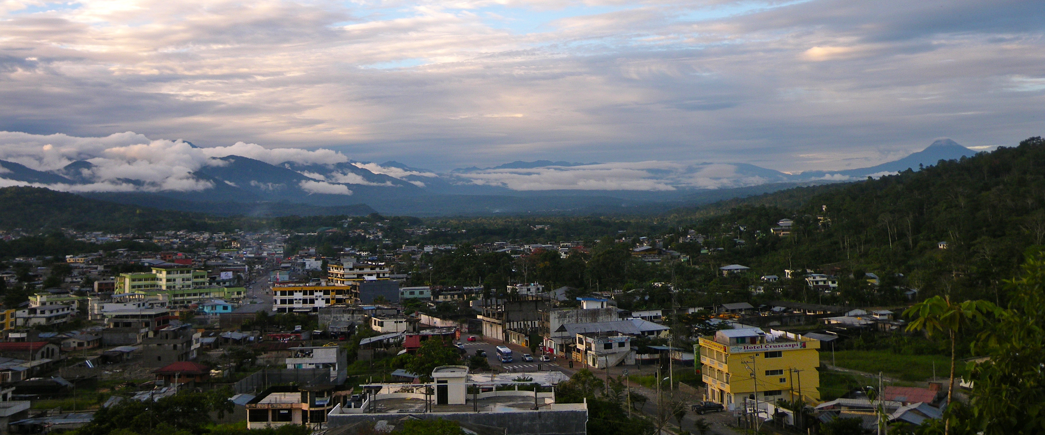
At the center of town stands Parque Amazonico La Isla, an island park reached by a curved pedestrian bridge called el Puente Espiral. The Tena and Pano rivers meet here, merge, and flow as the Tena River into the Misahualli, then into the Napo. The Napo is the 11th largest tributary of the Amazon by inflow. Everything that leaves Tena by water ends up in the Atlantic Ocean, four thousand kilometers east through Peru and Brazil. This is how the geography of the Oriente works. The Andes pile up to the west, visible from the main plaza on clear mornings, and the rivers pile up to the east, falling away through jungle toward the Atlantic.
Kayaks, Rafts, and Ecuador's Best Whitewater
The rivers on this side of the mountains carry more water and more consistent flow than anything draining to the Pacific, and word has gotten out. Tena hosts some of the best whitewater kayaking and rafting in Ecuador, Class III rapids on rivers like the Jatunyacu for beginners, Class IV-plus for the experienced. Cheap hotels, tour operators, and restaurants line the streets. Backpackers cycle through on their way deeper into the Amazon. The town is small enough to walk across, but the tour agencies run full at the height of season, launching rafts and organizing jungle expeditions to communities that sit hours upriver by motorized canoe.
Two Confederations, One Town
Tena houses headquarters for two major indigenous organizations. Fenakin is the Federacion de Organizaciones de la Nacionalidad Kichwa de Napo, representing the Kichwa communities of Napo Province. Ashin is the Asociacion de Shamanes Indigenas de Napo. During the 2001 indigenous uprising that shut down parts of Ecuador in protest of economic policies, one of the major standoffs happened here. The pattern is familiar: oil companies want to drill the 250-square-mile Pungarayacu heavy oil field, which sits partly under Kichwa territory. Illegal gold mining in Napo's rivers poisons water supplies and scars the banks. The Kichwa organizations push back through protests, lawsuits, international advocacy, and direct action. The jungle keeps the forest, and the people here keep defending it.
How You Get Here
The road from Quito is 99 percent paved as of 2021, a spectacular three to three-and-a-half hour drive that climbs Papallacta Pass above 4,000 meters, descends past several waterfalls, and on clear days shows the 3,990-meter Sumaco volcano rising to the east. Buses via Baeza take four hours. The original airport serving Tena, Mayor Galo de la Torre, closed in 2011. Jumandy Airport opened the same year, 27 kilometers east near Ahuano. TAME ended commercial flights in January 2016, citing low passenger loads. Most travelers still arrive by road, in shared vans from Quito or on the bus line, passing through cloud forest on the descent. Yellow truck-taxis run in town for $1.25 a trip. The pedestrian bridge over the Tena river is a few blocks from everywhere.
From the Air
Located at 0.99 degrees S, 77.82 degrees W, in Napo Province, Ecuador. Coordinates mark central Tena at the Tena-Pano river confluence, elevation 520m. Nearest airport is Jumandy Airport near Ahuano, 27km east. Quito (Mariscal Sucre, SEQM) lies 195km west over the Andes; Papallacta Pass reaches above 4,000m between them. On clear days Sumaco volcano (3,990m) is visible to the east. Best aerial viewing at 3,000-10,000 feet under morning sun, when Andean peaks still show to the west.