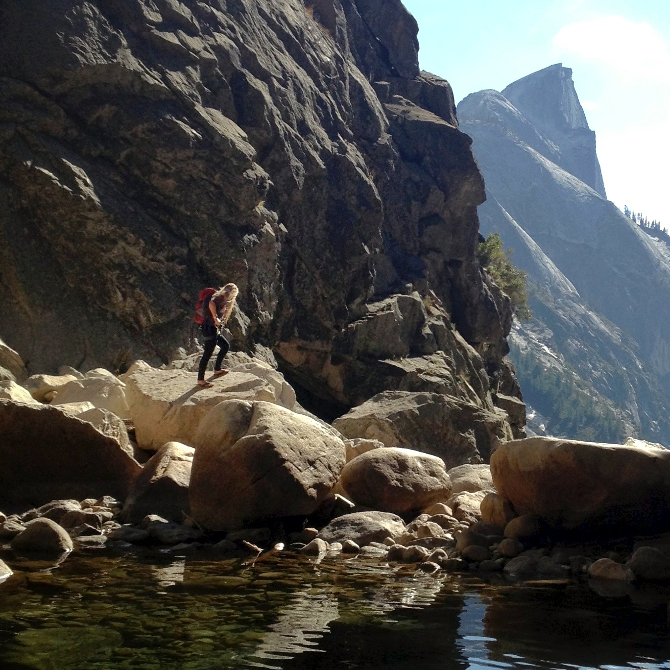
Tenaya Canyon
Park rangers call it the Bermuda Triangle of Yosemite. Signs at the canyon's entrance warn hikers to turn back. There is no trail, no maintained path, no way through that does not involve mandatory swimming, waterfall exposure, and traversing granite so polished by ancient glaciers that it gleams like wet glass even when dry. Tenaya Canyon runs 10 miles from the outlet of Tenaya Lake down to Yosemite Valley, carrying Tenaya Creek through a series of spectacular cascades, deep pools, and sheer-walled gorges beneath Clouds Rest and Half Dome. The American Canyoneering Association rates it 3B V - an intermediate difficulty that requires a day and a half to complete, with significant water volume and technical challenges at every stage. In 1996, two hikers died in the canyon on the same day. Those who know the canyon's history say Chief Tenaya would not have been surprised.
A Curse Spoken in Grief
The canyon bears the name of Chief Tenaya, leader of the Ahwahneechee people who had lived in Yosemite Valley for generations. In the 1850s, the Mariposa Battalion entered the valley with orders to forcibly remove the Ahwahneechee to a reservation. During the confrontation, Tenaya's son was killed. According to accounts from the period, the chief invoked a curse on the canyon and the land, born not from superstition but from the specific grief of a father watching his world destroyed. Whether one believes in curses or not, the canyon's record of accidents, deaths, and disappearances has given the story a persistent hold on the imagination of climbers, hikers, and park rangers alike. The name Tenaya, applied by the very soldiers who displaced his people, preserves both the man's memory and the bitterness of the history that gave the canyon its reputation.
Stone Polished to a Mirror
The geology of Tenaya Canyon explains its danger more precisely than any curse. During the ice ages, glaciers carved through the canyon with enormous force, but the quarrying happened unevenly. A longitudinal belt of fractures in the granite allowed the ice to pluck rock downward, deepening the canyon into a narrow V-shape, while solid rock masses on either side resisted lateral erosion. The result is a slot canyon with walls of glacially polished granite - stone smoothed to such a fine finish that it reflects light. This polish is beautiful and treacherous. When wet, the rock offers almost no friction. Even when dry, the surface can be deceptively slick. The canyon's staircase formations are underdeveloped compared to other glacially carved valleys, meaning that instead of step-like ledges, hikers encounter long, smooth ramps that funnel toward waterfalls. Pywiack Cascade, named for nearby Pywiack Dome, and Three Chute Falls near Mirror Lake are among the most dramatic of these drops.
No Trail by Design
Unlike most destinations in Yosemite, Tenaya Canyon has never been given a trail, and the park service has no plans to build one. The terrain is too unstable, the rock too slippery, the water too unpredictable. In spring and summer, when snowmelt swells Tenaya Creek, the canyon becomes a continuous gauntlet of cascading water, deep pools requiring mandatory swims, and hydraulic features that can trap and hold a human body. The canyon demands canyoneering skills - rope work, water reading, route finding through terrain with no markers and no obvious path. Even in late season, when water levels drop, the glacially polished granite makes every step a calculation. A slip on these surfaces does not mean a stumble; it means an uncontrolled slide toward a waterfall or a drop into a pool of unknown depth.
The View from Olmsted Point
From Tioga Pass Road, at a pullout called Olmsted Point, visitors can look down into the upper reaches of Tenaya Canyon and see Clouds Rest and Half Dome framing the gorge. It is one of Yosemite's finest roadside views - granite domes, deep blue sky, the dark line of the canyon cutting between massive rock formations. Nothing about the view suggests danger. The canyon looks serene from above, a natural corridor through the park's most iconic landscape. At the bottom, in Yosemite Valley, Mirror Lake sits where Tenaya Creek finally reaches level ground, accessible by shuttle bus and a short walk. Between that gentle lakeshore and the highway pullout lie 10 miles of terrain that has earned every warning sign posted at its entrance. The Quarter Domes rise nearby, and the canyon connects some of the park's most famous features - but it connects them through a passage that Yosemite itself seems to have decided should remain wild, unimproved, and honestly dangerous.
From the Air
Located at 37.74°N, 119.56°W in Yosemite National Park. The canyon runs roughly north-south from Tenaya Lake (8,150 ft) down to Yosemite Valley (4,000 ft), passing beneath Clouds Rest (9,926 ft) and adjacent to Half Dome (8,839 ft). Best viewed from 9,000-11,000 ft MSL. Tioga Pass Road (Route 120) crosses above the canyon's upper end. Nearest airports: Mariposa-Yosemite (KMPI) approximately 30 nm southwest, Lee Vining (O24) about 20 nm northeast. Mountain weather is highly variable; afternoon thunderstorms common in summer.