Tenryu River
The Tokugawa shoguns refused to let anyone build a bridge over it. For more than two centuries, every feudal lord traveling the great Tokaido highway between Edo and Kyoto had to cross the Tenryu River by ferryboat, braving currents so fast and deep that fording was impossible. In bad weather or high water, travelers could be stranded for days -- sometimes weeks -- waiting at riverside post stations like Mitsuke-juku. Hokusai and other ukiyo-e masters immortalized the scene: tiny boats bucking against a river that had earned its ancient name, the "Raging Dragon," in Nara period chronicles for its violent floods. The Tenryu still flows from the highlands of Nagano to the Pacific coast near Hamamatsu, but the dragon has been tamed by concrete, and the consequences of that taming reach far beyond its banks.
From Alpine Lake to Pacific Shore
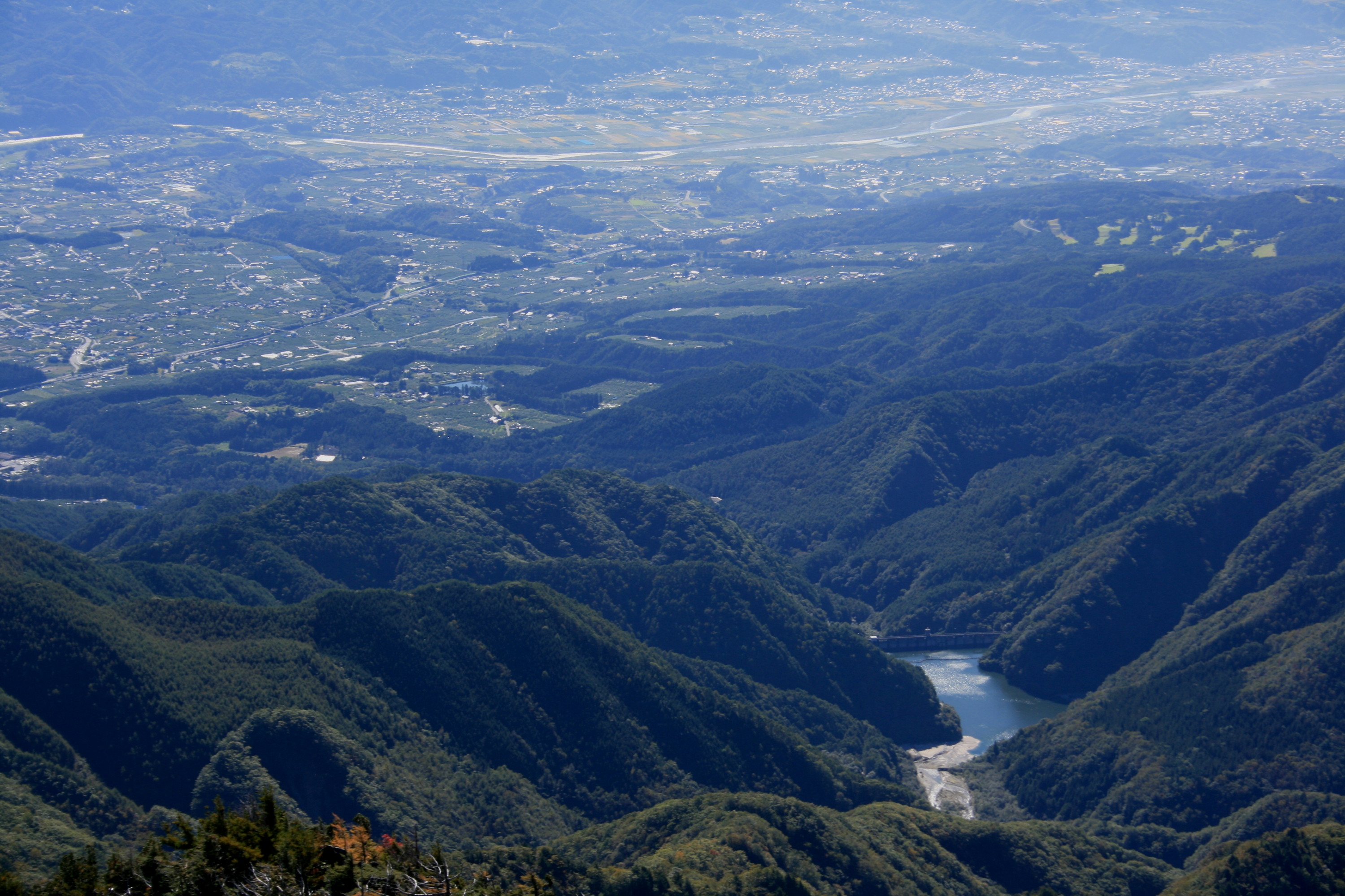
The Tenryu begins at Lake Suwa in the Kiso Mountains near the city of Okaya in Nagano Prefecture -- the only river that drains this highland lake. From there it runs generally south, threading through the Ina Basin, a rich agricultural valley, before squeezing through a narrow gap between the Kiso Mountains (Central Alps) to the west and the Akaishi Mountains (Southern Alps) to the east. This stretch, marking the border between Shizuoka and Nagano Prefectures, receives up to 3,000 millimeters of rainfall per year and is scored by deep V-shaped valleys. The river then broadens as it crosses the wide coastal plain of Shizuoka Prefecture, an area of fruit orchards and rice paddies, before emptying into the Philippine Sea near Hamamatsu. As Japan's ninth longest river, the Tenryu drains a vast and varied watershed that touches three prefectures -- Nagano, Aichi, and Shizuoka.
The Raging Dragon's Ledger
Japanese records have tracked the Tenryu's temper for over a thousand years. The Shoku Nihongi, an eighth-century national chronicle, records floods in 710 CE and 765 CE. Through the Heian and Kamakura periods, documentation is sparse, but by the Muromachi era, warlords and landholders along the river were building dikes, levees, and channels in an escalating effort to contain the water. When Tokugawa Ieyasu occupied Hamamatsu Castle, he invested heavily in irrigation infrastructure, carving new rice fields from the floodplain to boost the revenues of Totomi Province. A catastrophic flood in 1674 washed away much of that work, a reminder that the river's cooperation was always temporary. The cycle of construction and destruction defined life along the Tenryu for centuries.
Concrete Across the Current
The Meiji government recognized the Tenryu's hydroelectric potential early in the twentieth century -- high-volume flow, fast current, steep mountain tributaries, sparse population upstream. But initial investment went to the neighboring Oi River, and it was not until the Taisho period that dam building began in earnest on the Tenryu. Private entrepreneur Fukuzawa Momosuke founded the company that would eventually be nationalized into the prewar government power monopoly in 1938. The Yasuoka Dam, completed in 1935, was the first on the main stream, followed by the Iwakura Dam in 1938. The Hiraoka Dam, begun that same year, was delayed by World War II and not finished until 1951. After the war, American occupation authorities broke up the national power company into regional utilities. The enormous Sakuma Dam, completed in 1956 with United Nations loans and new construction techniques, was at the time the tenth largest dam in the world. Further dams followed through the 1960s and 1970s, with the Funagira Dam in 1976 marking the end of the building era.
The Price Downstream
The dams tamed the floods but created a problem nobody anticipated at scale. By trapping sand and silt that once flowed freely to the coast, the dam system starved the shoreline near Hamamatsu of the sediment that had built and maintained it for millennia. The lower reaches of the river, once abundant, now run nearly dry near the mouth. The most visible casualty is the Nakatajima Sand Dunes, one of Japan's three great dune systems, which has seen its shoreline retreat approximately 200 meters over the past forty years. The dams themselves are filling with the very sediment they intercept, shortening their operational lifespans far beyond original projections. Engineers have explored dredging and pipeline systems to shuttle trapped sand downstream to the ocean, but the solutions remain experimental. The Tenryu's story is a case study in unintended consequences -- each generation's infrastructure solving one problem while seeding the next.
Gorges, Rails, and Scenic Beauty
Not everything along the Tenryu is a cautionary tale. The upper valley lies partially within the Tenryu-Okumikawa Quasi-National Park, and the Tenryukyo Gorge near Iida in Nagano Prefecture holds official designation as a Place of Scenic Beauty. The gorge's sheer walls and clear pools draw hikers and photographers, while two rail lines trace the river's course: the Tenryu Hamanako Railroad follows the lower valley, and the Iida Line winds through the upper reaches into the mountains, stopping at Sakuma Station near the namesake dam. Today the Tokaido Shinkansen crosses the river in a matter of seconds -- a journey that once cost Edo-period travelers days of anxious waiting. The contrast captures the Tenryu perfectly: a river that has been obstacle, lifeline, power source, and ecological warning, all within the span of recorded Japanese history.
From the Air
The Tenryu River mouth is located at approximately 34.648N, 137.791E on the Pacific coast east of Hamamatsu. The river is a prominent terrain feature visible from altitude, running roughly north-south from Lake Suwa (Nagano) to the coast. Hamamatsu Air Base (RJNH) is approximately 5 nm west of the river mouth. Shizuoka Airport (RJNS) lies about 22 nm east. The upper valley passes between the Kiso and Akaishi mountain ranges with peaks exceeding 3,000 meters -- maintain safe altitude in mountain weather. Turbulence and low clouds are common in the V-shaped valleys upstream.