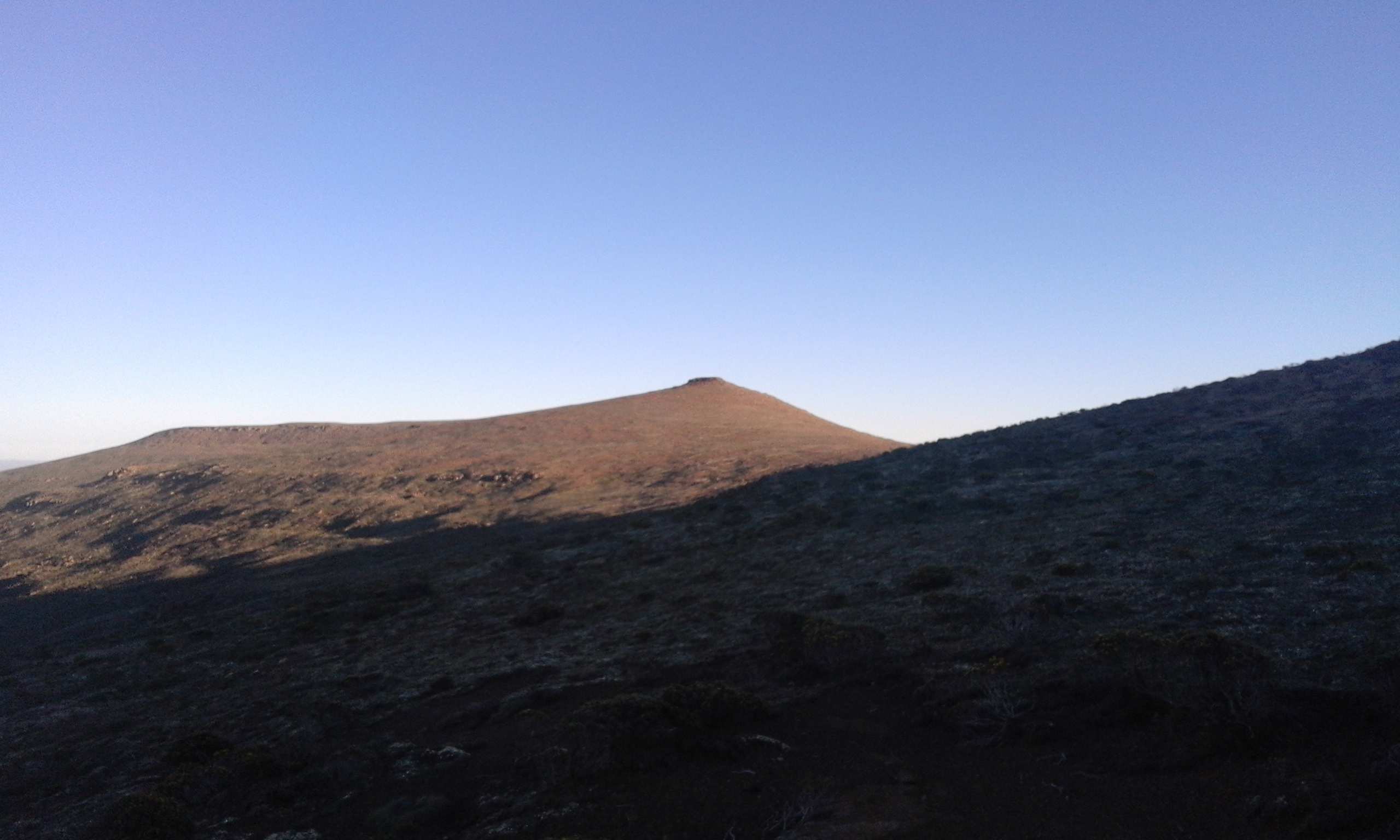
Thabana Ntlenyana
The name is a riddle. In Sesotho, thaba means mountain, the suffix -na makes it diminutive, and ntlenyana means beautiful. Put them together and you get 'Beautiful Little Mountain,' a startlingly modest name for the highest point in all of southern Africa. At 3,482 meters, Thabana Ntlenyana rises from the Maloti highlands of Lesotho with such gentle contours that first-time visitors sometimes walk right past it, scanning the horizon for something more dramatic. There are no jagged spires here, no glaciated walls. The summit is a broad basalt dome crowned with tussock grass, and the wind that crosses it carries the smell of wet earth and wild herbs. What makes the peak remarkable is not its shape but its solitude. Ranked 11th in the world for topographic isolation, Thabana Ntlenyana stands farther from any higher ground than almost any summit on Earth.
Flood Basalt and Deep Time
The rock beneath your feet on Thabana Ntlenyana is amygdaloidal flood basalt, formed during massive volcanic eruptions that spanned the Upper Triassic and Lower Jurassic periods, roughly 200 million years ago. These were not explosive eruptions but slow, relentless outpourings of lava that spread across the southern African interior in sheets hundreds of meters thick. The gas bubbles trapped in the cooling basalt left the distinctive almond-shaped cavities that geologists call amygdales, now filled with secondary minerals. Over the ages, erosion stripped away softer surrounding sediments, leaving the Maloti range and its highest point standing as remnants of that ancient volcanic plateau. Nearby, the headwaters of the Orange River begin their 1,300-kilometer journey westward to the Atlantic, draining a catchment of roughly 855,000 square kilometers that the river shares with its main tributary, the Vaal.
A Grassland Above the Trees
Above the treeline, the Drakensberg alti-montane grasslands occupy a world of their own. Summer rainfall often exceeds 1,000 millimeters, feeding a carpet of tussock grasses and ericoid shrubs that cling to thin, wind-scoured soils. Snow falls in winter, and temperatures swing from freezing nights to highs of 32 degrees Celsius, averaging just 13 degrees across the year. The vegetation reads like a botanical inventory of resilience: Merxmuellera disticha and M. drakensbergensis form dense tussocks, while sedges like Carex clavata thread through the wetter depressions. How these plants distribute themselves depends on what lies beneath them. Grain size, carbon content, and soil depth all shift across the plateau's geomorphic surfaces, creating a patchwork of micro-habitats invisible to the casual eye but legible to any botanist who kneels down and looks.
First Footprints on the Summit
The Basotho people have known these highlands for centuries, grazing their livestock on the high pastures and traversing the passes that link Lesotho's interior to the lowlands. But the first recorded ascent by Western-tradition mountaineers came in March 1951, when a South African-English team led by Desmond Watkins made the climb. The party included surveyors Barry Anderson and Roy Goodwin, mountaineer C. W. Jorgensen, and at least three other assistants whom Jorgensen described, with affectionate irreverence, as 'cooks, bottlewashers and scarecrows.' The peak is no technical challenge. Most climbers today approach from Sani Top Chalet or Vergelegen Nature Reserve, and the route involves more endurance than skill. At this altitude, however, the thin air turns every step into a negotiation. The eight-hour round trip from Sani Mountain Lodge demands an early start and a respect for weather that can shift from sunshine to whiteout in minutes.
The Kingdom in the Sky
Lesotho is the only country in the world whose entire territory lies above 1,000 meters, and its people call it the Kingdom in the Sky. Thabana Ntlenyana is the crown of that kingdom, a peak that belongs not to a mountain range shared across borders but entirely to this small, landlocked nation surrounded on all sides by South Africa. The Maloti highlands that radiate from it feed the rivers that sustain millions downstream, making Lesotho one of the continent's most important water sources. The Lesotho Highlands Water Project channels water from these catchments to the Gauteng region of South Africa, turning mountain rainfall into an economic lifeline. Standing on the summit, the landscape unfolds in every direction as rolling grassland under enormous skies, deceptively empty, profoundly alive.
From the Air
Coordinates: 29.47°S, 29.27°E, on the Mohlesi ridge in the Maloti Mountains of eastern Lesotho. The summit at 3,482 m (11,424 ft) is the highest point in southern Africa. From the air, the peak is a broad basalt dome with no sharp features, easily mistaken for surrounding ridgelines. Look for the treeless plateau terrain and the headwaters of the Orange River nearby. Sani Pass is visible to the south. Nearest airports: Moshoeshoe I International (FXMM) at Maseru, approximately 100 nm west-southwest; Pietermaritzburg (FAPM) approximately 110 nm east-southeast. Expect strong winds and rapid weather changes at altitude. Minimum safe altitude should account for the 3,482 m terrain plus adequate clearance.