Tho Chau Islands
The name is written in classical Chinese characters as 'earth pearl' -- a gem sitting in the middle of the sea. The Tho Chau Islands lie roughly 220 kilometers southwest of the Vietnamese mainland, an eight-island archipelago adrift in the Gulf of Thailand where the territorial waters of Vietnam and Cambodia blur into contested blue. Malay navigators once called the place Pulau Panjang, the Long Island, for the shape of its largest landmass. Vietnamese historians compare its name to Pearl Harbor, not for any military parallel but for the shared image of a pearl set in open water. For most of its modern history, this pearl has been fought over, abandoned, and slowly reclaimed.
Contested Waters
During the Republic of Vietnam era, the Tho Chau Islands fell under An Xuyen Province's administration. But Cambodia also claimed the archipelago, insisting the islands lay within its territorial waters. This dispute simmered for decades, unresolved by diplomacy and eventually decided by violence. The archipelago's remoteness -- far from both Phnom Penh and Saigon -- made it a place where sovereignty existed on paper but barely on the ground, a cluster of islands that both nations marked on their maps but neither fully controlled. The ambiguity made Tho Chau vulnerable to the upheavals that swept Southeast Asia in 1975.
The Massacre of 1975
On May 10, 1975 -- just eleven days after the fall of Saigon -- Khmer Rouge forces occupied Tho Chau Island. They abducted approximately five hundred civilians and transported them to Cambodia, where all were killed. The massacre happened in the chaos of regime changes across the region, when borders dissolved and armed groups seized whatever territory they could reach. Vietnamese forces counterattacked from May 24 to May 27, driving the Khmer Rouge from the island. Two years later, in 1977, the Khmer Rouge attempted another raid on Tho Chau but were repelled. By then, Vietnam and Cambodia were sliding toward open war, and the tiny archipelago had become one of many flashpoints along their disputed frontier.
Rebuilding from Six Families
After the wars ended, the islands sat largely empty. It was not until April 27, 1992, that the People's Committee of Kien Giang Province arranged for six families -- about thirty people in total -- to resettle on Tho Chau Island. These were the seed of a new community, arriving on an island that still bore the scars of occupation and abandonment. The Vietnamese government formalized the settlement the following year, establishing Tho Chau Commune in April 1993. Growth came slowly. Today the archipelago is home to roughly 500 households and nearly 2,000 inhabitants, many of them border guards and navy personnel who chose to stay after their service. The rest are civilians whose livelihoods depend on servicing fishing boats, small-scale manufacturing, farming, and coastal fishing.
Eight Islands, One Pearl
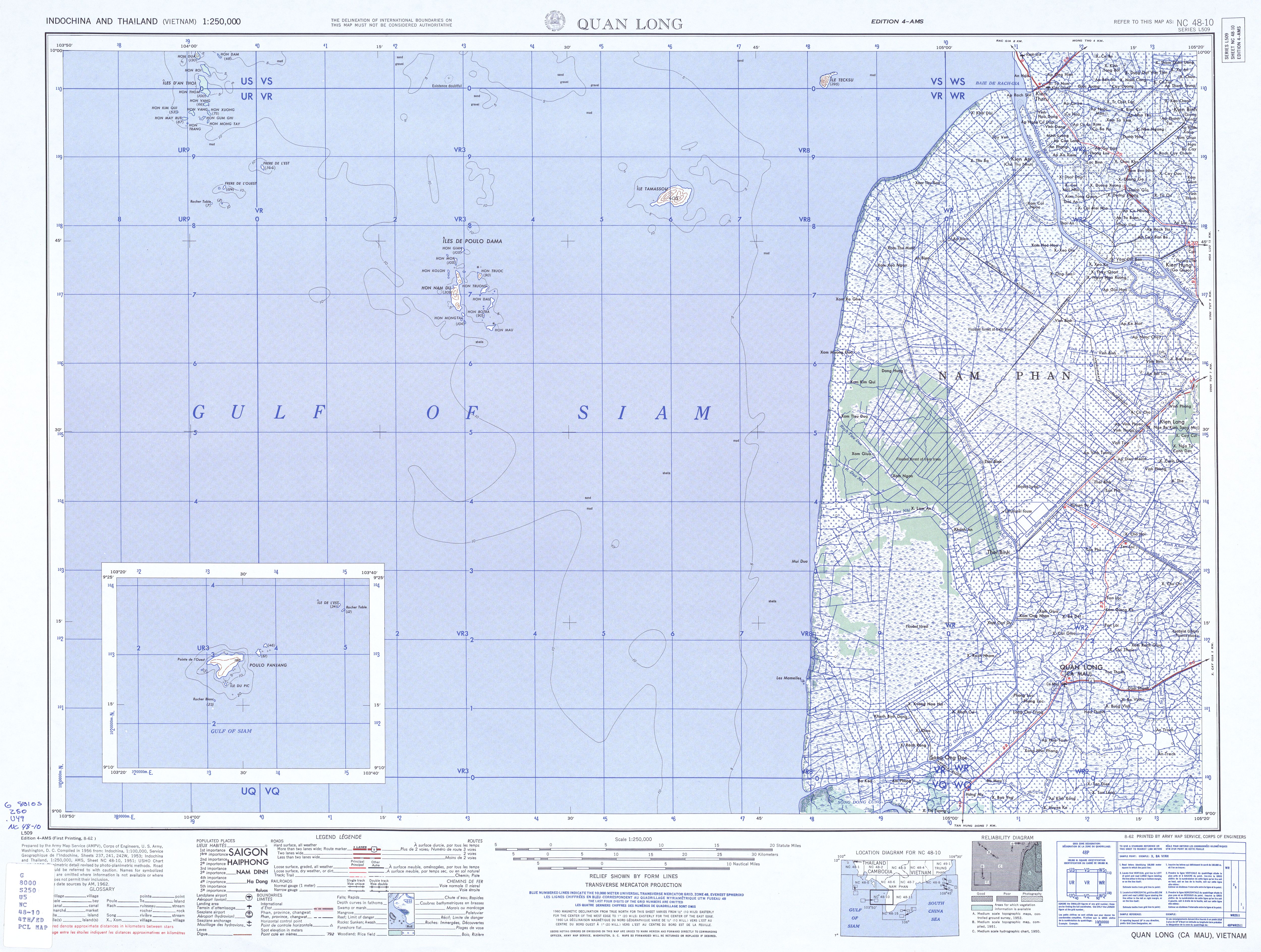
The archipelago comprises eight islands. Tho Chau Island itself, at 13.95 square kilometers, dominates the chain. The smaller members -- Hon Cao, Hon Cao Cat, Hon Kho, Hon Mo, Hon Nhan, Hon Tu, and Hon Xanh -- range from rocky outcrops to vegetated islets. Hon Nhan holds particular significance as base point A1 on Vietnam's territorial baseline, the legal starting point from which the nation measures its maritime sovereignty westward into the Gulf of Thailand. In 1995, Tho Chau was first proposed as a marine protected area, and the Asian Development Bank later recommended protecting 22,400 hectares around the island -- 1,190 hectares of land and 21,210 hectares of surrounding sea. In February 2025, Kien Giang Province formally approved the establishment of Tho Chau Island District, elevating the former commune to full district status without subdividing it into smaller administrative units.
The Edge of a Nation
Vietnamese press has described Tho Chau as the farthest point west in determining the nation's oceanic sovereignty. This is not merely a geographic curiosity -- it is the legal and symbolic anchor of Vietnam's western maritime claims. The archipelago briefly entered global awareness on March 8, 2014, when Malaysia Airlines Flight 370 lost contact with air traffic control while passing near Tho Chau, triggering one of the largest search operations in aviation history. But for the people living on these islands, the drama is quieter and more persistent: maintaining a community on a remote outpost where the nearest mainland is a long boat ride away, where fresh water and supplies arrive by sea, and where the simple act of inhabiting the land asserts a sovereignty that has been contested, defended with blood, and rebuilt from the determination of six families willing to start over.
From the Air
Located at approximately 9.3N, 103.48E in the Gulf of Thailand, roughly 220 km southwest of the Vietnamese mainland. The archipelago appears as a scattered chain of green islands against open sea. Tho Chau Island, the largest at nearly 14 square kilometers, is clearly visible from cruising altitude. The nearest significant landmass is Phu Quoc Island to the northeast. Nearest airport is Phu Quoc International (VVPQ), approximately 100 km to the northeast. Expect clear tropical visibility most of the year with monsoon cloud cover from May through October.