Thornton State Beach
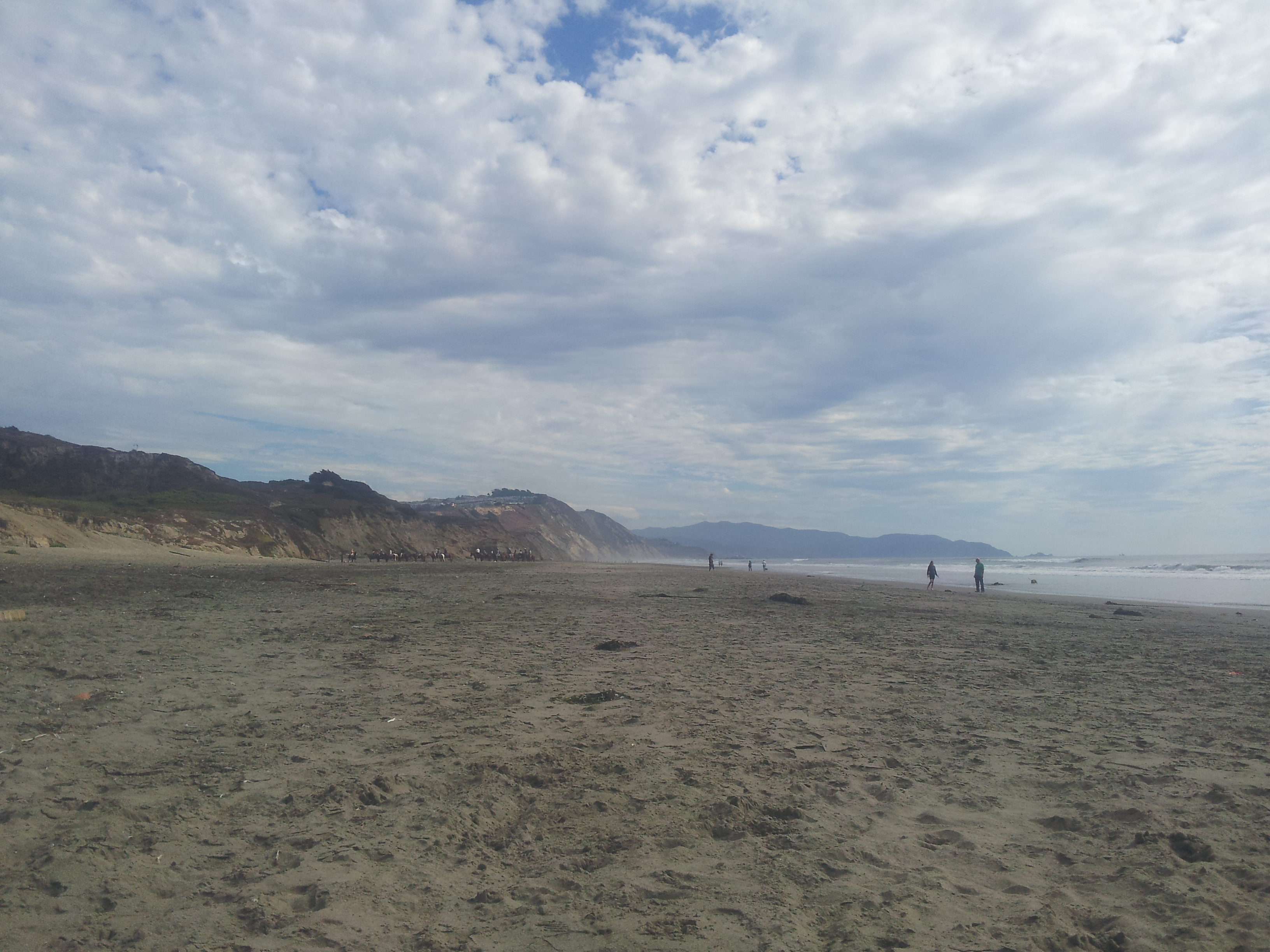
The bluffs are crumbling. That is the first thing visitors notice at Thornton State Beach, where the cliffs of Daly City's Pacific coastline meet the ocean in a slow-motion collapse of sand, clay, and rock. Established in 1955 as a 58-acre park in the California state beach system, Thornton sits at the place where suburban development meets raw coastal geology. Houses perch on bluffs that lose ground to erosion every winter storm. Below, the beach stretches between rocky outcrops, accessible by trails that themselves shift and change with each season's rains.
The Eroding Edge
Thornton State Beach occupies a stretch of coastline where the Santa Cruz Mountains, which form the spine of the San Francisco Peninsula, meet the Pacific Ocean. The bluffs here are composed of relatively soft sedimentary material that erodes quickly under the assault of waves, wind, and rain. The erosion is not subtle -- homeowners along the bluff tops have watched their backyards shrink over the decades. This geological instability makes the beach wilder and more dramatic than the manicured shores elsewhere in the Bay Area. Rock falls are common. The landscape changes visibly from year to year.
Wild Coast, Urban Edge
What makes Thornton remarkable is its proximity to one of the most densely developed areas in the Bay Area. Daly City's residential grid extends to within a few hundred feet of the bluff edge. The Westlake neighborhood, built in the 1950s as part of the postwar suburban boom, sits atop the cliffs. From the beach, looking back toward land, the houses look precarious -- a reminder that the Pacific Coast is not a static boundary but an active geological frontier. From the bluff tops, looking seaward, the view encompasses nothing but ocean, sky, and the windswept beach below. This duality -- suburban stability above, geological chaos below -- gives Thornton its unique character.
Between Fort Funston and Mussel Rock
Thornton State Beach sits between two other significant coastal landmarks. To the north, Fort Funston's sand cliffs attract hang gliders who launch from the bluffs. To the south, Mussel Rock marks the point where the San Andreas Fault enters the Pacific Ocean -- the same fault that ruptured in 1906 and destroyed San Francisco. Walking the beach between these landmarks, visitors traverse some of the most geologically active coastline in California. The waves that erode Thornton's bluffs are the same ones that crashed against this shore when the coast extended miles further west during the last ice age. The land is retreating. The beach endures.
From the Air
Thornton State Beach is at 37.68N, -122.50W on the Pacific coast of Daly City. The eroding bluffs and narrow beach are visible from the air, running between Fort Funston to the north and Mussel Rock to the south. The San Andreas Fault meets the ocean at Mussel Rock, just south of the beach. KSFO is 7nm to the southeast.