Thotlakonda
The Indian Navy was looking for a place to build a base. What they found instead, during an aerial survey of the coast north of Visakhapatnam, was something that had been hiding in plain sight for two millennia: the ruins of a Buddhist monastery complex crowning a 128-meter hill overlooking the Bay of Bengal. Thotlakonda -- Telugu for "hill of cisterns" -- earned its name from the dozens of rock-cut water tanks hewn directly into the hilltop bedrock. But the cisterns are just the beginning. Between 1988 and 1993, excavations by the Andhra Pradesh State Archaeology Department unearthed an entire monastic world: stupas, viharas, terracotta tiles, sculptured panels, and -- most intriguingly -- Roman silver coins lying alongside Satavahana dynasty lead coins, evidence that this remote hilltop once sat at the crossroads of international trade.
The Meridian Highway
Thotlakonda's location was no accident. The monastery sits near the 83.3-degree East meridian, a longitudinal line that connects several of Buddhism's most sacred sites: Sarnath, where the Buddha delivered his first sermon; Kushinagar, where he died; and Lumbini, where he was born. Pilgrims arriving by sea from Southeast Asia and Sri Lanka used this meridian as a navigational corridor, and Thotlakonda served as their first landfall. The deeply curved coastline created a natural harbor where ships could anchor safely, and the hilltop monastery offered rest and spiritual sustenance before travelers continued northward along the meridian to the great inland pilgrimage centers. In this way, Thotlakonda functioned less as a destination than as a gateway -- a coastal threshold between the maritime world and the Buddhist heartland.
Beacons on the Water
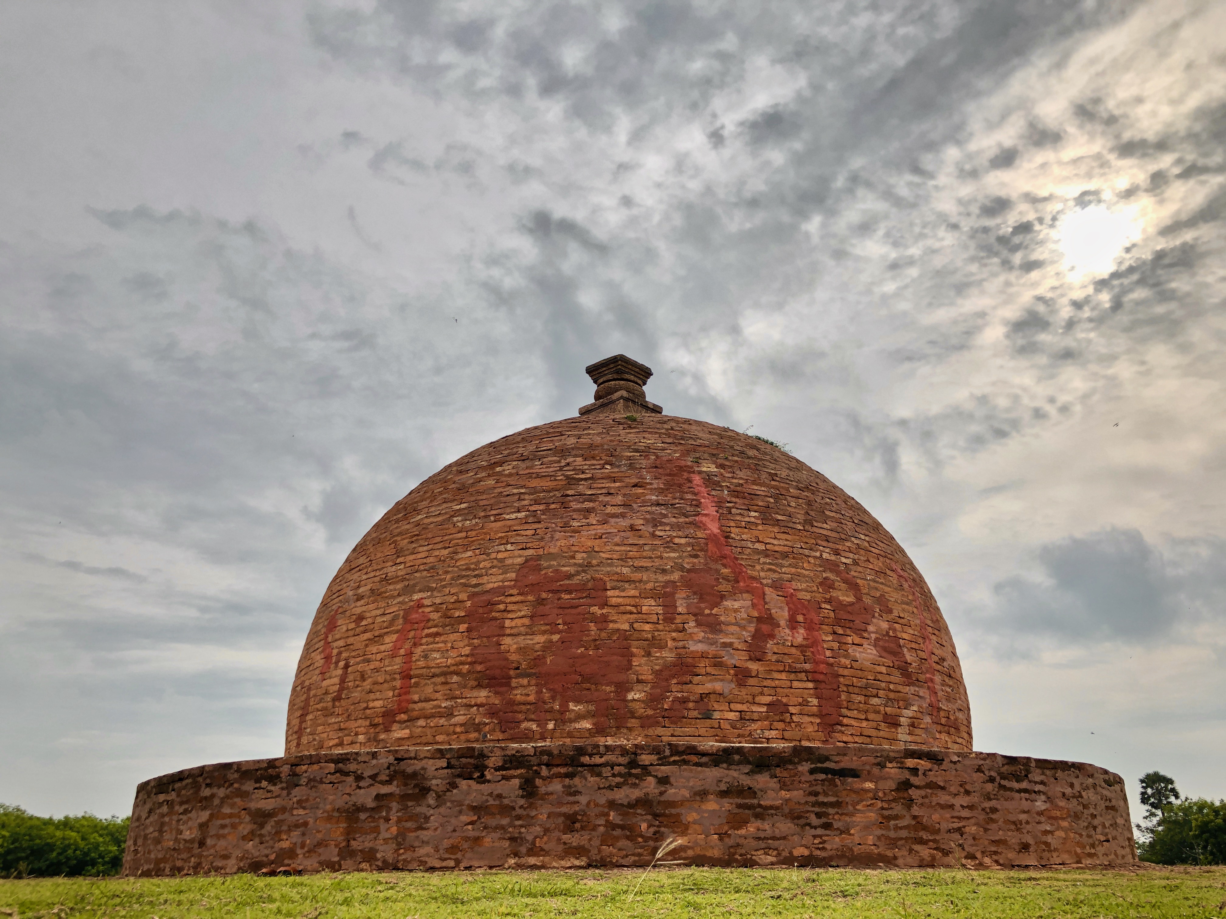
At its peak between the 2nd century BCE and the 2nd century CE, Thotlakonda thrived on brisk Roman trade and the religious missions that the Kalinga kingdom dispatched across the Indian Ocean. More than 100 bhikkhus may have lived here at once, in a complex that functioned as both monastery and academy, with dedicated storage for food, clothing, and medicines. The monks practiced Nikaya Buddhism, worshipping Gautama Buddha through aniconic symbols -- footprints called padukas, the eight auspicious signs of the ashtamangala -- rather than figurative images. The lofty stupas, coated in light lime plaster, would have gleamed white against the green hillside during the day. At night, rows of oil-wick lamps lined the structures, creating beacons visible far out to sea. For sailors navigating the dark coast, these lights were not just spiritual symbols but practical landmarks, guiding them toward safe harbor.
A Quiet Decline
No kings appear to have bankrolled Thotlakonda. Unlike the great monastic universities of Nalanda or Taxila, which enjoyed sustained royal patronage, this hilltop community depended on the generosity of local Buddhists and the traders whose ships anchored below. When Roman trade faltered in the 3rd century CE, the economic currents that had sustained the monastery shifted. By the end of that century, Thotlakonda had fallen silent. The monks moved on, the trade routes redirected, and the jungle slowly reclaimed the hilltop. For more than 1,700 years the ruins lay undisturbed, known only to the rock-cut cisterns that continued to collect rainwater long after the people who carved them had vanished. Nearby, the sister sites of Bavikonda and Pavurallakonda share a similar arc -- Buddhist complexes that rose and fell with the tides of Indian Ocean commerce.
Weathering the Centuries
Thotlakonda's rediscovery brought both attention and new threats. In 2019, monsoon rains partially damaged the main stupa, a loss that took two years and 42 lakh rupees to repair, with restoration completed in 2021. The site now draws visitors from Visakhapatnam and beyond, though its relative obscurity compared to India's more famous Buddhist sites means it rarely feels crowded. Walking among the excavated foundations, the layout of monastic life becomes legible: meditation halls, residential cells, communal kitchens, the southern water tank that sustained the community. Twelve inscriptions recovered during excavation suggest the hill was once called Senagiri -- from the Pali word sena, meaning "elder" or "superior" -- a name that hints at the respect this place once commanded among the faithful.
From the Air
Located at 17.83°N, 83.41°E on a coastal hilltop about 128 meters above sea level, 15 km north of Visakhapatnam. The ruins sit on a prominent hill overlooking the Bay of Bengal and are visible from low altitude. The curved coastline and hilltop clearing distinguish the site from surrounding vegetation. Nearest airport is Visakhapatnam (VOVZ/VTZ), approximately 15 km to the south. The hill is near Bheemunipatnam along the coastal road. Best viewed at 2,000-3,000 feet in clear weather for contrast between the excavated hilltop and the surrounding green hills and blue ocean.