Thung Yai Naresuan Wildlife Sanctuary
In February 2018, rangers in one of the most protected forests on Earth found a billionaire sitting beside the skinned carcasses of a black leopard, a Kalij pheasant, and a barking deer, with three rifles and ammunition at his side. Premchai Karnasuta, president of one of Thailand's largest construction companies, had been caught poaching in the Thung Yai Naresuan Wildlife Sanctuary, a UNESCO World Heritage Site that shelters some of Southeast Asia's last Indochinese tigers. His defense was two words: 'I didn't do it.' The incident laid bare a tension that has defined this sanctuary since its creation: who gets to use the forest, and who pays the price for its protection.
The Big Field of a Warrior King
The Thai name tells you what to expect. Thung yai means 'big field,' a reference to the savanna that opens up in the heart of the sanctuary, and Naresuan honors the Siamese king who supposedly stationed his army on this plain while waging war against Burma during his reign over the Ayutthaya Kingdom from 1590 until his death in 1605. At 3,647 square kilometers, the sanctuary is Thailand's largest protected area, bigger than the total area of Bangkok. Together with the adjoining Huai Kha Khaeng Wildlife Sanctuary, it forms the core of the Western Forest Complex, which at 6,222 square kilometers represents the largest contiguous block of protected land in mainland Southeast Asia. UNESCO recognized both sanctuaries as a World Heritage Site in 1991, declaring the savanna forest of Thung Yai the most complete and secure example of Southeast Asia's dry tropical forest.
Where Four Worlds Meet
What makes Thung Yai exceptional is its position at a biogeographic crossroads. Species with Sundaic, Indo-Chinese, Indo-Burmese, and Sino-Himalayan affinities all converge here, creating a faunal diversity that few single protected areas can match. Indochinese tigers and leopards hunt among the limestone hills and granite intrusions. Clouded leopards share the canopy with lar gibbons and macaques. On the forest floor, Malayan tapirs and Indian elephants move through terrain that rises from 180 meters at the Vajiralongkorn Reservoir to 1,811 meters at Khao Tai Pa, the sanctuary's highest peak. The World Heritage nomination lists 120 mammal species, 400 birds, 96 reptiles, 43 amphibians, and 113 fish species. All six species of hornbill found in mainland Southeast Asia live here. The Western Forest Complex is the region's largest tiger habitat, supporting around 200 of the animals, and Thung Yai is recognized as a natural breeding area for tigers in both Thailand and Myanmar.
The People the Forest Displaced
Long before conservation drew its boundaries, people lived here. Paleolithic, Mesolithic, and Neolithic stone tools found in the Khwae Noi and Khwae Yai river valleys attest to human presence stretching back millennia. For at least 700 years, Mon and Karen communities have called the Dawna-Tenasserim region home. When the sanctuary was established in 1972, Karen villages in Huai Kha Khaeng were removed. In the late 1970s, the Si Nakharin Dam flooded the remaining settlements. During the 1980s and early 1990s, Hmong communities were relocated from both sanctuaries. The Thai Royal Forest Department attempted to remove the remaining Karen from Thung Yai in the early 1990s but reversed course after public criticism. Since then, authorities have placed restrictions on the Karen's traditional land use system, measures that critics say are designed to make life unsustainable and force them to leave their homeland on their own. The World Heritage designation that protects the forest has come at a direct cost to the indigenous people who shaped it.
Two Hundred Rangers, One Million Rai
Protecting 3,647 square kilometers of wilderness is a task that dwarfs the resources allocated to it. The sanctuary employs roughly 200 staff spread across 25 ranger stations, each assigned three firearms, some of which no longer function. These rangers patrol approximately 12,000 kilometers of forest paths within Thung Yai and another 10,000 kilometers in the adjoining Huai Kha Khaeng sanctuary. The Thailand Development Research Institute calculates that each forest staffer is responsible for policing over 2,000 rai, an area no single person can effectively monitor. The government allocates about 61 baht per rai to manage the country's 443 protected forest zones. Against this backdrop, the Premchai poaching case resonated so deeply because it exposed the asymmetry between the resources devoted to enforcement and the impunity enjoyed by the wealthy. 'Rich people want to show off that they have barami, social power,' a Wildlife Friends Foundation spokesman told media. Illegal poaching by the powerful, he said, happens all the time.
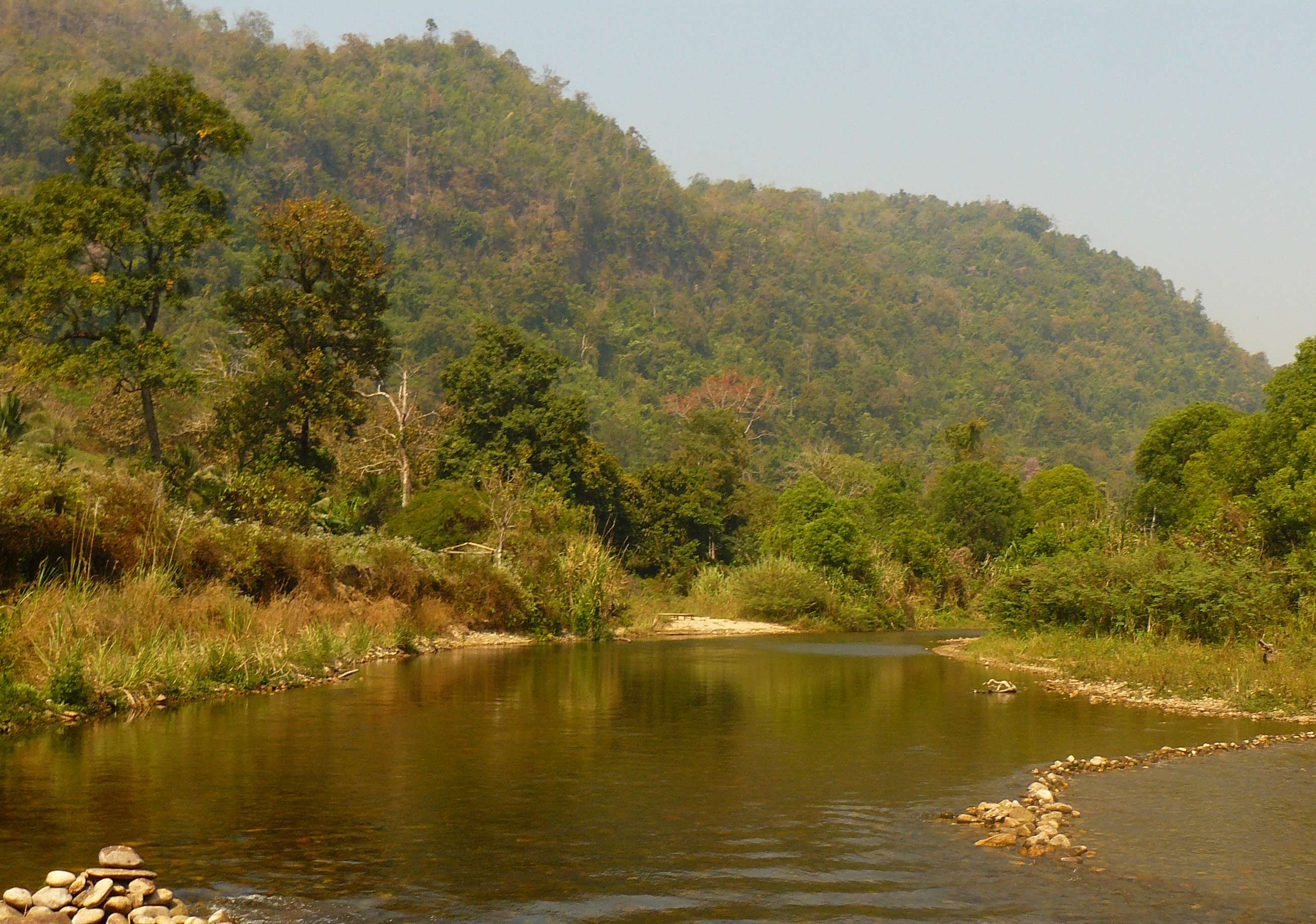
Rivers Flowing in Every Direction
The sanctuary straddles the border between Kanchanaburi and Tak provinces, its western edge running along Thailand's frontier with Myanmar in the southern reaches of the Dawna Range. Major rivers define the landscape: the Mae Klong and Mae Chan originate to the northeast and join within Thung Yai to form the upper Khwae Yai, feeding the Si Nakharin Reservoir. Smaller tributaries drain south and southwest into the Vajiralongkorn Reservoir, while the Mae Kasat and Mae Suriya flow northwest across the border into Myanmar. The terrain is predominantly mountainous, a mosaic of limestone, granite, quartzite, and schist shaped by the same geological forces that built the karst landscapes of western Thailand. From above, the sanctuary is an unbroken expanse of canopy stretching to the horizon in every direction, rivers glinting through gaps in the trees, mountains folding into one another like a green sea frozen mid-swell.
From the Air
Thung Yai Naresuan Wildlife Sanctuary is centered at approximately 15.333N, 98.917E along the Thailand-Myanmar border in western Thailand. The sanctuary covers 3,647 square kilometers of mountainous terrain in the Dawna Range, with elevations from 180 meters to 1,811 meters at Khao Tai Pa. From cruising altitude, the Western Forest Complex appears as an unbroken canopy stretching across the border region. The nearest airports are in Kanchanaburi and Tak provinces. Don Mueang (VTBD) and Suvarnabhumi (VTBS) in Bangkok are the closest major international airports, roughly 250-300 km to the southeast.