Tierra del Fuego National Park
The wind carries whispers of the Yamana through the lenga forests of Tierra del Fuego National Park. For ten thousand years, indigenous canoe people paddled these frigid waters, hunting sea mammals and gathering shellfish along these very shores. Then came the missionaries in 1880, bringing disease that would claim nearly all of them. Today, only grass-covered mounds of mussel shells mark where the Yamana once camped, silent monuments scattered near the water's edge. This 63,000-hectare wilderness at the bottom of the world, established as Argentina's only coastal national park in 1960, preserves the southernmost Andean-Patagonian forest and offers visitors a landscape both breathtaking and humbling in its remoteness.
Where Road and Land End
National Route 3, the famous highway that runs the length of Argentina, terminates here in the park, just 12 kilometers west of Ushuaia. The Tren del Fin del Mundo, an historic steam train, chugs through the landscape delivering visitors to the park entrance, its whistle echoing across valleys carved by ancient glaciers. The terrain unfolds in layers: great bays indent the coastline, small beaches give way to rugged mountains, and forests of lenga and guindo trees climb slopes shrouded in moss and fern. In the understory, the prickly calafate bush grows, the berry that legend says ensures anyone who eats it will return to Patagonia.
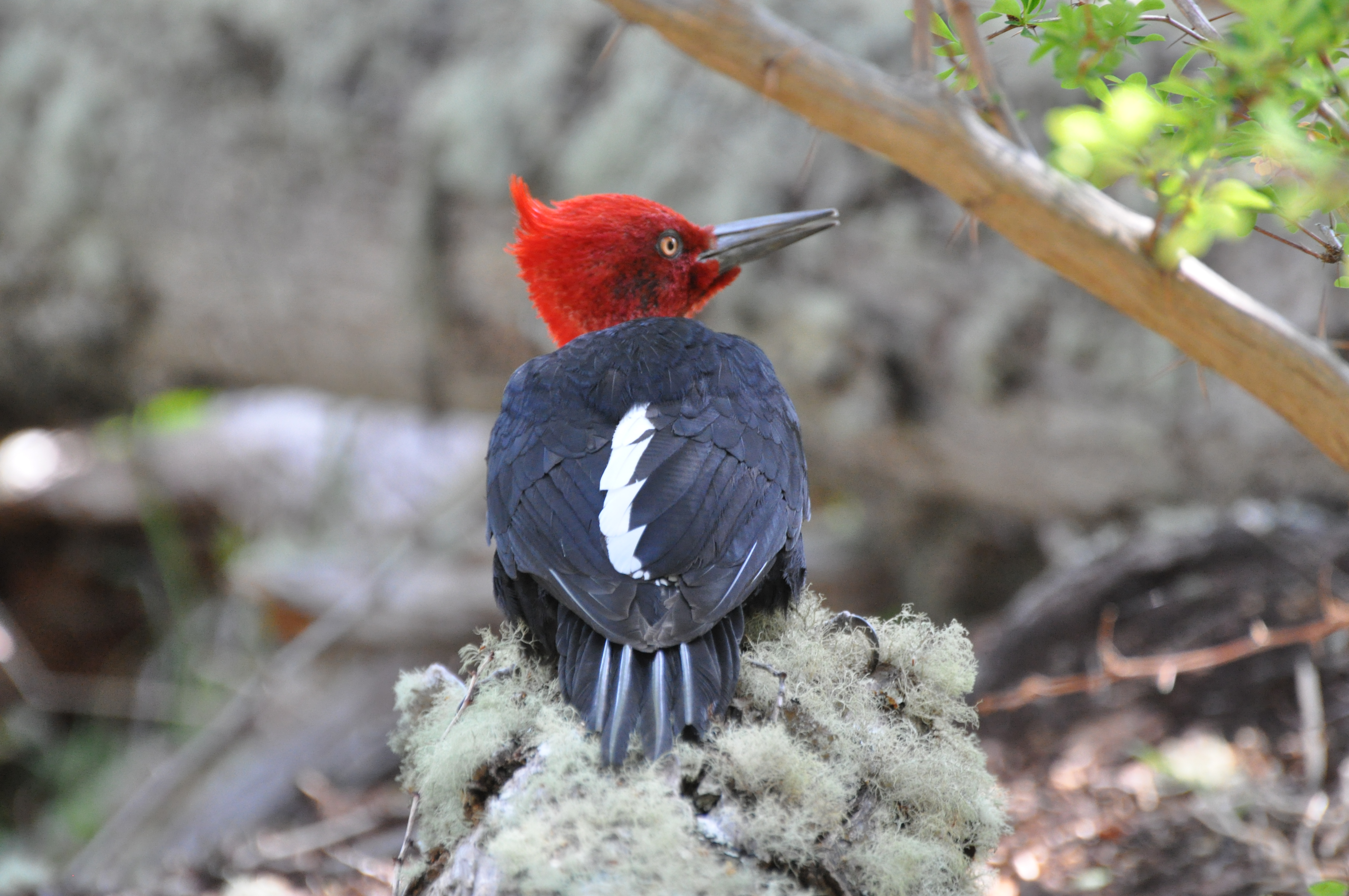
Life at the Edge
Twenty species of mammals call this cold corner home. Red foxes trot through the forest clearings, guanacos graze the open areas, and the elusive chungunco, the marine otter, hunts along the shoreline. Overhead, the Andean condor rides thermal currents while black-eyed albatrosses wheel above the Beagle Channel. The introduced Canadian beaver has transformed parts of the landscape, its dams creating ponds that flood sections of forest, a visible reminder of nature's delicate balance disturbed. Orange fungal nodules bulge from guindo trees, the parasitic farolito chino, while ferns carpet the forest floor beneath the canopy.
Trails to the Edge of the World
Hikers climb Cerro Guanaco for views worth every one of the 970 meters of elevation gain, the panorama from the summit encompassing the Beagle Channel and distant Chilean peaks. The Hito XXIV trail follows the shore of Lago Acigami for 10 kilometers, tracing the actual border between Argentina and Chile, a three-hour walk through international territory. Easier paths lead to Lapataia Bay through peat bogs and past abandoned beaver dams, while the Seaside Path hugs the marine coast for 8 kilometers between Ensenada and Lapataia. At Laguna Negra, tannins from the peat stain the water a deep black that reflects the southern sky.
The Cold Embrace
Winter temperatures hover around freezing while summer barely reaches 10 degrees Celsius, and the 700 millimeters of annual rainfall knows no dry season. The park receives fewer visitors in the cold months, when trails and mountainsides belong to the hardy few who venture into the solitude. At La Confiteria, where buses drop visitors, a crackling fire warms the small cafe that sells chocolate and basic snacks. For those who stay, free campsites near Lake Acigami offer basic amenities beneath the southern stars, as close to the end of the world as most will ever sleep.
From the Air
Located at 54.67S, 68.50W at the southern tip of South America. Nearest airport is Ushuaia Malvinas Argentinas International (SAWH), 12km east. The park borders Chile to the west, with the Beagle Channel visible to the south. From cruising altitude, the terminal end of the Andes is visible meeting the sea, with the park's glacial lakes and fjord-indented coastline clearly identifiable.