Tikal: The Lost Maya City That Rose Above the Jungle
In 1848, a Guatemalan expedition hacked through the Petén jungle, following rumors of ancient ruins. They found Tikal - a Maya city so overgrown that trees sprouted from temple tops. The howler monkeys that led them there screamed from pyramid summits. What they discovered was one of the greatest cities of the ancient Americas: 3,000 structures across 6 square miles, including temples that still rise 200 feet above the jungle floor. Tikal thrived for 800 years, housing 100,000 people at its peak. Then, around 900 AD, it was abandoned. The jungle swallowed it whole.
The City
Tikal was one of the largest and most powerful Maya city-states, flourishing from about 200 to 900 AD. At its peak around 700 AD, the urban core held 60,000 people, with another 40,000 in surrounding areas. The city controlled trade routes and waged wars across the Maya lowlands.
The site covers 6 square miles of mapped structures, but the greater Tikal area may extend 50 square miles into the surrounding jungle. Lidar surveys in 2018 revealed previously unknown structures hidden under vegetation - causeways, terraces, and defensive fortifications that suggest an even larger population than previously estimated.
The Temples
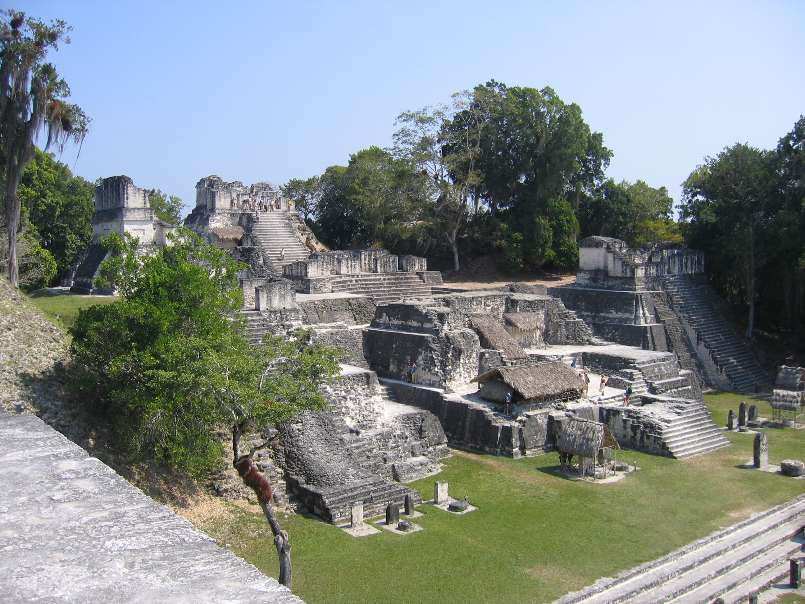
Tikal's signature is its temple-pyramids - steep-sided structures with roof combs that soar above the jungle canopy. Temple IV, the tallest surviving pre-Columbian structure in the Americas, reaches 212 feet. Temple I (Temple of the Great Jaguar) and Temple II face each other across the Great Plaza, their limestone facades glowing at sunset.
The temples served as tombs, sanctuaries, and astronomical observatories. Their alignment tracked solstices and equinoxes. The roof combs, originally covered in stucco and painted bright colors, announced the city's power to approaching visitors. From their summits, you can see the entire jungle - and other temple-pyramids breaking through the green canopy.
The Collapse
Around 900 AD, Tikal was abandoned. The last dated inscription is from 869 AD. Within a century, the population was gone. The temples fell silent. The jungle crept in.
The cause remains debated. Climate data suggests prolonged drought in the 9th century. Environmental evidence shows deforestation and soil degradation. Wars between city-states intensified. Perhaps all of these factors combined. Whatever happened, the Maya didn't 'disappear' - they abandoned their great cities and dispersed. Their descendants live in Guatemala today. But Tikal was lost to the forest for almost a thousand years.
The Rediscovery
Local people always knew the ruins existed, but European 'discovery' came in 1848 when Guatemalan authorities sent an expedition. The jungle had completely consumed the city. Trees grew from temple roofs. Roots split stones. Vegetation covered causeways.
Serious archaeological excavation began in 1956 under the University of Pennsylvania. Temples were cleared and stabilized. Tombs were excavated, revealing jade masks, obsidian blades, and inscribed bones. The decipherment of Maya hieroglyphics in the 1970s-80s finally allowed scholars to read Tikal's history, carved in stone for centuries but only recently understood.
The Experience
Today, Tikal is a UNESCO World Heritage Site within a protected biosphere reserve. Visitors can climb Temple IV to watch sunrise over the jungle, listening to howler monkeys and toucans as mist rises from the canopy. It's one of the most spectacular archaeological experiences in the world.
But much remains buried. Only a fraction of Tikal has been excavated. Hundreds of structures lurk beneath vegetation mounds. Each year, lidar reveals more. The city that the Maya abandoned, that the jungle reclaimed, that was lost for a millennium, is still being discovered.
From the Air
Tikal (17.22N, 89.62W) lies in the Petén jungle of northern Guatemala. Mundo Maya International Airport (MGTK) at Flores is 60km southwest. The pyramids are visible from the air, breaking through the jungle canopy - Temple IV especially is recognizable. The surrounding forest is part of the Maya Biosphere Reserve. Weather is tropical - hot and humid with distinct wet (May-October) and dry seasons.