Timbuctoo: Gold Rush Ghost of the Yuba
Somewhere in the Yuba County foothills, behind a chain-link fence, a pile of brick and stone sits under rusting sheets of tin. This is the Stewart Brothers Store and Wells Fargo Office, erected in 1855 -- the last structure standing in Timbuctoo, California, and it is no longer standing. Treasure hunters, convinced that gold still lay hidden within its walls, tore the building apart piece by piece. They found nothing. The irony is almost too perfect: a town built on gold, destroyed by the search for more of it.
A Name from Across the World
Legend traces the town's name to an African American miner who worked the nearby placer deposits along the Yuba River. He was said to have come from the region of Timbuktu in Mali, though whether the settlement was named by him or simply after him remains unclear. Some accounts describe him as an escaped slave, others as a freedman. A competing theory points to older towns called Timbuctoo in New York and New Jersey, suggesting Gold Rush immigrants may have carried the name westward. Whatever its origin, the name stuck to a settlement that would briefly become the largest town in eastern Yuba County, a place where permanent buildings of brick and wood replaced the tent shantytowns that characterized most mining camps.
Water Cannons and Brick Hotels
Timbuctoo's founders chose their location shrewdly. The site sat near the Yuba River's gold-bearing sandbars but perched high enough in the surrounding hills to escape the floods that plagued lower settlements. When hydraulic mining arrived in 1854, the town's fortunes surged. Miners aimed pressurized water cannons at hillsides, washing away entire slopes to expose the gold within, and the wealth that flowed from these operations transformed Timbuctoo from a mining camp into a proper town. Wells Fargo opened an office. Saloons lined the main street alongside hotels, a church, and a theater. A post office followed in 1858. For a few giddy years, Timbuctoo looked like it might last.
The Reckoning Downstream
Hydraulic mining was printing money for the mountain towns, but downstream it was burying the Sacramento Valley alive. Tons of sediment from the blasted hillsides choked the Yuba and Feather Rivers, raising their beds until riverboat traffic ground to a halt and floodwaters began drowning farmland that had never flooded before. Marysville, downstream on the Yuba, eventually enclosed itself entirely in levees -- a defensive measure that permanently stunted the city's growth. Farmers watched their fields disappear under mining debris and took the fight to court. In 1884, a United States District Court ruling effectively ended hydraulic mining in California. Congress later allowed a limited restart in 1893, requiring sediment retention dams, but by then it was too late. A severe flood in 1891 had already washed away the mining companies' flume infrastructure. The post office had closed in 1883. Timbuctoo was finished.
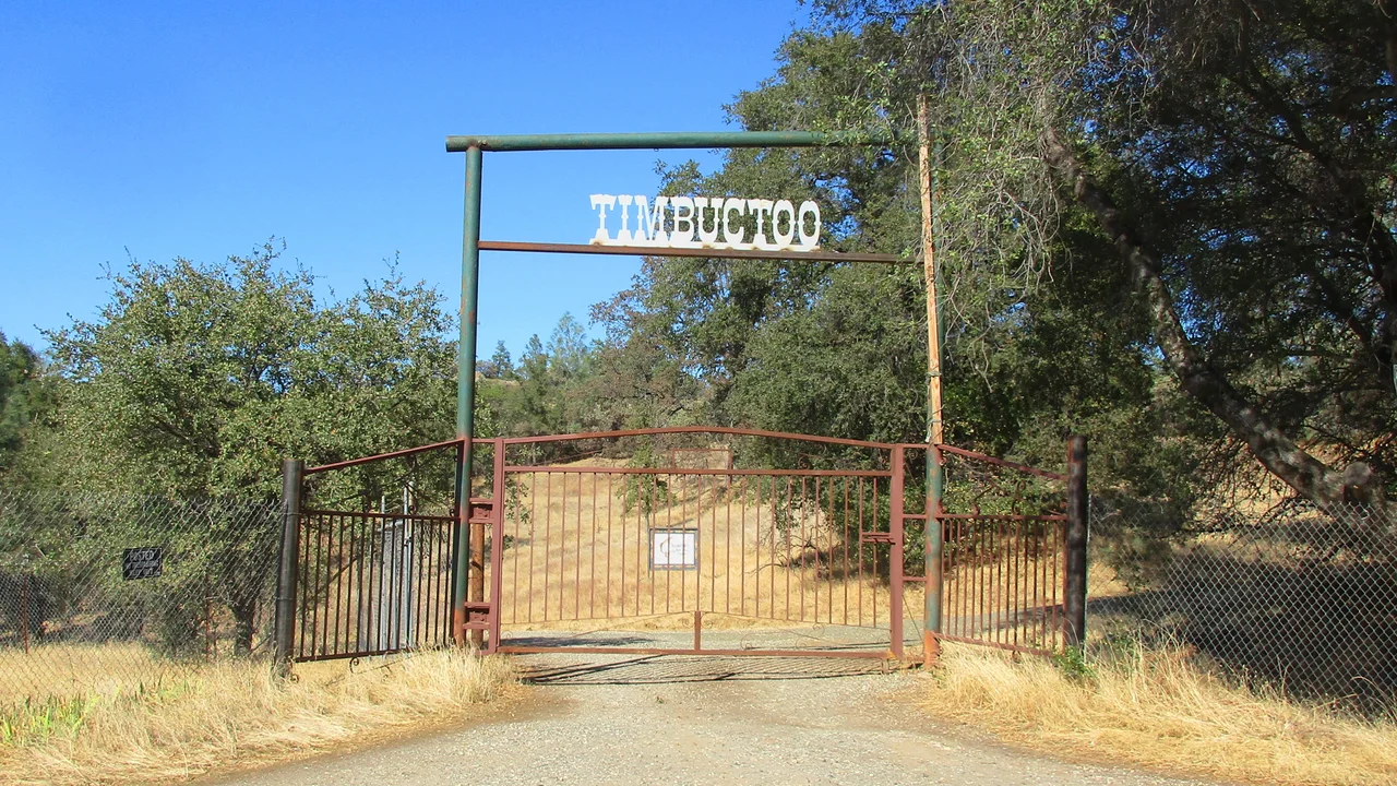
The Ghosts Who Won't Leave
Today, Timbuctoo is registered as a California Historical Landmark, though what exactly it is preserving has become an open question. The town site is reached via the much-neglected Timbuctoo Road, which loops off Highway 20 and crosses a stream gulch by bridge in two places. The western bridge buckled in 2008 and was not replaced until 2014. The Stewart Brothers Store ruin, once restored in the 1920s and given a commemorative plaque, has since been reduced to rubble by looters chasing gold rumors. A fence now guards the remains. Five miles west on Highway 20, a historical marker tells visitors about a town they cannot quite reach and a building they can no longer see whole.
Bones Beneath the Oaks
The Timbuctoo Cemetery, dating to 1855, holds approximately 89 graves -- most from the late nineteenth and early twentieth centuries -- behind its own protective fence and gate. It remains in use, making it one of the few living connections to a town that otherwise exists only as a cautionary tale. Timbuctoo once attracted tourists and preservationists who believed its story deserved telling. But vandalism, neglect, and the sheer difficulty of maintaining remote historical sites have turned it into what historians call a failed preservation effort. The gold is gone, the buildings are gone, and even the effort to remember has frayed. What remains is a name borrowed from the far side of the world, attached to a hillside in Yuba County where fortune arrived fast and departed faster.
From the Air
Timbuctoo is located at 39.217N, 121.319W in the foothills of Yuba County, California, at an elevation of approximately 397 feet. The site sits northwest of Smartsville along Highway 20. Look for Timbuctoo Road looping off Highway 20, crossing a stream gulch. The Yuba River and its gold-bearing sandbars are visible to the south. Nearby airports include Yuba County Airport (KMYV) approximately 20 miles west in Marysville and Nevada County Airport (KGOO) approximately 18 miles northeast. Best viewed at 1,500-2,500 feet AGL; the terrain is rolling foothills with scattered oaks.
Nearby Stories
- Forty-Five Names on a Constitution 5 km away
- Malakoff Diggins State Historic Park 8.5 km away
- United Auburn Indian Community 12 km away
- The Yuba County Five 19 km away
- Sutter's Mill 25 km away
- Rico Harris 31 km away
- Western Pacific Railroad Museum 49 km away
- Rancho Tehama Shootings 61 km away