Tiwanaku
Ephraim Squier called it "American Stonehenge" -- and in 1877, when he sketched the Gateway of the Sun with its exaggerated vertical scale, the comparison seemed apt. But Tiwanaku is not Stonehenge. It is older in ambition if not in years, more architecturally precise, and far more mysterious, because the people who built it left no written language to explain themselves. Located on the Bolivian altiplano about seventy kilometers from La Paz and roughly twenty from the shores of Lake Titicaca, Tiwanaku was the capital of a civilization that at its peak around AD 800 supported an estimated ten to twenty thousand inhabitants and influenced cultures across the central Andes. Today the site covers four square kilometers of decorated ceramics, megalithic blocks, and monumental platforms that have been looted, quarried for railroad ballast, and used for military target practice -- and still manage to astonish.
Stone in the Center
The Jesuit chronicler Bernabe Cobo reported that Tiwanaku's original name was taypiqala -- Aymara for "stone in the center" -- reflecting the belief that this place lay at the center of the world. It was the Spanish conquistador Pedro Cieza de Leon who first recorded the site in 1549, searching for the southern Inca capital of Qullasuyu. The dating of Tiwanaku has been revised dramatically over the past century. Arthur Posnansky spent decades arguing it was eleven to seventeen thousand years old. Modern radiocarbon analysis places its founding around AD 110, with the city growing steadily from the first century and reaching its height between AD 375 and 700. Its collapse around AD 1000 remains debated, though geological evidence points to a prolonged drought that would have devastated the raised-field agriculture sustaining the population. The language spoken here may have been Puquina, now extinct, though the Aymara people who live in the region today consider themselves descendants of Tiwanaku's builders.
Monuments Aligned to the Sky
The structures at Tiwanaku reveal a civilization deeply attuned to astronomy. The Akapana, a terraced platform mound shaped like half an Andean cross, stands 16.5 meters tall and 257 meters wide. Researchers speculate it served as an astronomical observatory, aligned with the peak of Quimsachata to track the rotation of the Milky Way from the southern celestial pole. The Kalasasaya, a courtyard more than three hundred feet long, is oriented to frame the sunrise on the equinox and both solstices. Within it stands the Gateway of the Sun, a carved monolith depicting a front-facing figure holding a spear-thrower and snuff tray -- possibly Viracocha, the creator god, or perhaps the Aymara deity Tunuupa. The gateway is incomplete, missing portions of its recessed frame, and scholars believe it was moved to the Kalasasaya from its original location. At Pumapunku, the T-shaped platform mound contains the site's largest stone block, estimated at 131 metric tonnes. The precision of the stonecutting reveals knowledge of descriptive geometry that still impresses engineers.
A World in Three Layers
Tiwanaku cosmology divided existence into three realms: Arajpacha, the upper world of celestial beings associated with the Milky Way; Akapacha, the middle world of the living; and Manqhapacha, the lower world where life is inverted. The site itself occupies a valley between two sacred mountains, Pukara and Chuqi Q'awa, and its proximity to Lake Titicaca -- the spiritual birthplace of Viracocha in Incan mythology -- reinforced its religious significance. Excavations of the Akapana uncovered remains of human and camelid sacrifices. The Semi-Subterranean Temple, a sunken courtyard oriented unusually on a north-south axis, features walls studded with carved stone heads in many different styles, suggesting the space was repurposed over centuries for evolving ceremonial functions. In 2013, marine archaeologists exploring the Khoa reef in Lake Titicaca recovered lapis lazuli figurines, ceramic incense burners, and a ceremonial medallion from the lake floor, evidence of the scale and opulence of Tiwanaku religious practice.
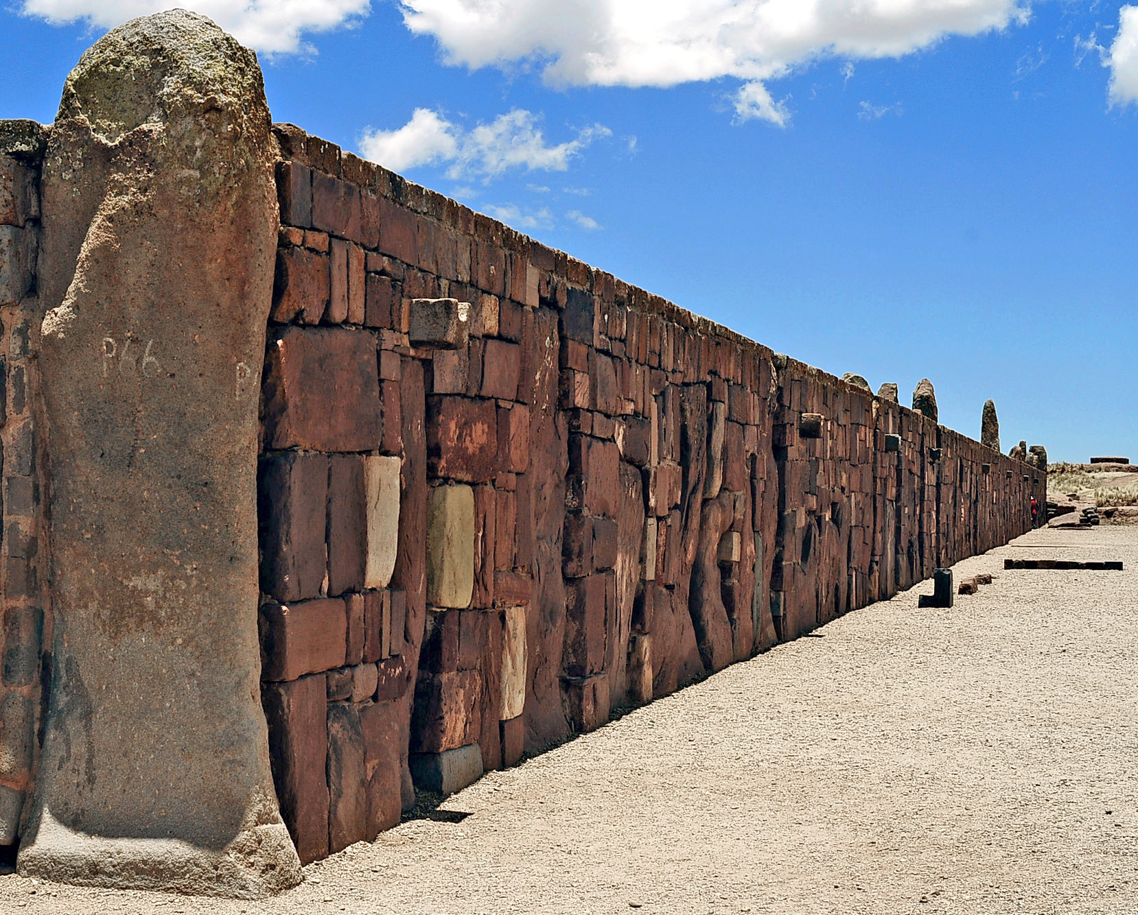
Looted, Quarried, and Still Standing
No original buildings survive at Tiwanaku. What visitors see today are foundations, reconstructed walls of debatable accuracy, and scattered megalithic blocks. The destruction began almost immediately after the civilization's collapse and continued through the Spanish colonial period, the nineteenth century, and into the twentieth -- when stones were hauled away for building projects and railroad construction, and soldiers used the ruins for target practice. In the 1960s, the Bolivian government attempted restoration, rebuilding the Kalasasaya walls, but the work was poorly grounded in evidence and lacks the quality of the original stonework. A Harvard field school operating from 2004 to 2007 drew controversy for allowing untrained students to excavate, and in 2009, UNESCO halted government restoration work on the Akapana after the platform was inappropriately faced with adobe. Despite all of this, Tiwanaku earned UNESCO World Heritage status. The Bennett Monolith, a 7.3-meter stele found in the Semi-Subterranean Temple -- the largest ever discovered in the Andean world -- now stands in the site museum, testament to a civilization whose ambitions outlasted every attempt to dismantle them.
From the Air
Located at 16.55S, 68.67W on the Bolivian altiplano, approximately 70 km west of La Paz and 20 km south of the Lake Titicaca shoreline. The site appears as a flat, semi-arid expanse at roughly 3,850 meters elevation. The ruins are visible at lower altitudes as a distinct cleared area with exposed foundations. El Alto International Airport (SLLP) serving La Paz is the nearest major airfield, approximately 55 km northeast. The Cordillera Real is visible to the east.