Tlaquepaque
The name gives everything away. Tlaquepaque derives from Nahuatl and means "place above clay land" -- or, in another interpretation, "men who craft clay pieces." Either way, the identity of this city south of Guadalajara has been shaped by the material beneath its feet for as long as anyone can remember. Before the Spanish arrived, the Tonalteca people fashioned pottery here. Today, San Pedro Tlaquepaque is a Pueblo Mágico, designated in 2018, where blown glass catches the afternoon light in gallery windows and the smell of fired clay hangs in workshops along the Andador Independencia.
A Queen's Calculated Welcome
When Nuño de Guzmán and his Spanish forces approached in March 1530, the indigenous population split. Queen Cihualpilli Tzapotzinco of the Tonalá kingdom, which included Tlaquepaque among its subject towns, chose diplomacy over bloodshed. She sent a delegation bearing chickens, eggs, honey, avocados, and fruit to meet the Spaniards at San Martín de las Flores. The representatives came from across the kingdom -- Coyotl and Chitacotl from Tlaquepaque, Coyopitzantli from Tetlán, Ipac from Atemaxac. Not everyone agreed. Tlaquitehuitli of Tetlán led a faction that resisted, meeting Guzmán's forces with arrows and war cries. The resistance was crushed. On March 25, 1530, Guzmán formally claimed the kingdom. Queen Cihualpilli was baptized as Juana Bautista Danza -- the name "Danza" chosen by lottery over alternatives like Petra and Micaela, commemorating a dance she had organized in the Spaniards' honor.
The Weight of Tribute
Colonial rule remade Tlaquepaque into a tributary settlement. By 1548, Franciscan friar Antonio de Segovia had renamed it San Pedro Tlaquepaque, and the town fell under the corregimiento of Guadalajara. A 1551 census counted 1,416 inhabitants living in 177 jacales, or thatched huts. The tribute demands reveal the scale of extraction: four loads of grass daily, ten chickens, ten loads of firewood, five laborers per week, thirty blankets, forty Tapatío cloaks, twenty pairs of quills, six loaves of salt, two jugs of honey every two months, and -- annually -- 400 fanegas of corn and 20 fanegas of chili. These were not abstract taxes. They were the daily labor of real families, measured in chickens and firewood and weeks of forced work.
Independence Passed Through Here
On the morning of November 26, 1810, the priest Miguel Hidalgo y Costilla arrived in San Pedro Tlaquepaque with roughly 7,000 men, having marched from Atequiza. The town arranged him the most comfortable house available, served a grand banquet at noon, and hosted a reception that evening for visiting officials from church and government. The next day, Hidalgo led his forces into Guadalajara, arriving at the cathedral gates around midday. A decade later, the town's role in independence became even more direct: on June 13, 1821, Brigadier Pedro Celestino Negrete signed the proclamation of Jalisco's independence from Spain in San Pedro Tlaquepaque itself, making the pottery town the birthplace of the state's sovereignty.
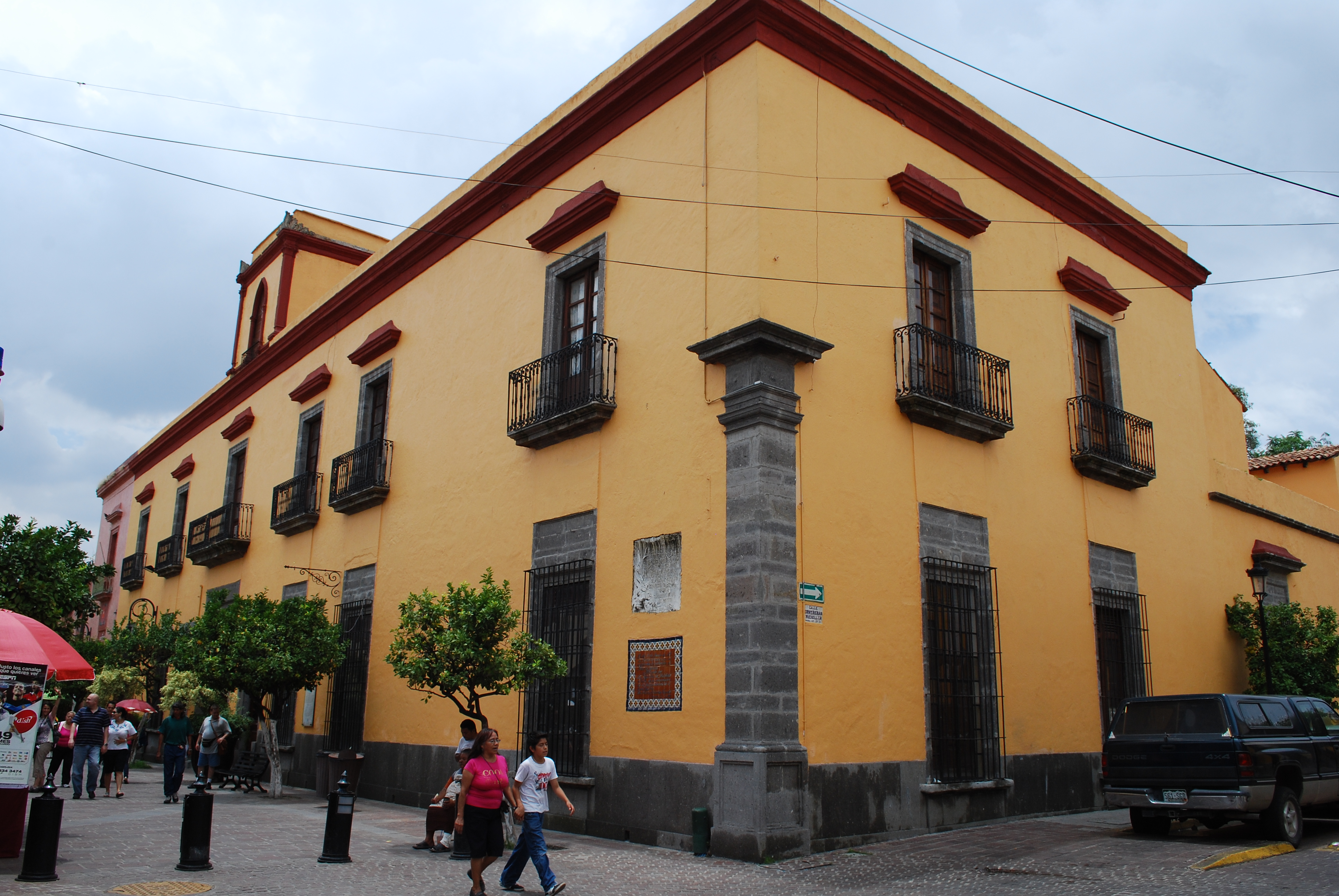
Clay, Glass, and the Pueblo Mágico
Walk the Andador Independencia today and the artisan heritage that gave Tlaquepaque its name is everywhere. Galleries display hand-blown glass in jewel tones. Workshops sell pottery and papier-mâché alongside leather goods and brass work. El Parián, the town's famous gathering place, holds 18 restaurants and bars under columned arcades where mariachi bands play and families gather for celebrations. The Regional Ceramics Museum houses pieces from across Jalisco and Mexico, including the miniature works of local artist Angel Carranza. Nearby, the Pantaleón Panduro Museum displays winners of the National Prize for Ceramics. The Cultural Center El Refugio, originally built in 1859 as a hospital designed by Fray Luis Argüello Bernal, was converted in 1984 by architect Alejandro Zhon into a cultural and commercial space that preserved the original colonial architecture. Tlaquepaque is also famous for its tepache, a drink made from fermented pineapple and brown sugar -- best enjoyed cold, in one of El Parián's arcades, while the clay dust settles on everything around you.
From the Air
Located at 20.64°N, 103.31°W, immediately south of central Guadalajara in the Jalisco highlands. From altitude, Tlaquepaque is fully integrated into the Guadalajara metropolitan area and not visually distinct as a separate city. The municipality covers 270.88 square kilometers. Nearest airport is Guadalajara Miguel Hidalgo y Costilla International (MMGL/GDL), approximately 10 km to the southeast. Elevation roughly 5,100 feet with a semi-dry climate and rainy season from June to August.