Toba Inlet
The name is an accident of bureaucracy. In 1792, Spanish naval officers Dionisio Alcala Galiano and Cayetano Valdes explored a deep, steep-walled inlet on the British Columbia coast and found, on its eastern shore, a wooden plank covered with Indigenous paintings. They named the waterway Canal de la Tabla -- "Channel of the Plank." Three years later, in 1795, Spanish cartographers renamed it Toba in honor of Antonio Toba Arredondo, the only officer under Captain Alejandro Malaspina who had not yet had a coastal feature named for him. Two centuries later, Toba Inlet still carries the name of a bureaucratic act of recognition, a fitting label for a place that resists easy description.
The Plank and the Passage
The story of European contact at Toba Inlet is a story of cooperation between rivals. In June 1792, British and Spanish expeditions found themselves working the same stretch of coast. George Vancouver, charting inlets in his search for the Northwest Passage, had set up operations in nearby Desolation Sound. The Spanish, under Dionisio Alcala Galiano, were doing the same. Rather than duplicating effort, Vancouver proposed splitting the work into three boat parties, and the Spanish volunteered to take Toba Inlet. Valdes departed on June 25 and returned two days later with his report: the inlet was closed, its waters deep, its shores steep, its peaks high. He also described the painted plank and several empty villages along the shoreline. The British followed shortly after, confirming the Spanish findings. Vancouver adopted the Spanish name Canal de la Tabla. In 1795, Spanish cartographers changed it to Toba to honor Antonio Toba Arredondo, a Malaspina expedition officer who lacked a named place of his own.
Steep Walls and Short Rivers
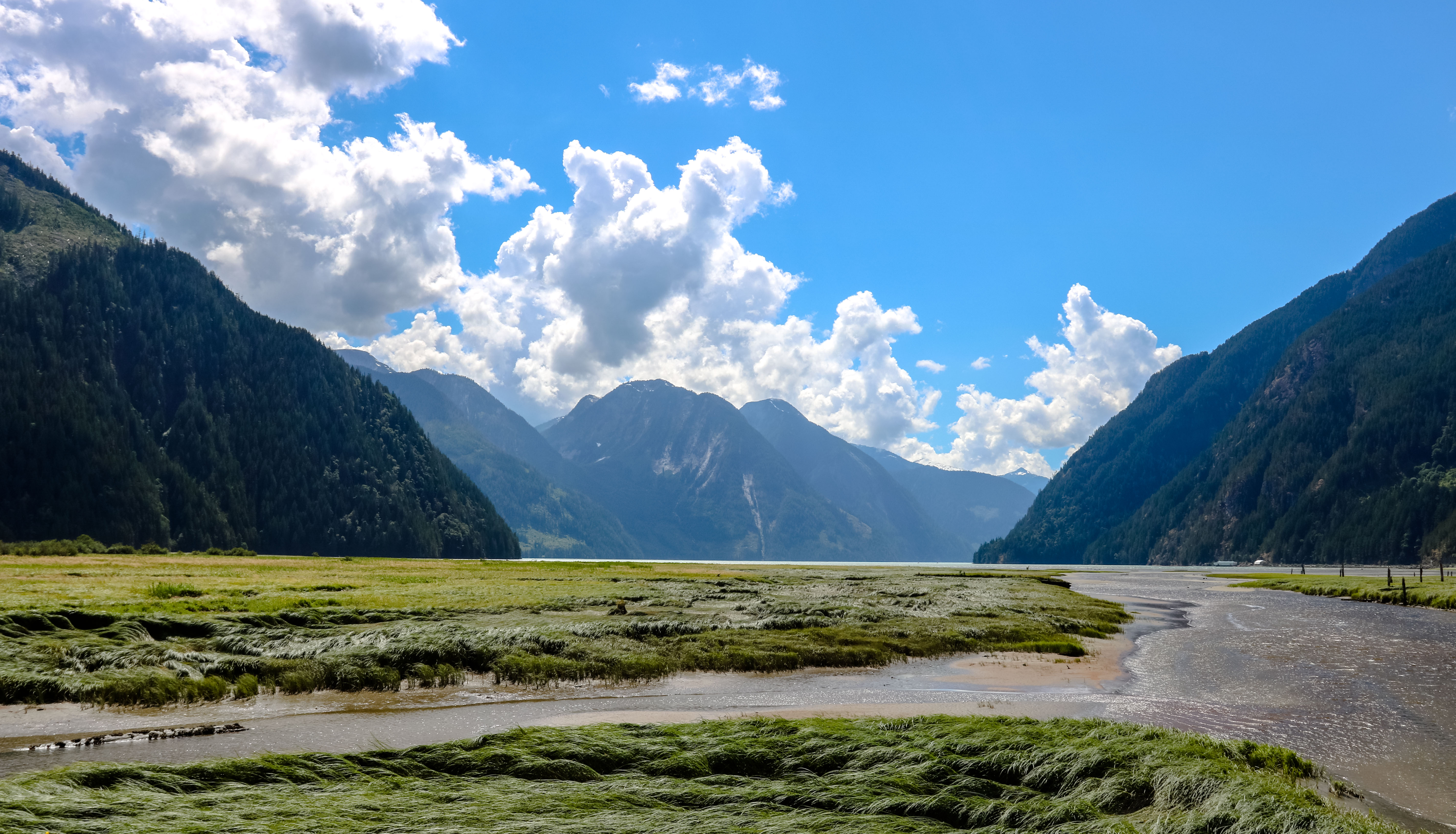
Toba Inlet is compact by BC coastal standards. It stretches roughly 35 kilometers from the mouth of the Toba River to its opening at the junctions of Pryce Channel and Homfray Channel, near the northern tip of East Redonda Island. Its average width is only about 2.5 kilometers, making the fjord feel more like a corridor than a basin. The walls rise steeply on both sides, and the water beneath them runs deep. The Toba River itself is powerful but short, draining glaciers and snowfields in the Coast Mountains before emptying into the head of the inlet. The Klahoose First Nation maintains the Klahoose 1 Reserve at the river's mouth, a community whose connection to this landscape predates every European name on the chart. In the Coast Salish language, the inlet is called Yekwamen.
Grizzly Country
The Toba Valley is one of the most reliable places on the BC coast to encounter grizzly bears. The combination of salmon runs in the Toba River, dense forest cover, and minimal human presence creates ideal habitat. Bears fish the river during spawning season and forage through the valley's avalanche chutes and berry patches through summer and fall. The inlet's remoteness -- no roads reach it, and the nearest settlement of any size is Powell River, across multiple channels to the south -- means the bears have room to move without regular human conflict. For the few boaters and kayakers who venture this far up the coast, the possibility of spotting a grizzly on the shoreline is part of the appeal and part of the caution.
A Fjord Between Empires
Toba Inlet occupies a peculiar position in the history of Pacific Northwest exploration. It sits at the boundary where Spanish and British ambitions overlapped during the final years of the 18th century. The cooperation between Vancouver and Galiano here was genuine but temporary; within a few years, the Nootka Convention would settle the larger territorial dispute in Britain's favor, and Spanish names would begin fading from coastal charts. Toba survived the shift of imperial power, its name transformed in 1795 from a description of a painted plank to a bureaucratic tribute to a Malaspina officer. Today the inlet remains one of the quieter corners of the BC coast, visited mainly by fishing guides, wildlife watchers, and sailors willing to navigate the island-choked approaches. The painted plank that Valdes found is long gone. But the steep shores and high peaks he described look much the same as they did on that June day in 1792.
From the Air
Located at 50.42°N, 124.50°W on the BC mainland coast. The fjord runs roughly northeast-southwest, 35 km long and narrow at 2.5 km wide. Best viewed at 3,000-5,000 ft to see the full length of the inlet. Powell River Airport (CYPW) lies approximately 30 nm to the south. The inlet opens where Pryce Channel meets Homfray Channel near East Redonda Island. Look for the Toba River delta at the head of the inlet. Surrounding peaks rise steeply, so maintain altitude when overflying in variable weather.