Tokuyama Dam
In 1987, Tokuyama Village disappeared from the maps. Not destroyed by earthquake or typhoon, but erased by bureaucratic decree, its 466 households and roughly 1,500 residents relocated to make way for a reservoir that would not begin filling for another two decades. The eight hamlets that once dotted the two valleys near the headwaters of the Ibi River now lie beneath 660 million cubic meters of water, held back by a wall of rock and clay that stands 161 meters tall. Tokuyama Dam, completed in 2008 in the remote mountains of northwestern Gifu Prefecture, is Japan's largest dam by structural volume and impounds the country's biggest reservoir. It is also a monument to the price of infrastructure, a place where the ghosts of a village rest beneath perfectly still water.
Half a Century in Planning
The story of Tokuyama Dam begins in December 1957, when the Electric Power Development Company selected the Ibi River for study at the 23rd Electric Power Development Coordinating Meeting. What followed was one of the longest development timelines in Japanese dam history. The Ministry of Construction released its policy bulletin on the project in 1976. The project was incorporated into the national Electric Power Development Basic Plan in 1982. Government approval finally came in 1998, more than four decades after the initial site selection. The original design was even more ambitious than what was eventually built: a 400-megawatt pumped-storage hydroelectric scheme with Tokuyama Dam as the upper reservoir and a second structure, the Sugihara Dam, serving as the lower. A design change in 2004 scaled the project back to a conventional 153-megawatt hydroelectric station, but the dam itself remained colossal.
The Village That Went Under
Tokuyama Village occupied some of the most isolated terrain in Gifu Prefecture, near the borders of Fukui and Shiga Prefectures. It was a mountain settlement of about 1,500 people living in eight hamlets strung along the valleys at the headwaters of the Ibi River. When the dam project advanced, the entire population had to be relocated, all 466 households uprooted from a community with deep roots in the landscape. In 1987, the village was officially abolished and annexed to neighboring Fujihashi Village, now part of Ibigawa Town. The human cost was significant. Researchers later documented the psychological damage of involuntary resettlement: landlessness, joblessness, and the loss of access to communal resources. In a quiet act of defiance, about ten elderly former residents returned to the abandoned village in the late 1980s, determined to live out their remaining years in the place they had always called home.
A Mountain of Rock and Clay
The Tokuyama Dam is a rock-fill embankment dam with a clay core, stretching 427 meters across the valley at a height of 161 meters. Its total structural volume of 13.7 million cubic meters makes it the largest dam by volume in all of Japan. The reservoir behind it holds 660 million cubic meters of water, covering a vast surface area in the narrow mountain valleys. Construction began in May 2000 and the dam was completed in 2008, with initial reservoir filling starting in September 2006. The dam supports two Francis turbine generators: one with a capacity of 130 megawatts housed in an underground power station downstream, and a second 23-megawatt unit at the base of the dam. The first generator was commissioned on May 15, 2014. Beyond power generation, the dam serves critical roles in flood control for the Ibi River basin and water supply for the region.
Still Water, Deep Memory
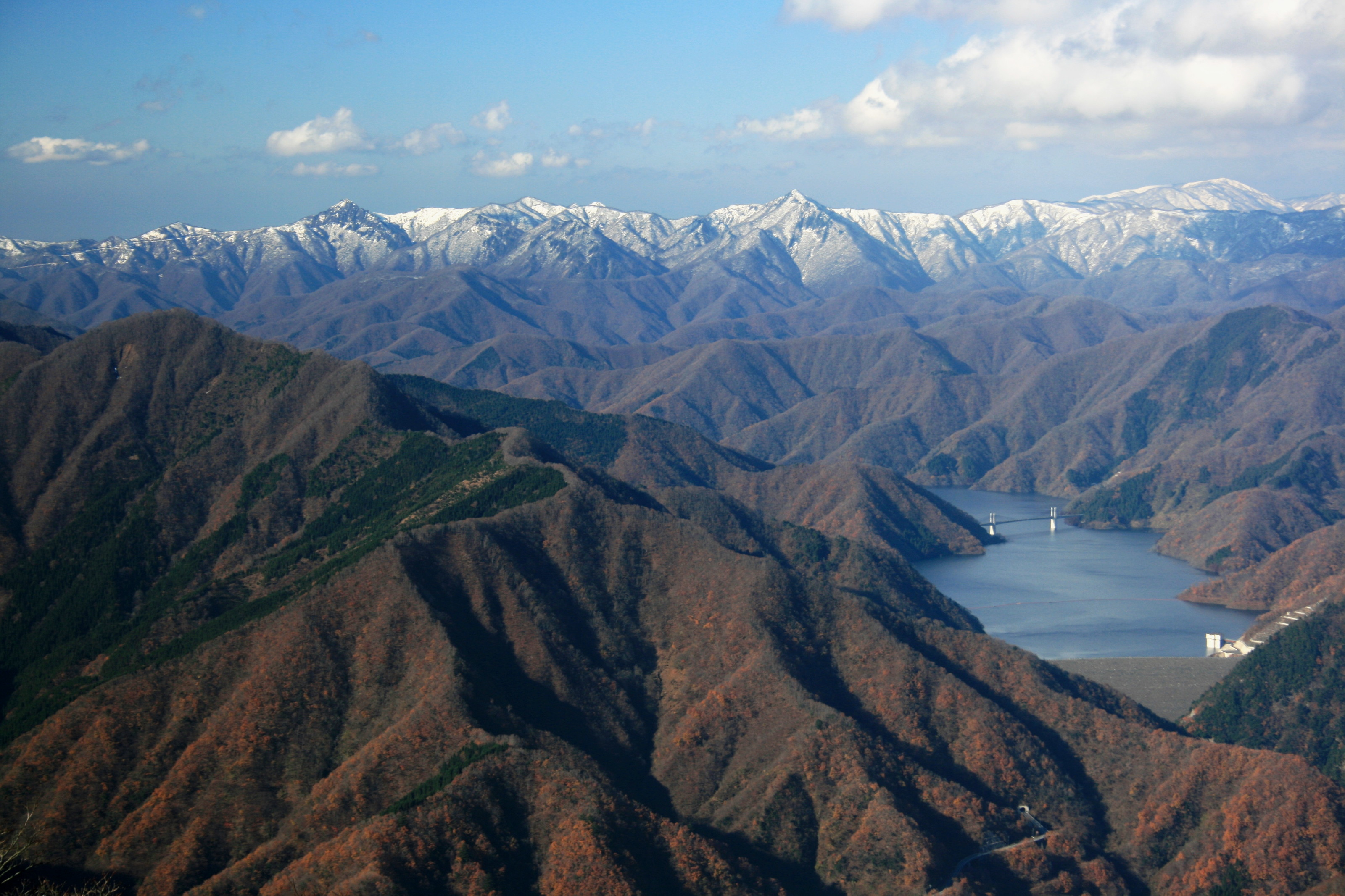
From the air, Tokuyama Dam's reservoir appears as an improbable sheet of turquoise wedged into the folds of forested mountains. There are no towns on its shores, no marinas or resort hotels. The remoteness that once defined Tokuyama Village now defines the reservoir itself. The Japan Water Agency manages the facility, and the dam has become a quiet destination for infrastructure enthusiasts and the occasional hiker. But the reservoir carries a weight that no engineering report captures. Beneath its surface lie the foundations of homes, the paths between hamlets, the common lands where villagers gathered wood and foraged. Photographer Masuyama Tazuko documented the village in its final years, creating a visual record of a community in the process of vanishing. The Tokuyama Dam stands as both a feat of engineering and a reminder that Japan's largest reservoirs are measured not only in cubic meters but in the communities they displaced.
From the Air
Located at 35.63N, 136.48E in the remote mountains of northwestern Gifu Prefecture. The dam and reservoir are visible from altitude as a large body of turquoise water in a narrow mountain valley surrounded by dense forest. Best viewed from 5,000-8,000 feet. The dam wall stretches 427 meters across the valley. Nearest significant airport: Gifu Air Base (RJNG) approximately 50 km southeast. Nagoya Airfield/Komaki (RJNA) lies about 60 km to the southeast. Terrain is mountainous with peaks above 1,000 meters surrounding the reservoir. Exercise caution with mountain weather and terrain clearance.