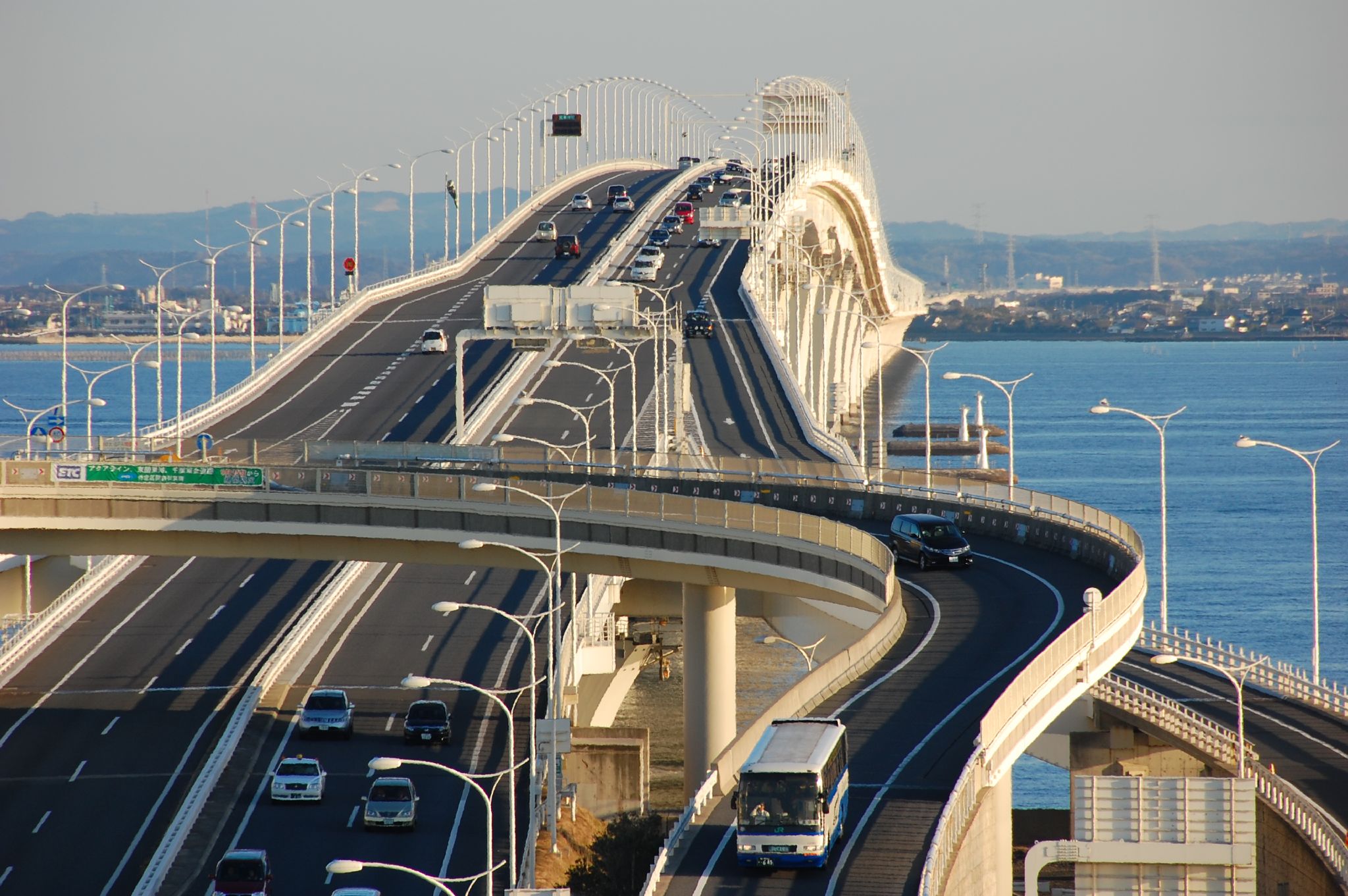
Tokyo Bay Aqua-Line: The Highway That Disappears Underwater
Halfway across Tokyo Bay, the highway vanishes. Drivers heading from Kawasaki toward the Chiba coast enter a tunnel mouth and descend into a 9.6-kilometer bore running beneath the seafloor -- the fourth-longest underwater tunnel in the world. After nearly ten kilometers in artificial twilight, the road climbs back to daylight on Umi-Hotaru, a man-made island perched in the middle of the bay, complete with restaurants, amusement facilities, and panoramic views of the Tokyo skyline. From there, a 4.4-kilometer bridge carries traffic the rest of the way to Kisarazu on the far shore. The entire crossing spans 23.7 kilometers. Before it opened, the same trip required a hundred-kilometer detour through the heart of Tokyo. The Tokyo Bay Aqua-Line turned ninety minutes into fifteen.
Japan's Last Great Megaproject
The Aqua-Line was one of the final megaprojects of twentieth-century Japan, a country that had spent decades pouring concrete, steel, and ambition into infrastructure on a scale few nations could match. Construction cost 1.44 trillion yen -- roughly 11.2 billion US dollars -- and the expressway opened on December 18, 1997, linking Kawasaki in Kanagawa Prefecture to Kisarazu in Chiba Prefecture as part of National Route 409. The engineering challenge was immense: boring a tunnel beneath an active shipping channel, building an artificial island to serve as the transition point between tunnel and bridge, and anchoring a multi-span bridge across open water in a bay prone to typhoons and earthquakes. The result connected two of Japan's most important industrial prefectures by a direct line across the water, bypassing the congested ring of highways that circles the bay through central Tokyo.
The Island in the Middle
Umi-Hotaru -- 'sea firefly' in Japanese -- is the artificial island that marks the junction between tunnel and bridge. Rising from the bay surface like a beached cruise ship, it serves as both a structural necessity and a destination in its own right. The island provides a rest stop with shops and restaurants spread across multiple floors, each offering views across the bay toward Tokyo, Yokohama, and the distant Boso Peninsula. A distinctive tower called the Kaze no To -- 'the tower of wind' -- rises above the tunnel's midpoint, drawing on the bay's nearly constant winds to power the ventilation system that keeps air circulating through the underwater bore. The island has become a popular excursion spot, drawing visitors who come for the views and the novelty of standing on dry land in the middle of one of the world's busiest waterways.
The Toll Road's Bargain
The Aqua-Line was built to redirect traffic away from central Tokyo, and in that it has partially succeeded -- but the expensive toll limited its impact. A single cash crossing costs 3,140 yen for an ordinary car, though the electronic toll collection system reduces the fare, and weekend and holiday discounts bring it down further. Highway bus services now use the route heavily, connecting major stations in Tokyo, Yokohama, Kawasaki, Shinagawa, Shibuya, and Shinjuku to cities across the Chiba coastline, from Kisarazu to Tateyama at the tip of the Boso Peninsula. The expressway also opened the southern Boso Peninsula's seaside leisure spots to weekend visitors from Tokyo and Kanagawa, transforming a remote coastline into a practical day trip. But the toll remains a friction point -- a reminder that even the most ambitious infrastructure must pay for itself.
Midnight on the Aqua-Line
The Aqua-Line developed an unexpected reputation in its early years: it became a magnet for illegal street racing. The long, straight bridge section and the tunnel's controlled environment attracted racers who treated the late-night hours as their private track, meeting on Umi-Hotaru before tearing across the bay at speeds well above the limit. The phenomenon earned enough notoriety that authorities responded with speed cameras and stricter enforcement, which curtailed but never fully eliminated the practice. The Aqua-Line at night remains a striking experience for legal drivers as well -- the tunnel's orange sodium lighting gives way to the open darkness of the bridge, with the lights of the Kanto plain spread across the horizon and the red warning beacons of ships passing below.
From the Air
Coordinates: 35.46°N, 139.88°E, crossing Tokyo Bay between Kawasaki (west) and Kisarazu (east). From the air, the Aqua-Line is unmistakable: a straight bridge section running east from Umi-Hotaru island to the Chiba shore, while the tunnel section to the west is invisible beneath the water surface. The artificial island Umi-Hotaru is the clearest landmark, appearing as a bright rectangular platform in the middle of the bay. Best viewed at 2,000-4,000 feet AGL. Nearby airports: Tokyo Haneda (RJTT) approximately 10 nm north-northwest, Kisarazu Airfield approximately 5 nm east. The bridge section aligns roughly east-west across the bay's narrowest crossing point.