Tondabayashi Jinaimachi: The Temple Town That Time Forgot
Every night for centuries, four wooden gates swung shut across the streets of Tondabayashi Jinaimachi. The moat at the northern edge filled with dark water. Bamboo groves thickened along the earthworks to the east, south, and west. Inside the perimeter, merchants locked their storefronts and the temple bell at Kosho-ji marked the hour. This was how a fortress town worked in Japan's Sengoku period -- not with stone walls and samurai garrisons, but with religious authority, cooperative governance, and the quiet discipline of closing the gates. What makes Tondabayashi remarkable is not that it once existed this way, but that it still does. The grid of streets laid out in the 1550s remains. More than 200 traditional buildings stand on their original plots. The town measures 400 meters east to west and 350 meters north to south, the same dimensions it held when warlords fought over the provinces around it.
A Temple Builds a City
Around 1558, during the first year of the Eiroku era, Kosho-ji temple acquired a tract of wasteland along the Tonda plain in what is now southern Osaka Prefecture. The temple's leaders cooperated with eight headmen to lay out something ambitious: not merely a monastery, but an entire self-governing town. They designed a grid plan of six streets running north to south and seven streets running east to west, creating 25 rectangular blocks at the center and 16 irregular blocks along the edges. They built the town on a fluvial terrace above the left bank of the Ishi River, using the natural ten-meter cliff as a foundation for earthwork defenses. They dug a moat along the northern edge and planted bamboo groves along the other three sides. The name Tondabayashi replaced the old designation, and the new jinaimachi -- a temple-centered town -- was granted privileges and immunities by the authorities of the age. The townspeople governed themselves under the religious authority of Kosho-ji, answerable to no feudal lord.
Cotton, Rapeseed, and Sake
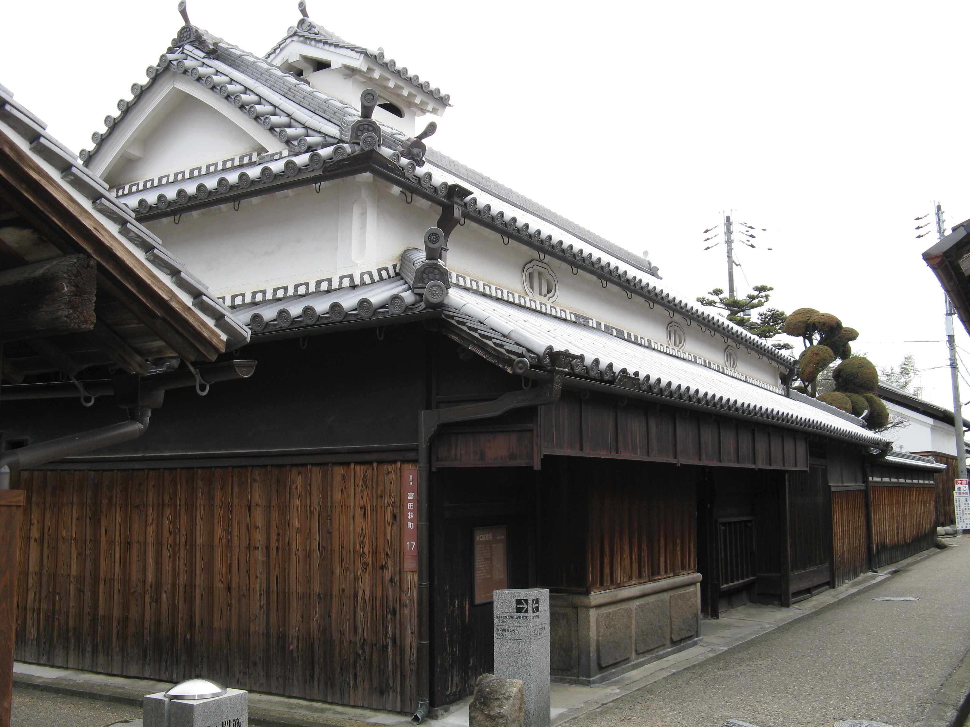
The Sengoku period's chaos eventually ended, and with it went the town's special autonomy. Under the Edo period shogunate, Tondabayashi forfeited its immunities and privileges. But the loss of political independence brought commercial prosperity. The town reinvented itself as a zaigoumachi -- a merchant town in the countryside -- drawing traders and craftspeople from surrounding villages. Lumber dealers, cotton merchants, rapeseed oil producers, and sake brewers filled the grid of streets with enterprise. The machiya townhouses that line the blocks today date largely from this era, their narrow street-facing facades hiding deep lots that stretch back through workrooms, storerooms, and private gardens. The Old Sugiyama family residence and the Nakamura family residence survive as particularly fine examples of Edo-period merchant architecture. For over two centuries, Tondabayashi thrived as the political and commercial heart of southern Kawachi Province.
Saved by Neglect
The Meiji Restoration after 1868 initially changed little for Tondabayashi. The town continued as a regional center. But from the latter Meiji period onward, modernity arrived in forms that bypassed the old grid entirely. Railways drew commerce to new stations built elsewhere. Land reform dissolved old property arrangements. Motorization made the narrow streets impractical for the traffic patterns of the twentieth century. Tondabayashi headed into a slow, quiet decline. Across Japan, towns that modernized tore down their machiya for wider roads, concrete buildings, and parking lots. Tondabayashi simply lacked the economic pressure to do the same. Postwar development passed it by. The very stagnation that impoverished the town preserved it, leaving the Sengoku-era street grid and Edo-period buildings standing when nearly every comparable example elsewhere had vanished.
Walking the Grid Today
In 1997, the Japanese government designated Tondabayashi Jinaimachi as one of its Important Preservation Districts for Groups of Traditional Buildings, recognizing the extraordinary survival of its urban fabric. The 12.9-hectare district contains over 200 structures of historical significance, including Kosho-ji temple, Myokei-ji temple, Jokoku-ji temple, and rows of merchant machiya with their distinctive latticed facades, clay-walled storehouses, and tiled roofs. The Nakauchi ophthalmic clinic stands out as an example of early modern architecture grafted onto the traditional streetscape. Walking the town today means following the same grid that the eight headmen and Kosho-ji temple laid out nearly five centuries ago. The streets are narrow and quiet. The earthwork defenses are still readable in the landscape. The ellipsoidal outline of the original fortified perimeter still defines where old town ends and the modern city begins.
From the Air
Located at 34.50N, 135.60E on a fluvial terrace above the Ishi River in southern Osaka Prefecture. The ellipsoidal town plan is visible from above as a distinct historical grid surrounded by modern development. Kansai International Airport (RJBB) lies approximately 20 nautical miles to the west-southwest across Osaka Bay. Osaka International Airport at Itami (RJOO) is roughly 20 nautical miles to the north. Best viewed at 2,000-3,000 feet AGL to appreciate the contrast between the preserved grid plan and the surrounding modern urban sprawl.