Tone River
The Japanese nicknamed it Bando Taro -- the eldest son of the Kanto Plain -- and like any eldest son in an old family, the Tone River carries the weight of expectation and a complicated history. At 322 kilometers, it is the second-longest river in Japan. Its drainage basin of 16,840 square kilometers is the largest in the country, collecting water from the mountains of Gunma and Niigata and delivering it across the broad Kanto flatlands where forty million people live. But the river you see today is not the river that nature made. The Tone once emptied into Tokyo Bay. It took sixty years of Tokugawa-era engineering, a Dutch civil engineer, and centuries of accumulated flood grief to force it eastward to the Pacific. The Tone River is, in the most literal sense, a work of human will imposed on moving water.
The Uncontrollable Eldest Son
The Tone begins high in the Echigo Mountains at Mount Ominakami, straddling the border between Gunma and Niigata Prefectures within Joshin'etsu Kogen National Park. In its natural state, the river was notorious for changing course with every major flood. Its tributaries -- the Agatsuma, Watarase, Kinu, and Omoi -- once flowed as independent river systems, each with its own path to the sea. The main channel of the Tone curved south through what is now the greater Tokyo metropolitan area and emptied into Tokyo Bay along the course of the present-day Edo River. Every typhoon season brought destruction. The river earned its nickname, Bando Taro, not as an endearment but as a warning: this was the dominant, unpredictable force of the Kanto region, and it answered to no one.
A River Redirected
When Tokugawa Ieyasu established his shogunate in Edo in 1603, the new capital sat squarely in the Tone's flood path. The solution was audacious: redirect the entire river. Beginning in 1594, even before the shogunate was formally established, engineers began the Eastward Diversion Project, a campaign of canal building, levee construction, and tributary rerouting that would take sixty years to complete. By 1654, the Tone's lower course had been shifted from its southward path into Tokyo Bay to an eastward outlet at Choshi in Chiba Prefecture. The work continued through the Meiji period, when the Dutch civil engineer Anthonie Rouwenhorst Mulder helped finalize the modern channel. The result is a watershed that is, to a remarkable degree, artificial -- a river whose course was chosen by humans rather than geology. Three warships of the Japanese Navy have carried the Tone's name, including the lead ship of the Tone-class heavy cruisers in World War II.
The Lifeline of Edo
Before railways, the Tone was the Kanto Plain's highway. Flat-bottomed boats carried soy sauce from the brewing port of Choshi, rice from the northern Tohoku region, and goods of every kind to the markets of Edo. The river route avoided the dangers of the open Pacific coast, offering a protected inland passage through a network of canals and tributaries that connected the capital to the ocean. Inland ports flourished: Noda, Sekiyado, Nagareyama, and Sawara became thriving river towns. The artist Hiroshige captured the canal traffic in his ukiyo-e woodblock prints, depicting the Tone's waterways as scenes of commerce and daily life. The railway arrived in the nineteenth century and ended the river's dominance as a trade route almost overnight. The port towns shrank. The flat-bottomed boats disappeared. But the Yagisawa Dam, the largest reservoir on the Tone, still supplies drinking water to millions in the Tokyo metropolitan area.
Two Wheels, Two Hundred Kilometers
Today the Tone River is home to Japan's longest car-free cycling path. The Tone River Cycling Road stretches over 220 kilometers from Shibukawa City in Gunma Prefecture to Choshi City in Chiba, running along detached paths high atop the river embankments. The route begins in mountain country, with views of the peaks that feed the river's headwaters, then gradually flattens as the terrain opens into the vast rice paddies and agricultural land of the Kanto Plain. The final ten kilometers into Choshi follow a road rather than a dedicated path, but for the rest of the journey, the only traffic is other cyclists and the occasional runner. The embankment paths sit well above the river, offering panoramic views across the watershed that Tokugawa engineers spent sixty years reshaping. From mountain to ocean, the ride traces the full arc of a river that humans bent to their purpose -- and that still serves as the lifeline of Japan's most populated region.
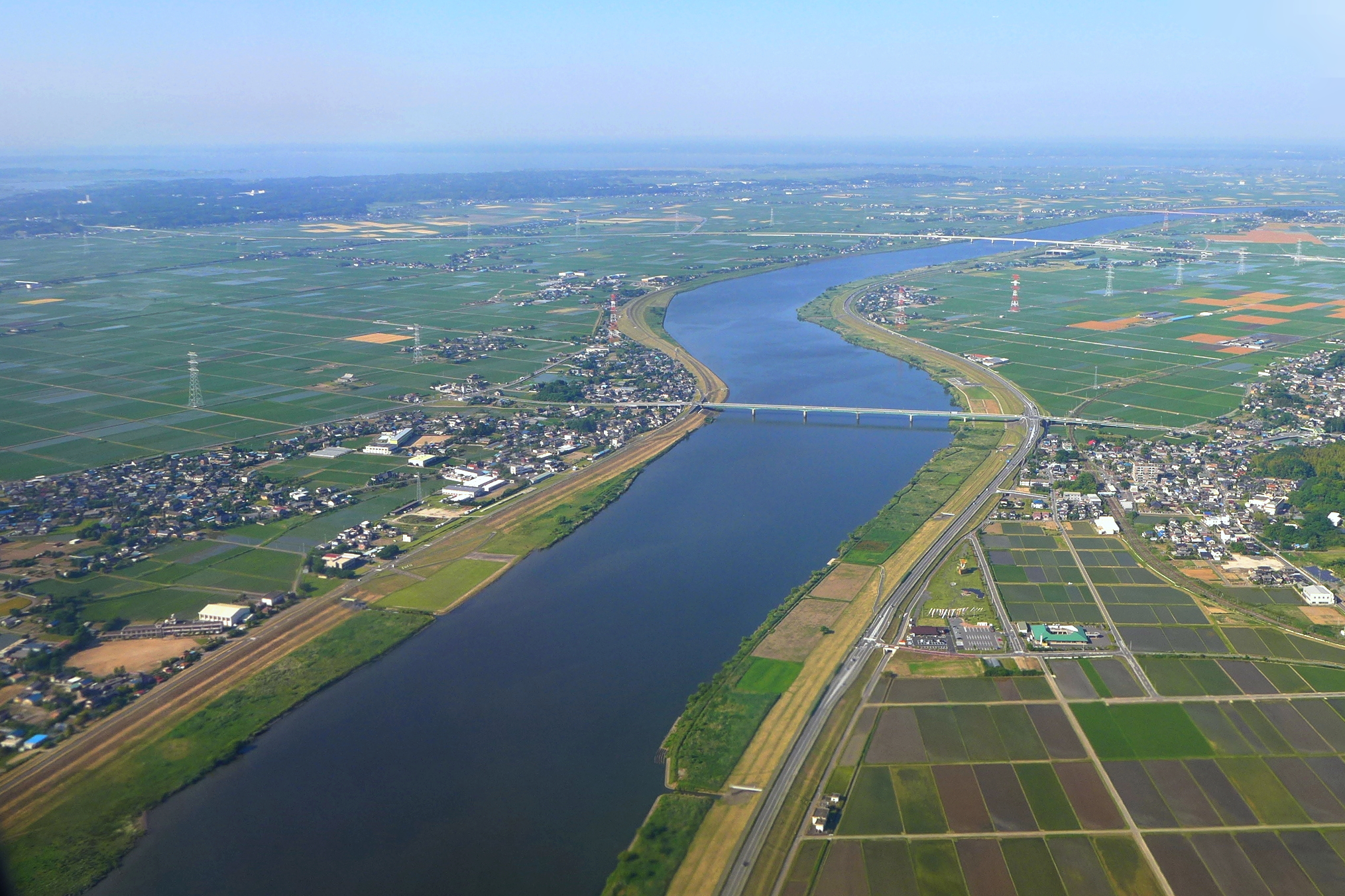
From the Air
The Tone River source is located at approximately 37.05N, 139.10E in the Echigo Mountains. The river flows generally south and then east across the Kanto Plain, visible from altitude as a broad, meandering waterway with extensive levee systems. The river mouth is at Choshi, Chiba Prefecture, on the Pacific coast. From cruising altitude, the Tone is one of the most prominent water features of the Kanto region, flanked by rice paddies and agricultural land. Niigata Airport (RJSN) lies to the northwest near the headwaters. Tokyo's Narita International Airport (RJAA) and Haneda Airport (RJTT) are both within the broader Tone watershed. The river's course is particularly visible on the flat Kanto Plain below 5,000 feet AGL.