Torotoro National Park
The footprints are everywhere, stamped into the stone like a message no one erased. In the canyons of Torotoro National Park, more than 2,500 dinosaur tracks from the Cretaceous period -- 120 million years old -- lie exposed on tilted slabs of rock, recording the passage of theropods and sauropods across a world that no longer exists. Getting here requires commitment: a five-and-a-half-hour bus ride from Cochabamba on roads that test both vehicle and passenger, or a chartered flight that covers the same distance in thirty minutes. The difficulty of arrival is part of the point. Torotoro does not make itself easy, and that is why it remains one of Bolivia's most extraordinary and least crowded natural wonders.
Footprints in Deep Time
The park's most famous features are its paleontological treasures. Dinosaur bone fragments and more than 2,500 individual footprints cover exposed rock surfaces throughout the park -- tracks left by bipedal and quadrupedal dinosaurs, carnivorous theropods and massive sauropods, all dating to the Cretaceous period roughly 120 million years ago. Some prints are scattered across open hillsides where guided tours stop for photographs. Others require scrambling along canyon walls to reach. The sheer density of tracks in such a compact area makes Torotoro one of the richest dinosaur trackway sites in South America. A recognition chart near the main site helps visitors distinguish raptor prints from sauropod impressions, though the scale difference alone -- some tracks barely wider than a hand, others the size of a bathtub -- tells its own story.
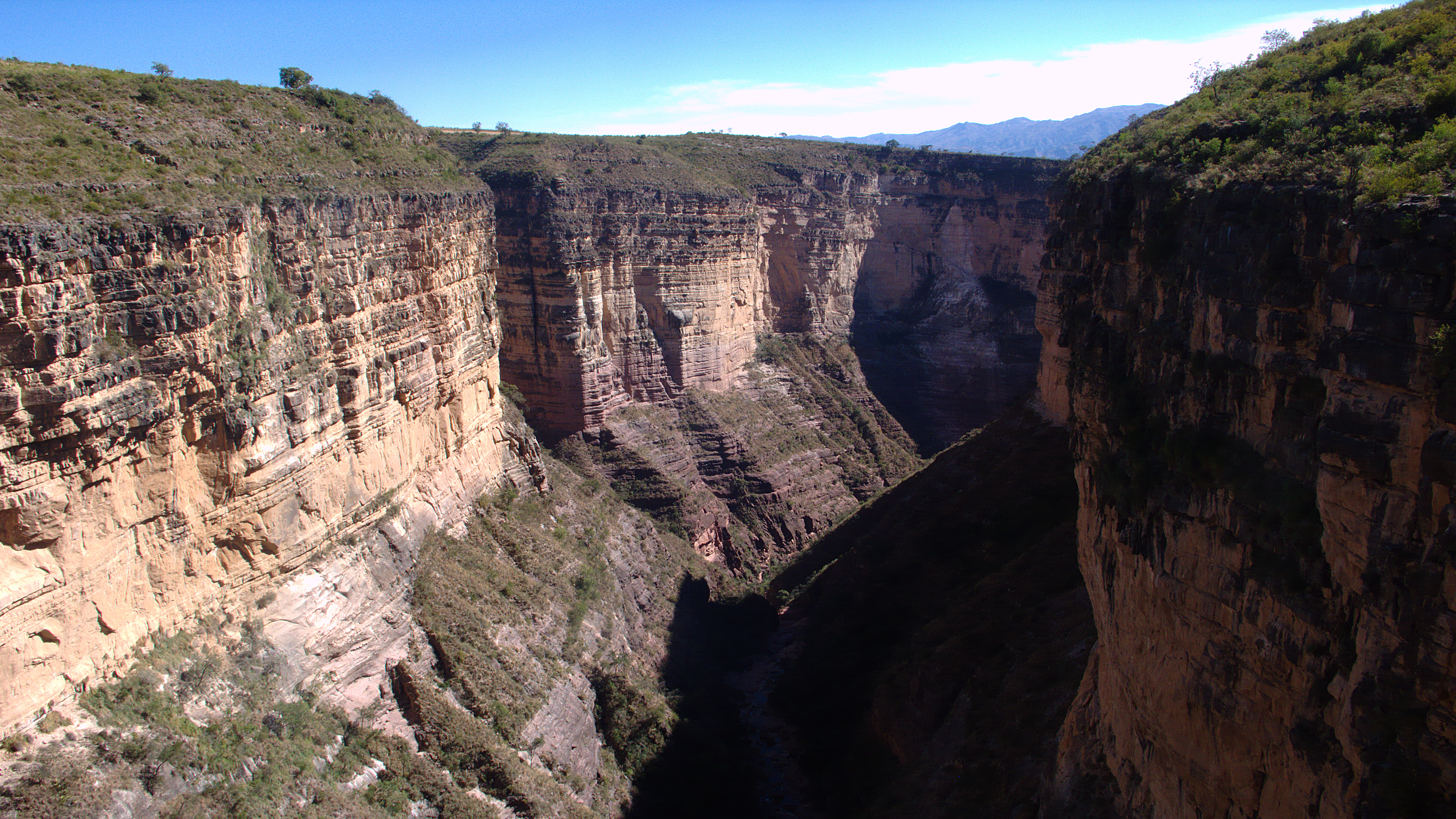
Canyons, Caves, and Carved Stone
Beyond the dinosaur tracks, the park's 165 square kilometers hold a landscape shaped by deep time and relentless erosion. Canyons plunge 300 meters into the earth, their walls exposing Paleozoic and Cretaceous calcitic deposits layered with fossils. The Caverna de Umajalanta, the park's most visited cave system, winds underground through limestone passages that demand a guide and a headlamp. El Vergel Canyon offers a different kind of spectacle: a lush gorge where waterfalls drop into pools surrounded by vertical rock walls. The semi-arid terrain above the canyons gives way to surprising pockets of green where water has found its way through the stone. Flocks of parakeets wheel through the canyon air, and the red-fronted macaw -- a species found only in central Bolivia -- makes its home in the park's scrubby woodland.
The Road That Earns the Destination
Reaching Torotoro is an adventure in itself. From Cochabamba, 140 kilometers to the north, minibuses depart from the Torotoro bus station throughout the day. The ride takes four and a half hours in a minibus or five and a half by full-size bus during dry season -- longer, sometimes much longer, during the rains when roads can become impassable. Travelers who take the bus are advised to grab the front upper window seat for views that are either spectacular or terrifying, depending on one's relationship with vertigo. A chartered small plane from Cochabamba airport can carry up to five passengers and covers the distance in about thirty minutes, landing at a small strip near the village. The park sits at altitudes between 2,000 and 3,600 meters above sea level, with a sub-Andean climate that turns cold from June through August and wet from December through March.
Small Village, Big Fossils
The village of Torotoro itself is a quiet settlement where guides gather at the park office each morning, forming groups of up to six visitors before heading out to the major sites. Two days suffice to see the park's highlights: the dinosaur trackways, the Caverna de Umajalanta, El Vergel Canyon, and the Ciudad de Itas rock formations. Accommodation is basic -- dorm beds and simple rooms starting at about 40 bolivianos -- and supplies are limited to a few grocery shops. But the simplicity is part of the charm. Torotoro has not been polished for mass tourism. The trails are rough, the guides are local, and the dinosaur footprints sit right there in the open, unfenced and unglassed, as close to touching deep time as most people will ever come.
From the Air
Located at 18.10S, 65.77W in the Northern Potosi department of Bolivia. The park sits in a rugged canyon landscape at altitudes between 2,000 and 3,600 meters. From the air, the deep canyons and eroded terrain are distinctive against the surrounding semi-arid plateau. Nearest major airport is Jorge Wilstermann International Airport (SLCB) in Cochabamba, approximately 140 km to the north. A small landing strip near Torotoro village can accommodate chartered light aircraft. Best viewed at medium altitude in clear conditions during dry season (April-November).