Torreya State Park
Ninety-eight percent gone. That is the estimated decline of the Florida nutmeg tree, Torreya taxifolia, over the last three generations - a collapse so severe that the species is listed as critically endangered on the IUCN Red List. The tree's entire wild range is a narrow strip of limestone bluffs along the east bank of the Apalachicola River in the Florida Panhandle, and the park named in its honor is the last place on Earth where conservation efforts have any realistic chance of saving it. Torreya State Park is many things - a National Natural Landmark, a Civil War site, a Depression-era creation of the CCC - but at its core, it is a lifeboat for a species running out of time.
Bluffs That Defy Florida
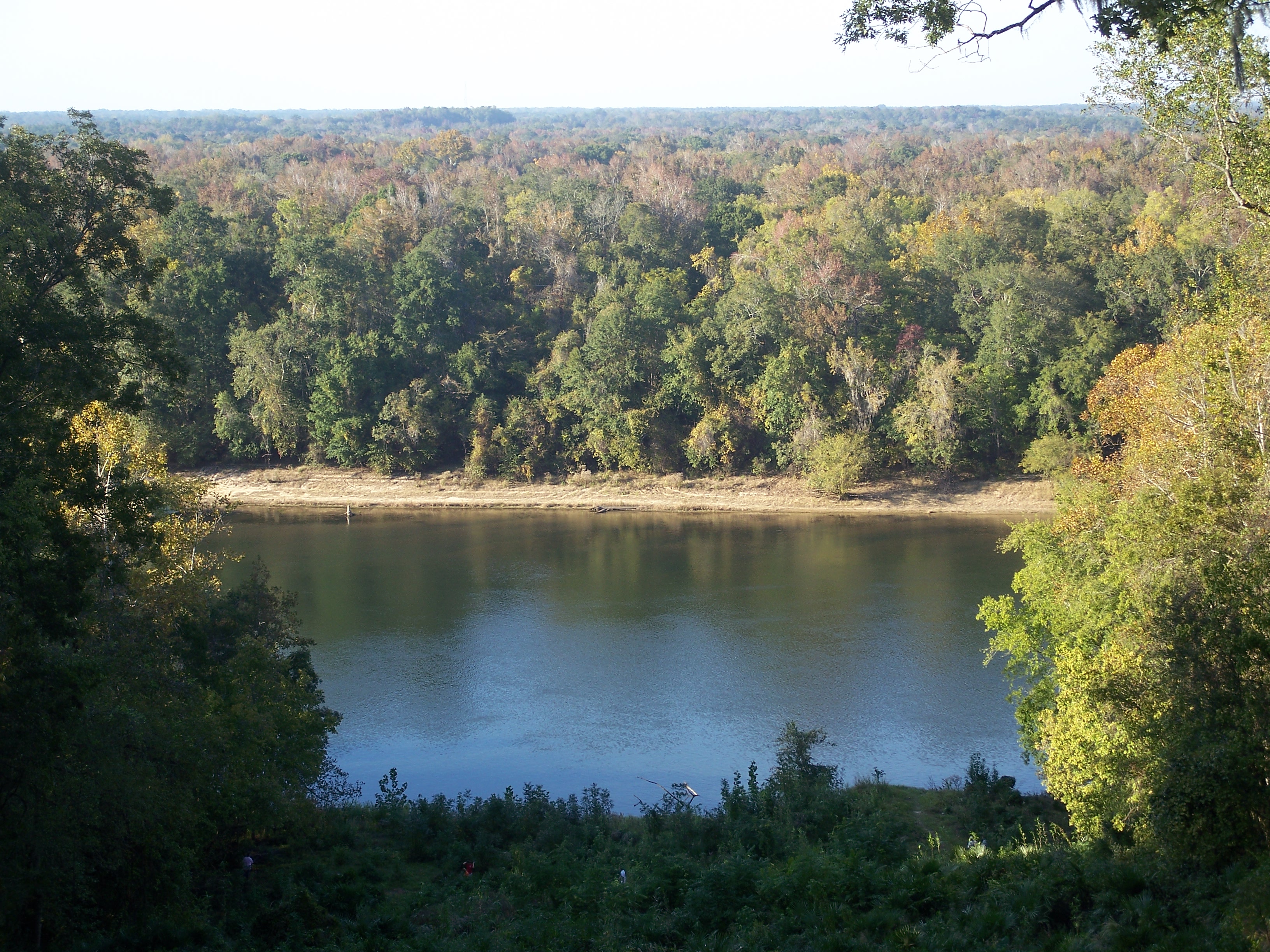
Florida does not do hills. The state's mean elevation is barely 30 meters, its topography shaped by sand and sediment rather than rock and uplift. Torreya State Park defies that reputation. The Apalachicola River has cut deep into the limestone here, carving ravines, exposing bluffs, and creating terrain that rises to about 300 feet at the top of Logan Hill - dramatic vertical relief by any Florida measure. River swamps spread below, high pinelands crown the ridges, and streams cut steep-sided gullies through the slopes between. The result is one of the most variable terrains of any park in the state, a pocket of Appalachian character dropped into the coastal plain. The Apalachicola River Bluffs Trail, designated a National Recreational Trail, follows the ridgeline and offers views that seem borrowed from a different state entirely.
Wars and Crossings
The bluffs above the Apalachicola have drawn strategic attention for centuries. In 1818, General Andrew Jackson and his army crossed the river here during the First Seminole War, pushing south into Spanish Florida in pursuit of Seminole warriors and freedom seekers. A decade later, the first government road to cross the new Florida Territory - the Bellamy Road - met the river at this same point. During the Civil War, Confederate forces recognized the bluffs' commanding position and installed a six-cannon battery to prevent Union gunboats from passing upriver. The cannons never fired a shot in anger at this location, but the gun pits remain visible in the park, sunken earthworks slowly filling with leaf litter and pine needles. Native American inhabitation stretches back much further still, confirmed by archaeological discoveries scattered across the area.
A House That Crossed a River
In 1849, Jason Gregory built a plantation house at Ocheesee Landing, on the west bank of the Apalachicola opposite the park's current location. After the Civil War, like most Florida Panhandle plantations, it fell into slow decay. When the Civilian Conservation Corps arrived in the 1930s to develop Torreya as one of Florida's original state parks, they decided the Gregory House was worth saving. In 1935, CCC crews disassembled the antebellum structure plank by plank, ferried the pieces across the Apalachicola, and reassembled it on a bluff within the new park. The Gregory House stands there today, a museum open to visitors for a small fee - a plantation home transplanted not just across a river but across a century, preserved by the labor of Depression-era workers who likely had more in common with the people Gregory had once enslaved than with Gregory himself.
The Tree That Time Forgot
The Florida nutmeg is a glacial relict - a species that once ranged more widely but retreated to the Apalachicola valley during the last ice age, when cooler temperatures shrank its habitat to this single refugium. It never expanded back. Restricted to the limestone bluffs and ravines within and near the park, Torreya taxifolia was among the first plants federally listed as endangered, in 1984. Disease and habitat pressures have hammered the remaining population. Another critically endangered species shares the same narrow range: the Florida yew, Taxus floridana, which resembles the nutmeg but has shorter, blunt-tipped leaves. Together, these two trees make Torreya State Park one of the most botanically significant sites in the southeastern United States - a place where the deep past of the continent's flora is still barely, stubbornly alive.
After the Eye Wall
On October 10, 2018, the eye of Hurricane Michael passed just miles west of the park, bringing sustained winds above 130 miles per hour. The destruction was catastrophic. Trees were felled, snapped, and stripped bare, thinning the canopy to a degree that transformed the landscape overnight. The park closed for months as staff cut hazardous trees and cleared debris. But when the chainsaws fell quiet and the surveys came in, a quiet piece of good news emerged: many of the Florida nutmeg trees under the park's protection had survived. The species that had endured ice ages and millennia of geological change had weathered one of the most powerful hurricanes in Florida Panhandle history. Torreya State Park reopened, battered but intact, its rarest inhabitants still holding on.
From the Air
Located at 30.569N, 84.948W along the east bank of the Apalachicola River in Liberty County, Florida Panhandle. The park is visible from the air as a heavily forested area on high bluffs above the river's east bank, north of Bristol. The Apalachicola River is the dominant visual landmark - follow it north from the coast. The steep bluffs and ravines create a textured canopy that contrasts with the surrounding flat terrain. Nearest airports: Tallahassee International (KTLH) approximately 55nm east, and Blountstown (FAA LID: 1J0) approximately 15nm south. Best viewed at 2,000-4,000 feet AGL. Evidence of Hurricane Michael's 2018 damage may still be visible in the canopy.