Trinity Alps Wilderness
Botanists have puzzled over the Trinity Alps for generations. Here, just thirty miles from the Pacific Ocean, grow foxtail pines, lodgepole pines, whitebark pines, and red firs, species you would expect to find hundreds of miles east in the Sierra Nevada. The Klamath Mountains have always done things their own way. At the heart of this range, the Trinity Alps rise in three distinct colors: the White Trinities of granite, the Red Trinities of ultramafic rock, and the Green Trinities of endless conifer forest. Thompson Peak, the highest point at 9,001 feet, stands watch over a landscape that refuses to be categorized.
A Wilderness in Triplicate
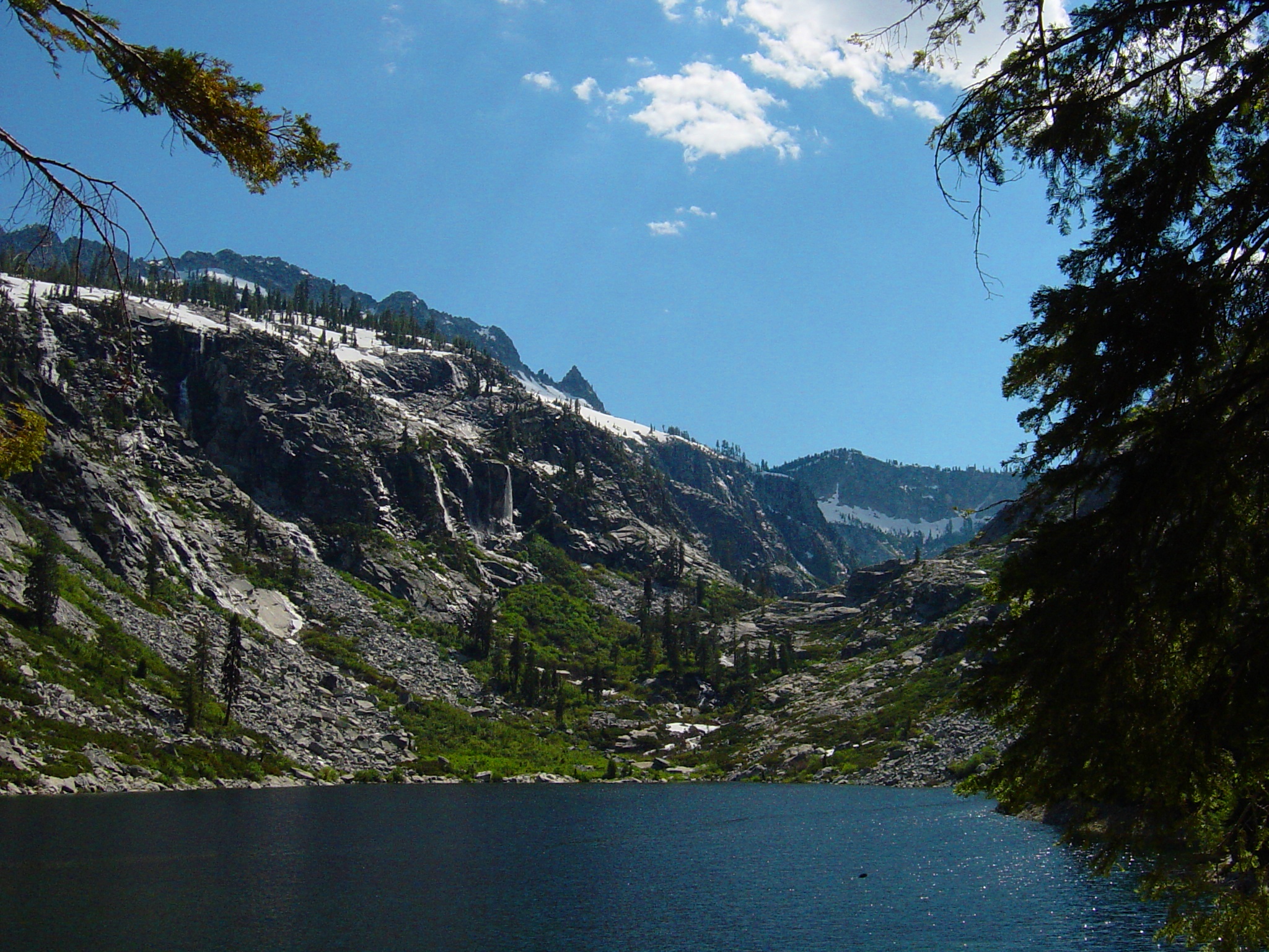
Three national forests share administration of the Trinity Alps Wilderness: Shasta-Trinity, Klamath, and Six Rivers. The Bureau of Land Management handles additional acreage. This jurisdictional complexity reflects the wilderness's geographic position at the intersection of the Salmon and Scott Mountains, subranges of the greater Klamath Mountains region. The eastern half holds the high granitic and ultramafic peaks that give the wilderness its name. Glacial cirques dominate the high country, scooped bowls that now cradle small lakes stocked with trout and ponds where newts breed in summer. The western half, the Green Trinities, descends into forested slopes that have burned and regrown through recent wildfire cycles.
The Sierran Puzzle
What are Sierra Nevada trees doing this close to the ocean? The answer lies in the Klamath Mountains' ancient isolation. As tectonic forces reshaped California, this range became a botanical refuge. Species that once grew throughout the region survived here after disappearing elsewhere. The endemic Brewer spruce, found nowhere else on Earth, grows alongside foxtail pines, western white pines, ponderosa pines, and the familiar firs of higher elevations. The floral diversity attracted botanists beginning in the nineteenth century. A 1974 university study attempted to catalog the entire alpine flora. The work continues. Some corners of the Trinity Alps remain botanically unexplored.
Gold, Trails, and Forgetting
Historic gold mining structures still dot parts of the wilderness, relics of the nineteenth-century rush that brought prospectors to every California creek. Gold panning remains productive for experienced amateurs. But most visitors come for the trails. The wilderness contains approximately five hundred miles of hiking routes, including sections of both the Pacific Crest Trail and the Bigfoot Trail. Canyon Creek, accessible by paved road from Junction City, is the most popular trail. The longest routes require several days. Many trails are in poor condition, hard to follow, requiring map and compass skills that have largely disappeared from American outdoor culture. This deters some visitors. Others consider it the point.
Bears, Salmon, and the Wild Residents
Black bears are common enough that the wilderness practically mandates bear canisters or bear bags. Black-tailed deer browse the meadows. Cougars, coyotes, bobcats, porcupines, and spotted skunks round out the mammal population. Birds of prey circle the peaks. Songbirds fill the forest. But the most remarkable wildlife may be in the water. Tributaries to the lower Trinity River still run with migratory steelhead and chinook salmon, following ancestral routes that predate human habitation of the continent. Streams offer trout fishing. The glacial lakes, tucked into cirques at altitude, are stocked for anglers willing to make the climb.
The View from Granite Peak
Hikers seeking perspective climb to Granite Peak or Silligo Peak on the Four Lakes Loop. From either summit, Trinity Lake spreads south and much of the wilderness unfolds in every direction. Remnants of an old fire lookout station remain on Granite Peak, a reminder of the decades when human eyes scanned these ridges for smoke. Until recently, private inholdings fragmented the wilderness. The Wilderness Land Trust has purchased more than forty percent of these private parcels, slowly restoring the integrity of protected land. Most of the Trinity Alps sees few visitors. The high lakes draw summer crowds, but the rest of this vast space rewards those willing to get lost. That is, after all, what wilderness means.
From the Air
Located at 41.02N, 123.09W between Eureka and Redding in Northern California. Best viewed from 10,000-12,000 feet AGL. Thompson Peak (9,001 ft) is the prominent high point. Look for the distinctive color variations: white granite peaks in the core, reddish ultramafic rock in the southeast, and green forested slopes to the west. Trinity Lake is visible to the south. Glacial cirques holding small lakes are scattered throughout the high country. Nearest airports: Weaverville (O54) approximately 15nm south, Redding Municipal (KRDD) approximately 45nm east. Watch for rapidly changing mountain weather.