Tromelin Island: The Forgotten Enslaved People of the Isle of Sand
Fifteen years. That is how long they waited. In July 1761, the French frigate Utile wrecked on the reefs of a tiny, flat island in the Indian Ocean while illegally transporting 160 enslaved Malagasy men, women, and children from Madagascar to Mauritius. The French crew and about sixty of the enslaved people made it to shore. The rest - locked in the hold because the ship carried no shackles, being a frigate rather than a purpose-built slave vessel - drowned. The crew salvaged timber and built an escape boat. They sailed away, promising to send rescue. On November 29, 1776, when the corvette Dauphine finally arrived, the rescuers found seven women and an eight-month-old baby. Everyone else was gone. The island is now named for Jacques Marie Boudin de Tromelin de La Nuguy, the captain who brought them home. It was once called, simply, the Isle of Sand.
The Wreck of the Utile
The Utile departed Bayonne, France, with 142 crew members and stopped at Mauritius - then called the Isle de France - before sailing to Foulpointe on Madagascar's east coast. There, the captain, Jean de La Fargue, took aboard 160 Malagasy people to be enslaved on Mauritius, in direct violation of the governor's prohibition on trafficking. A navigation error caused by two conflicting charts drove the frigate onto the reefs of what was then called the Isle of Sand on July 31, 1761. The ship broke apart. Because the Utile was not equipped as a slave ship, the enslaved people were held below decks but not in chains - a detail that made their captivity no less lethal. Those trapped in the hold had no way out as the hull flooded. About sixty Malagasy people reached the island alongside the crew. Together, they salvaged food, equipment, and wood from the wreckage and dug a well that provided drinking water. They survived on turtles and seabirds.
The Promise That Took Fifteen Years
The crew built a small boat from the wreckage and departed for Mauritius, leaving the surviving Malagasy people behind with a promise to return. A junior officer named Castellan made it back to Mauritius, then sailed for France in 1762, never abandoning hope of organizing a rescue mission to the Isle of Sand. News of the stranded people reached Paris and briefly stirred the intellectual circles of the Enlightenment - but the moment passed. The Seven Years' War ended, the French East India Company went bankrupt, and the enslaved castaways on their wind-blasted island were forgotten. For fifteen years, the survivors sustained themselves on a speck of land only seven meters above sea level, swept by heavy winds for most of the year, battered by cyclones in summer. They had no trees for shelter, only low shrubs and grass bent sideways by the constant east wind. What they built, what they ate, how they organized their small community across a decade and a half of isolation - these questions have driven archaeological expeditions to the island in recent years.
An Island Reclaimed by Birds
The rats that arrived with the Utile's wreckage devastated Tromelin's ecology for over two centuries, decimating seabird populations until only two booby species remained. In 2005, a rat eradication program began. The results have been remarkable. Seventeen years after the rats were removed, and without any active restoration beyond the eradication itself, the seabird community expanded from two breeding species to seven, and from 353 breeding pairs to 4,758. Masked boobies of the western Indian Ocean subspecies, for which Tromelin is a stronghold, rebounded alongside red-footed boobies - the only polymorphic population in the region, a sign of the island's deep biogeographical isolation. Great and lesser frigatebirds, once extirpated from the island, returned to nest. Green sea turtles continue to use the beaches as a nesting site, crawling ashore on sand that still occasionally yields artifacts from the 1761 wreck.
Sovereignty and Memory
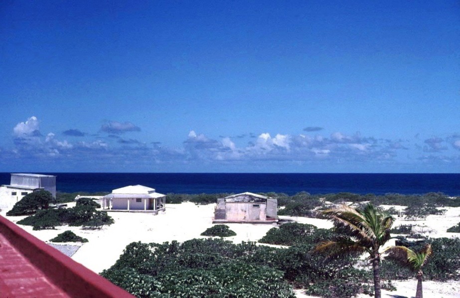
Today, Tromelin is claimed by both France and Mauritius. France counts it among the Scattered Islands in the Indian Ocean, administered as part of the French Southern and Antarctic Lands with a weather station and landing strip built in 1954. Mauritius argues that the island should have been ceded to Britain under the 1814 Treaty of Paris and, by extension, should have become Mauritian at independence. A co-management agreement was reached in 2010 but never ratified. The island's exclusive economic zone covers 280,000 square kilometers, contiguous with that of Reunion - a vast stretch of ocean surrounding a landmass so small that its weather station staff, rotated every three months from Reunion, constitute its entire population. Archaeological work on the island has uncovered the remains of the survivors' dwellings, their cooking fires, their tools fashioned from coral and wreckage. These artifacts have become central to how France and Mauritius remember the island - not for its geopolitical value but for the endurance of the people who were abandoned there, whose survival across fifteen years stands as testimony to a resilience that their enslavers never intended to test.
From the Air
Located at 15.89S, 54.52E in the western Indian Ocean, approximately 450 km north of Reunion and 600 km east of Madagascar. The island is extremely small and low (only 7 meters elevation), making it difficult to spot from altitude without precise coordinates. It appears as a pale sandy speck surrounded by reef in open ocean. No nearby airports - the island has its own short landing strip used for resupply missions from Reunion. The island is part of France's Scattered Islands (Iles Eparses). Approach carefully; the surrounding reefs that wrecked the Utile extend well beyond the visible shoreline. Best spotted from 2,000-3,000 feet in clear conditions.