Tsau ǁKhaeb (Sperrgebiet) National Park
For more than a hundred years, the word meant the same thing to anyone who encountered it: stay out. Sperrgebiet -- German for "Prohibited Area" -- was the name the colonial government stamped on 26,000 square kilometers of southwestern Namibia in September 1908, five months after a railway worker named August Stauch found a diamond glinting near Grasplatz station. That single stone triggered a rush, then a lockdown. The German authorities handed sole mining rights to the Deutsche Diamantengesellschaft, and the desert behind the fences became one of the most restricted landscapes on Earth. Today the territory is a national park, but its century of enforced emptiness created something no conservation program could have planned: a vast, nearly untouched stretch of the Namib where ecosystems evolved in isolation and ghost towns slowly vanished under drifting sand.
Diamonds, Empires, and Barbed Wire
The diamond rush of 1908 reshaped the politics of German South West Africa overnight. Within months, the colonial government carved the Sperrgebiet from the coastal desert between Oranjemund, on the South African border, and a point roughly 45 miles north of Luderitz. It extended about 100 kilometers inland. When South African forces under General Jan Smuts and Prime Minister Louis Botha invaded during World War I, they defeated the Germans and seized control of the territory -- including the diamonds. De Beers assumed total control and held it until the 1990s, when the newly independent Namibian government purchased a fifty-percent stake and formed the Namdeb Diamond Corporation. Throughout all these power shifts, one thing remained constant: civilian access was forbidden. Mining itself occupied only about five percent of the Sperrgebiet. The other ninety-five percent sat behind fences as a buffer zone, guarded and ignored.
The Ghosts That Sand Reclaims
Several towns sprang up during the diamond boom and died just as quickly when the deposits played out. The most famous is Kolmanskop, built in the early 20th century with a hospital, ballroom, skittle alley, and theatre -- all the trappings of European confidence transplanted into the Namib. When richer deposits were found farther south, the miners moved on. Pomona and Elizabeth Bay followed the same arc: construction, extraction, abandonment. Today, barchan dunes migrate through empty doorways and sand piles waist-deep in what were once living rooms. At a graveyard outside one of these ghost towns, wind erosion has partially exposed half-mummified bodies -- a grim reminder that the desert reclaims everything, even the dead. In a separate discovery, a shipwreck carrying Iberian coins, bronze cannons, copper, and ivory surfaced from the shifting sands of the Sperrgebiet, its cargo destined for a museum in Oranjemund.
An Accidental Eden
The irony of the Sperrgebiet is that a century of diamond greed produced an unintended conservation triumph. Scientists now call it the world's only arid biodiversity hotspot. Because humans were kept out of ninety-five percent of the territory, the desert's ecology developed without grazing, roads, or development. The Tsaus Mountains, Mount Aurus, the Klinghardt Mountains, and the permanent spring at Kaukausib support plant communities found nowhere else. Bird species include the African oystercatcher, the black-headed canary, and the dune lark. The landscape also holds Roter Kamm, an ancient impact crater in the southern Namib, its rim a reminder that violent forces shaped this place long before diamonds or empires mattered. In 2004, Namibia formally declared the Sperrgebiet a national park, acknowledging that its enforced isolation had created something irreplaceable.
A Green Hydrogen Gamble
The Sperrgebiet's next chapter may be as transformative as its first. In 2021, Namibia announced a US$9.4 billion green hydrogen project inside the park's boundaries, an investment roughly equal to the country's entire GDP at the time of planning. HYPHEN Hydrogen Energy, a joint venture between Nicholas Holdings Limited and ENERTRAG South Africa, will build and operate the facility for 40 years. The plan calls for 2 GW of renewable electricity generation capacity initially, scaling to 5 GW, producing up to 300,000 tons of green hydrogen annually. The project promises 15,000 construction jobs and 3,000 permanent positions, more than ninety percent filled by Namibians. The park's combination of co-located onshore wind and solar resources near both sea and land export routes makes it, according to HYPHEN's CEO, one of the top five locations in the world for low-cost hydrogen production. Whether industrial energy infrastructure can coexist with the biodiversity that a century of exclusion protected remains the central question.
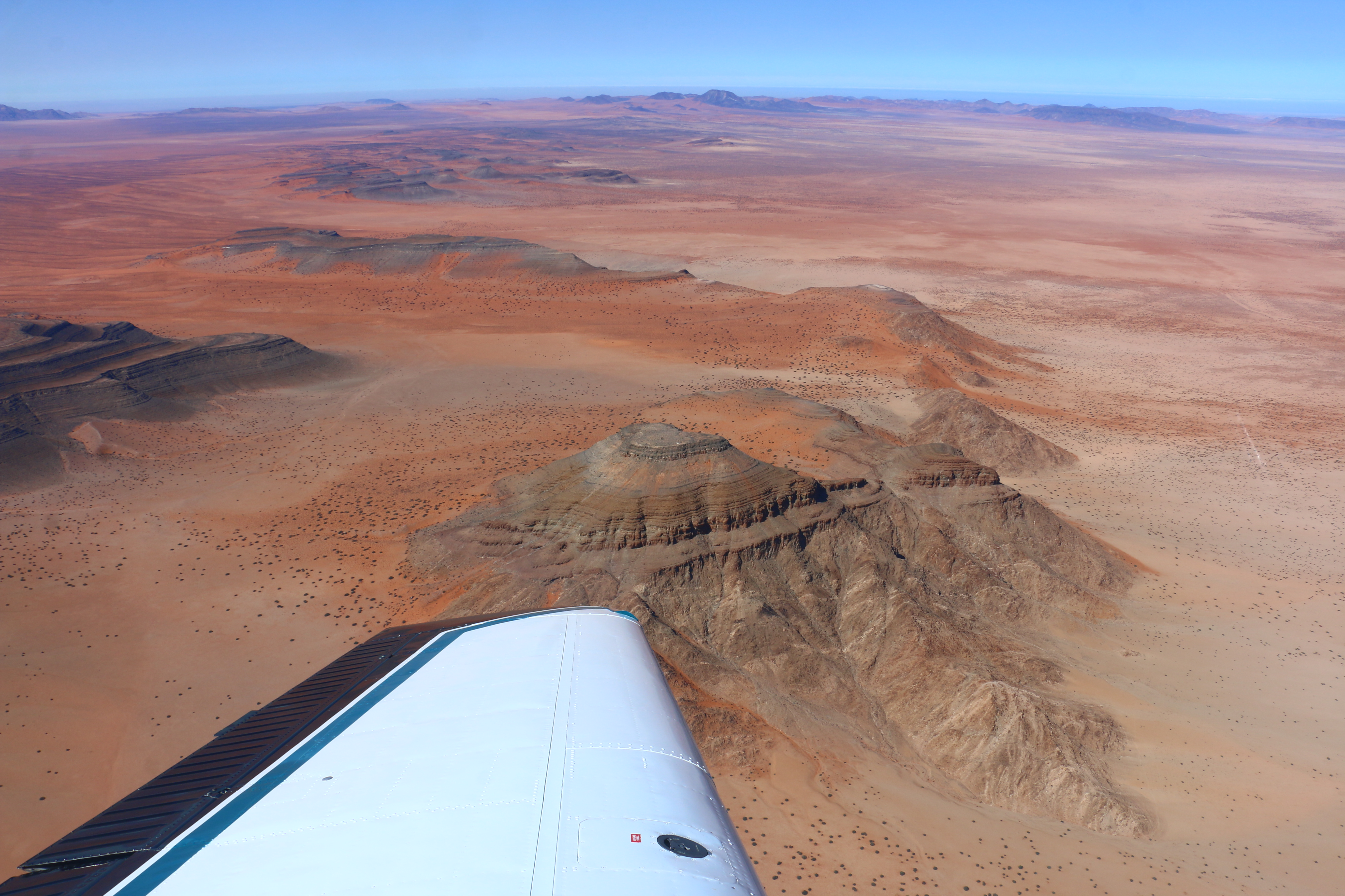
From the Air
Located at 26.68S, 15.09E along the southwestern Namibian coast. From altitude, the park presents as a vast expanse of hyper-arid desert stretching from the Atlantic coast inland, with visible dune fields, gravel plains, and the faint outlines of abandoned mining settlements. The ghost town of Kolmanskop may be discernible as a cluster of structures being overtaken by sand dunes near Luderitz. The Roter Kamm impact crater is visible as a circular depression in the southern portion. The coast runs north-south with the Atlantic to the west. Nearest significant airport is Luderitz Airport (FYLZ), approximately 45 miles north of the park's northern boundary. Walvis Bay Airport (FYWB) is farther north.