Tsavo East National Park
In 1898, two maneless male lions began hunting the workers building the Kenya-Uganda Railway bridge over the Tsavo River. Over nine months, the pair killed an estimated 35 laborers, though the railway's chief engineer, Lt. Col. John Henry Patterson, later claimed the number was as high as 135. Patterson eventually shot both lions, and their story became the basis of the 1997 film The Ghost and the Darkness. The lions' taxidermied bodies still stand in Chicago's Field Museum. The land where they hunted is now Tsavo East National Park, a place where the scale of the African bush swallows history whole and the red dust that coats everything, including the elephants, makes the landscape feel ancient and slightly alien.
The Splitting of a Wilderness
Tsavo was established as a single national park on April 1, 1948, covering 21,812 square kilometers, making it the largest park in Kenya. It held that distinction for exactly one month. The sheer size made administration impractical, and the park was split along the Nairobi-Mombasa railway line into Tsavo East and Tsavo West. The railroad that once attracted man-eating lions became the boundary between two parks with distinct characters. Tsavo East, the larger half, is defined by flat, dry plains that stretch to the horizon in every direction, crossed by the Galana River and its surrounding marshland. The openness of the terrain makes wildlife easier to spot than in the denser vegetation of Tsavo West, which is one reason Tsavo East draws more visitors. The other reason is proximity: the park sits between Nairobi and the Kenyan coast, making it a convenient stop for travelers heading to or from Mombasa.
Red Elephants and the Galana
Tsavo East's elephants are famous for their color. They are not a different species; they are African bush elephants that have been coated in the park's distinctive laterite soil, turned rust-red by years of dust-bathing in the iron-rich earth. Watching a herd of these red-dusted elephants move across the burnt-orange plains is one of the defining visual experiences of the park. Beyond elephants, Tsavo East supports buffalo, rhino, lion, leopard, hippos, crocodiles, waterbucks, lesser kudu, gerenuk, and the critically endangered hirola antelope. The Galana River, formed by the confluence of the Tsavo and Athi rivers, is the park's lifeline. Along its banks, the vegetation thickens into swampy marshland that attracts animals and waterbirds year-round, creating a green corridor through the otherwise arid landscape.
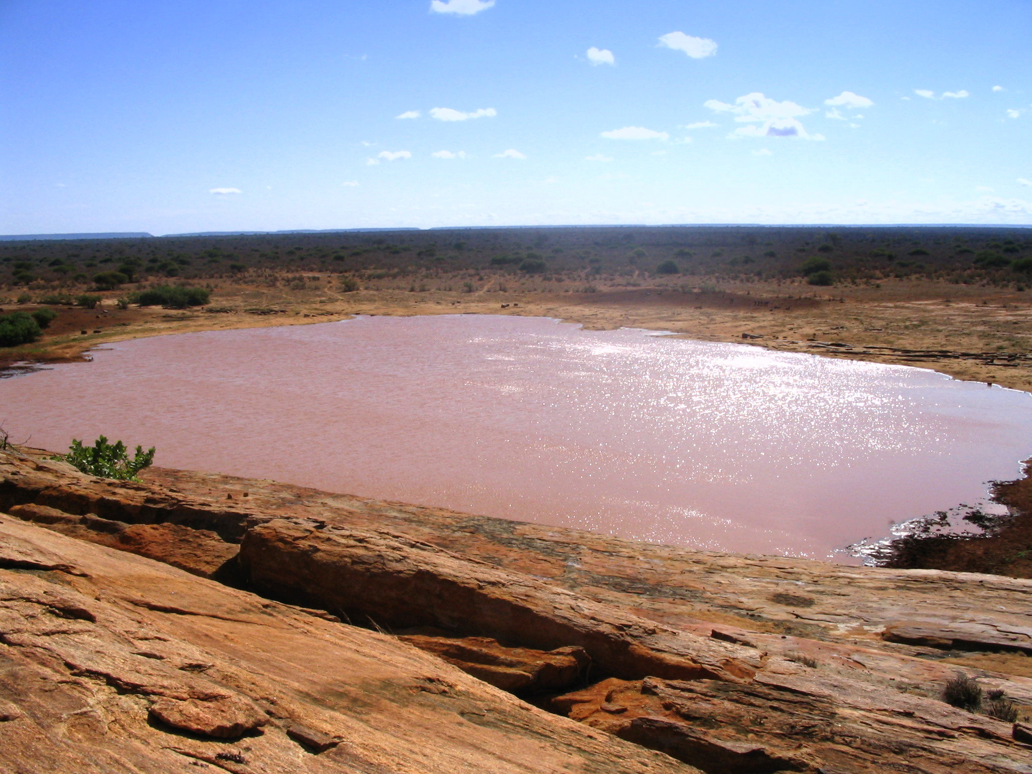
Lava Flows and Rock Fortresses
The Yatta Plateau runs along the western edge of the park for roughly 290 kilometers, making it one of the longest lava flows on Earth. This basalt ridge was formed by volcanic activity millions of years ago and now stands as an elevated shelf visible from much of the park. Closer to the Galana River, Lugard's Falls are not falls at all but a series of rapids where the river squeezes through sculpted rock channels, the water having carved the stone into fantastical shapes over millennia. Mudanda Rock is another geological landmark: a massive outcrop stretching about 1.6 kilometers, with a dam at its base that creates a natural watering hole. During the dry season, animals converge here in large numbers, making it one of the park's best wildlife viewing spots. The Aruba Dam, built in 1952 across the Voi River, serves a similar function, drawing both mammals and waterfowl to its shores.
Into the Red Dust
Tsavo East is entered through four gates: Voi Gate, the main entrance near the town of Voi on the Nairobi-Mombasa highway; Manyani Gate; Buchuma Gate; and Sala Gate in the south. A smartcard system controls access, and the card can be obtained at Voi Gate, at the main gates of Nairobi National Park and Lake Nakuru, or at the Kenya Wildlife Service office in Mombasa. The climate is warm and dry for most of the year, with daytime temperatures around 27 degrees Celsius and nights dropping to about 22. The long rains from March through May make roads difficult and wildlife harder to spot in the tall grass. The short rains from October to December are gentler and do not significantly disrupt safaris. August and September offer the best viewing, when the grass is low and animals cluster around water sources. Campsites inside the park are mostly unfenced, meaning elephants and other wildlife can wander through camp at night, an experience that is, as the guidebooks note with British understatement, both unnerving and exhilarating.
From the Air
Tsavo East National Park is located at 2.78S, 38.77E in southeastern Kenya, between Nairobi and Mombasa. From the air, the park is a vast expanse of red-brown savanna bisected by the green ribbon of the Galana River. The Yatta Plateau is visible as a long, elevated ridge along the western boundary. Best viewed at 3,000-6,000 feet AGL. The nearest commercial airport is Moi International Airport (HKMO) in Mombasa, approximately 150 km to the southeast. Voi airstrip serves charter flights. The Nairobi-Mombasa railway line marks the western boundary, separating Tsavo East from Tsavo West.