Tunnel View
You drive through darkness for nearly a mile. The Wawona Tunnel swallows your car, and the granite walls close in, lit only by headlights and the amber glow of aging fixtures. Then the tunnel ends. The light hits all at once, and there it is - the entirety of Yosemite Valley laid out in a single glance. El Capitan anchors the left, its 3,000-foot face catching afternoon sun. Bridalveil Fall threads white down the cliffs on the right. And straight ahead, seven miles into the distance, Half Dome floats above the valley floor like a granite sentinel. This is Tunnel View, and since 1933 it has been the moment when Yosemite stops being a name on a map and becomes something that takes your breath away.
The Reveal That Changed the Road
Tunnel View was not an accident. When Yosemite's engineers designed the Wawona Road in the early 1930s, they understood the power of contrast. The old routes into the valley from the south wound gradually through forest, offering glimpses and partial views before arriving. The new road, routed through the 4,233-foot Wawona Tunnel, would do something different. It would deprive visitors of any view at all for nearly a mile, then deliver the entire valley in a single, overwhelming moment. The viewpoint opened in 1933, the same year the tunnel was completed, and it was an instant sensation. A pullout with a parking lot was built directly east of the tunnel's eastern portal, allowing visitors to stop, step out, and absorb what they had just seen. For many arriving by car from Fresno or Southern California, this remains their first sight of Yosemite Valley. The darkness of the tunnel makes the revelation feel almost theatrical - a curtain drawn back on a stage that took glaciers millions of years to carve.
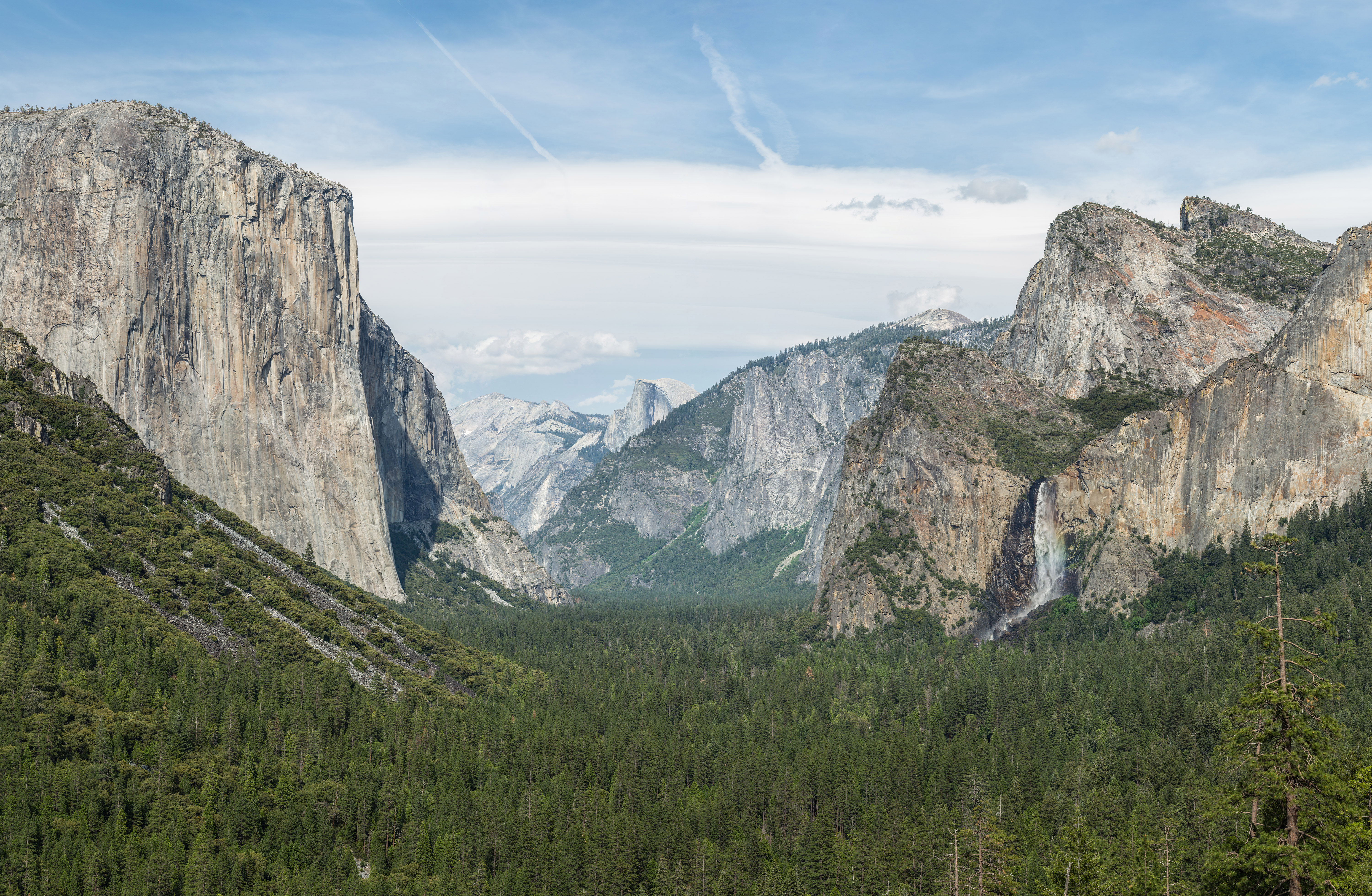
A Panorama of Icons
What makes Tunnel View extraordinary is not any single feature but the composition. The viewpoint sits at roughly 4,000 feet elevation on the south rim, looking east-northeast down the length of the valley. El Capitan dominates the left foreground, its sheer face the largest exposed granite monolith in the world. Bridalveil Fall cascades 620 feet on the right, its mist drifting across the valley entrance like a veil - the Ahwahneechee people called it Pohono, "Spirit of the Puffing Wind." Cathedral Rocks rise behind the fall in a cluster of spires. The valley floor stretches between these walls, threaded by the Merced River through meadows and dark stands of pine and oak. And at the far end, Half Dome's distinctive silhouette closes the view. No other viewpoint in the park gathers so many of Yosemite's defining landmarks into a single frame, which is why Ansel Adams returned here again and again, and why millions of visitors each year stand in the same spot and reach for their cameras.
Ansel Adams and the Art of the View
Before there was a tunnel, before there was a paved road, there was Inspiration Point - a viewpoint higher on the ridge that offered a similar but more distant perspective. It was from near this vantage that Ansel Adams made one of his most iconic photographs in 1934, just a year after Tunnel View opened. His black-and-white image of the valley, with storm clouds sweeping over Half Dome and fresh snow dusting the cliffs, became one of the most reproduced landscape photographs in history. Adams understood what the engineers had intuited: this angle distills Yosemite to its essence. The depth of the valley, the verticality of the walls, the drama of weather moving through granite corridors - it all converges here. Painters had been drawn to similar vantage points since Thomas Ayres sketched the valley in 1855, but it was Adams who fixed this particular view in the American imagination. Today, Tunnel View is as much a cultural artifact as a geographic one.
Seasons of a Single View
The valley that Tunnel View reveals is never the same twice. In spring, snowmelt turns Bridalveil Fall into a roaring torrent and fills the valley with the sound of moving water. Dogwood and azalea bloom white against the dark conifers. By midsummer, the falls thin to silver threads or disappear entirely, and the meadows turn golden in the heat. Autumn brings a quieter palette - the black oaks flame orange and red against granite, and the first dustings of snow appear on the high country above Half Dome. Winter transforms the scene entirely. Fresh snow silences the valley, outlines every ledge and crack on El Capitan's face, and turns the river into a dark ribbon through white meadows. Fog sometimes fills the valley like a lake, leaving only the cliff tops visible, the granite walls rising from cloud like islands. On clear winter mornings, the cold air sharpens every edge, and the valley looks exactly as it did when the first visitors emerged from the tunnel in 1933 and saw something they would remember for the rest of their lives.
From the Air
Located at 37.7156°N, 119.6769°W on the south rim of Yosemite Valley, directly east of the Wawona Tunnel's eastern portal on California State Route 41. The viewpoint overlooks the full length of Yosemite Valley, with El Capitan to the north (left), Bridalveil Fall to the south (right), and Half Dome in the distance to the east. Best viewed at 4,000-6,000 ft AGL when approaching from the south along SR-41. Nearest airports: Fresno Yosemite International (KFAT), 65 miles south; Mariposa-Yosemite Airport (MPI), approximately 30 miles west. The Wawona Tunnel entrance is visible as a dark opening in the granite ridge.