Turks and Caicos Islands
The name comes from a cactus. The Turks Islands take theirs from the indigenous Melocactus, whose red-capped shape early sailors thought resembled a Turkish fez. It is the kind of detail that sets the tone for a place where almost nothing is quite what outsiders expect. Thirty islands scattered across the southeastern tail of the Bahamas archipelago, only eight of them inhabited, holding a population that has nearly doubled since the turn of the century. The Turks and Caicos Islands sit at the edge of the Caribbean and the Atlantic, a British Overseas Territory that flies the Union Jack but drives on the left, speaks English alongside a homegrown Creole, and built its first economy not on tourism but on scraping salt from shallow ponds under a relentless sun.
Salt, Sisal, and the Sea
Before the resorts and the cruise ships, there was salt. For centuries, the flat, sun-baked salinas of Grand Turk and Salt Cay produced the commodity that preserved food across the colonial Atlantic. Bermudian settlers controlled the trade from the late 1600s, and the rhythms of salt raking -- flooding the shallow ponds, waiting for evaporation, harvesting the crystals -- defined island life for generations. When salt declined, East Caicos briefly tried sisal, running a horse-drawn railway fourteen kilometers from plantation to port. That industry collapsed too. Conch and lobster fishing became the next lifeline, and seafood still anchors the local economy: conch fritters and conch salad remain the dishes visitors are told to try first. The world's only conch farm operates here, a fact locals mention with quiet pride.
Where Astronauts Came Ashore
Grand Turk holds a piece of American space history that few people remember. From 1950 to 1981, the United States maintained a missile tracking station on the island, and NASA used it during the early days of the space program. In February 1962, after John Glenn completed his three orbits aboard Friendship 7, he splashed down in the nearby Atlantic and was brought ashore to Grand Turk -- the first American to orbit the Earth, stepping onto a tiny Caribbean island to begin his return to a hero's welcome. A replica of the Friendship 7 capsule still sits at the airport. Decades later, the islands found themselves connected to spaceflight again when, in 2025, a SpaceX Starship exploded within sight of the archipelago, its debris disrupting more than 230 airline flights and rattling residents on the ground.
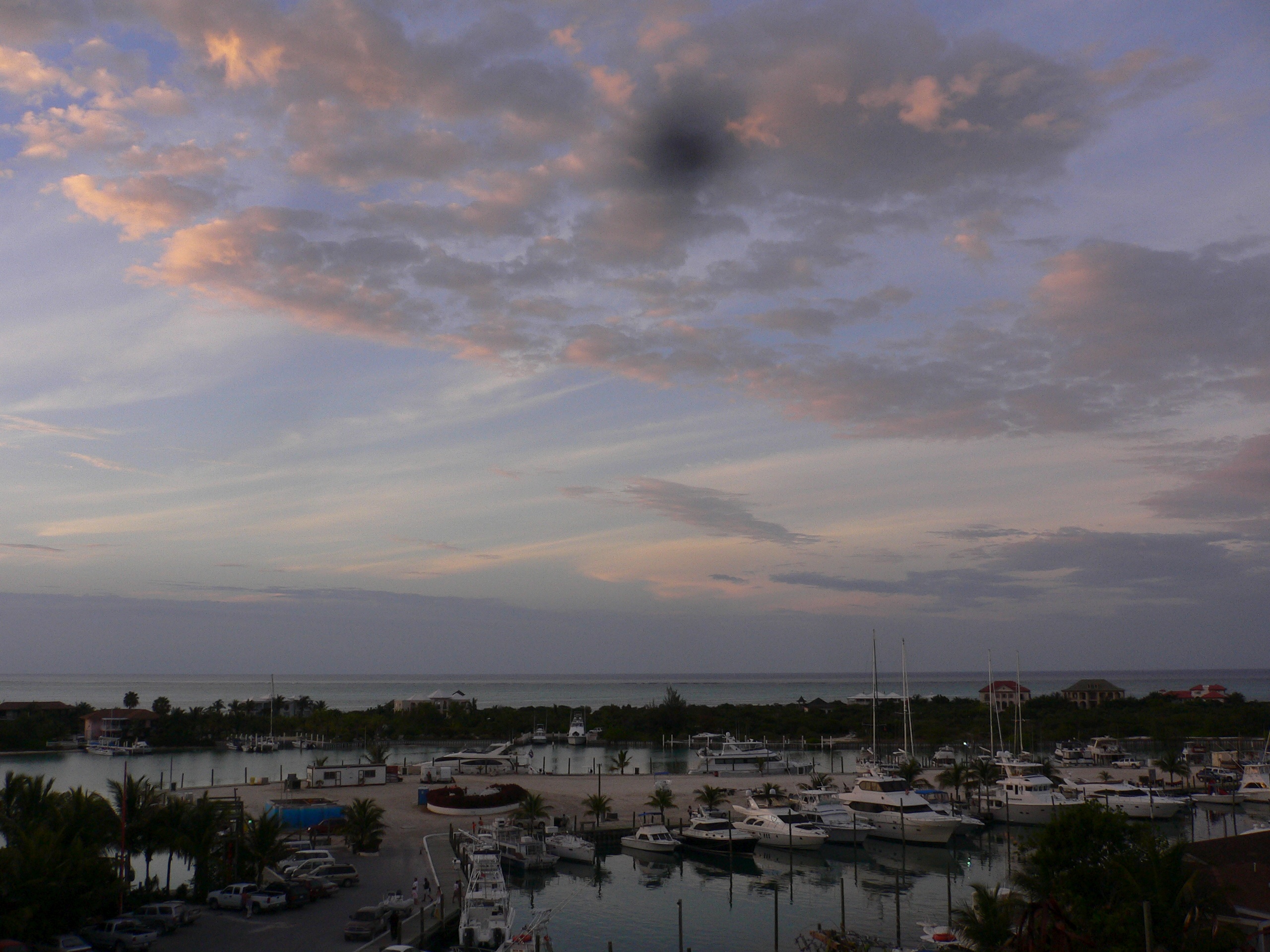
Grace Bay and the Tourism Transformation
The shift from salt to sand happened gradually, then all at once. Club Med opened a resort at Grace Bay on Providenciales, and in the 1980s funded an upgrade to the airstrip so larger aircraft could land. That single investment cracked the islands open to the outside world. Grace Bay Beach, with its powdery white sand and water so clear it barely registers as blue, now consistently ranks among the finest beaches on the planet. Providenciales grew from a quiet backwater into the territory's economic engine, with hotels, restaurants, and financial services accounting for nearly half of all economic activity. The government courts both high-end travelers -- attracted by upscale resorts and celebrity homeowners -- and cruise-ship passengers, who arrive at a large terminal on Grand Turk. More than 10,000 people attend the annual Music and Cultural Festival at Turtle Cove Marina, where headliners have included Lionel Richie, Alicia Keys, and John Legend.
A Culture Carried from Africa
Beneath the tourism gloss lies a culture with deep and layered roots. The Turks and Caicos are perhaps best known musically for ripsaw, a genre born on these islands from instruments improvised out of saws, scrapers, and goatskin drums. Women on the larger Caicos islands continue to weave straw into baskets and hats using techniques that may trace back to liberated Africans who arrived directly from the continent in the 1830s and 1841 -- survivors of shipwrecked slave vessels who brought their craft traditions with them and wove them into the fabric of island life. Cricket, not baseball, is the national sport, a legacy of British colonial ties that still run deep. Belonger status -- the local equivalent of citizenship -- determines who truly counts as an islander, and the rules around it remain a source of ongoing debate and identity.
The View from Above
From the air, the Turks and Caicos reveal their true geography: two distinct island groups separated by the Turks Island Passage, a deep-water channel that plunges more than 2,000 meters between the shallow banks. The Caicos Islands to the west form a loose crescent around a turquoise interior lagoon, their reefs among the longest in the world. The smaller Turks Islands to the east -- Grand Turk and Salt Cay chief among them -- sit exposed on their own bank, low and flat against the Atlantic horizon. Seven airports serve the inhabited islands, with Providenciales International handling the bulk of international traffic. The contrast is striking: a territory that measures barely 948 square kilometers of dry land, surrounded by some of the most spectacular underwater terrain in the Caribbean.
From the Air
Located at 21.78N, 71.80W, the Turks and Caicos Islands are southeast of the Bahamas and north of Hispaniola. Approach from the northwest for the best view of the Caicos bank and its turquoise shallows. Providenciales International Airport (MBPV) is the main entry point; JAGS McCartney International Airport (MBGT) serves Grand Turk. Norman B. Saunders Sr. International Airport (MBSC) on South Caicos offers a third option. Best viewed at 5,000-8,000 feet to appreciate the contrast between the shallow banks and the deep Turks Island Passage. The islands are extremely low-lying and flat, so look for the color change in the water rather than terrain features.