Turtle Mound
From the air, Florida's Atlantic coast is flat. Relentlessly, monotonously flat -- sea-level sand and marsh and lagoon for miles in every direction. Then, south of New Smyrna Beach, something breaks the pattern: a wooded hill rising 35 feet above the shoreline, its dense canopy standing taller than anything else on the barrier island. It looks natural. It is not. Turtle Mound is the largest shell midden on the mainland United States, a hill built entirely from oyster shells discarded by the Timucua people between roughly 800 and 1400 AD. Six centuries of meals, stacked into a monument that Spanish explorers used as a navigation landmark and that still serves as one of the highest points on this stretch of coast.
A Mountain Made from Meals
The numbers are staggering for something made of garbage. Turtle Mound stretches over 600 feet along the western shore of the Mosquito Lagoon and contains more than 35,000 cubic yards of oyster shells -- enough to fill roughly 3,500 dump trucks. Before shell mining reduced its height in the 19th and 20th centuries, the mound may have stood as tall as 75 feet. Even at its diminished height, it remains the dominant feature of the landscape, a two-acre hill on a coast where elevation is measured in inches. The Timucua who built it harvested oysters from the lagoon's brackish waters, eating the shellfish and discarding the shells in heaps that grew, generation after generation, into something resembling geology.
Where the Tropics Begin
Something unexpected happens on Turtle Mound's slopes. Tropical plants grow here that have no business being this far north. A botanical study in 1923 found the mound's flora to be "largely of a tropical character," and repeated surveys have confirmed the site as the northernmost outpost of several tropical plant species on the Atlantic coast. The explanation lies in the shells themselves: oyster shells retain heat, creating a microclimate warmer than the surrounding flatlands. Combined with the mound's elevation, its sheltered seaside position, and the dense maritime hammock that has engulfed it since the 19th century, Turtle Mound functions as a tiny tropical island embedded in a temperate landscape. Rare species cling to its slopes, thriving in warmth generated by centuries-old refuse.
Navigators and Mapmakers
Spanish explorers charted Turtle Mound centuries before archaeologists studied it. On a flat coast where landmarks were scarce, a hill visible from miles at sea was invaluable. The mound appeared on early maps and served as a reference point for ships navigating the treacherous waters off Cape Canaveral. The Timucua themselves likely used it for more than waste disposal -- its height made it a natural lookout point, and archaeologists have speculated it may have served ceremonial purposes or as a refuge during hurricanes. No complete excavation has ever been conducted, leaving the mound's full story locked inside its layers of shell.
Preserved Between Lagoon and Ocean
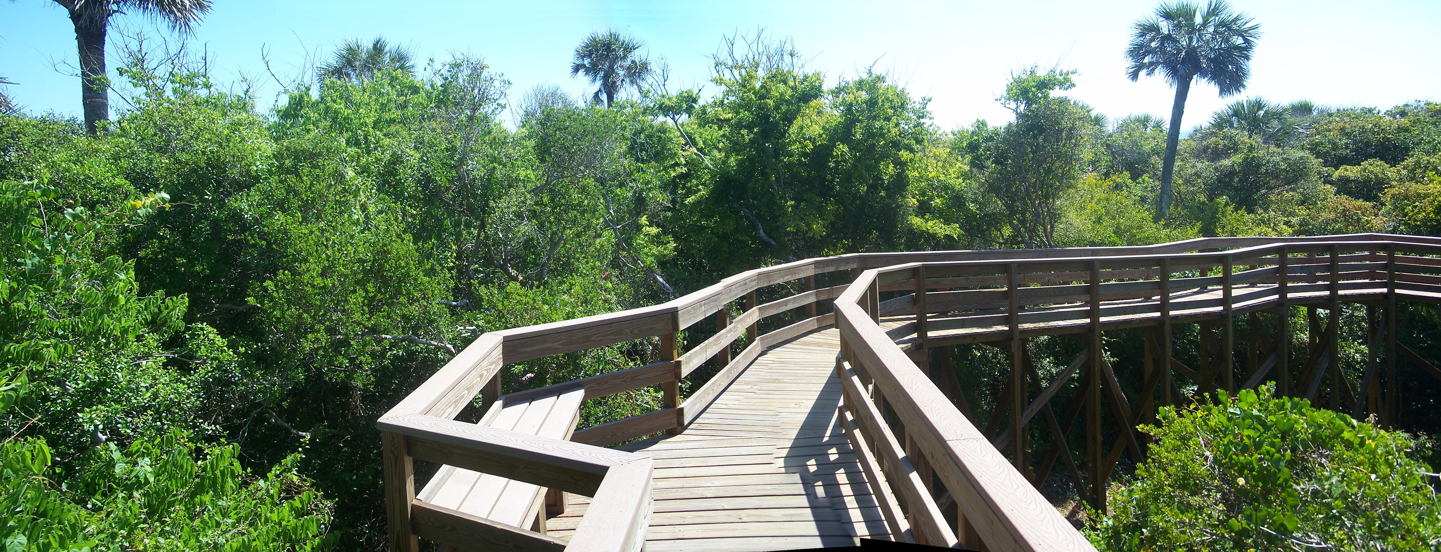
Turtle Mound was added to the National Register of Historic Places on September 29, 1970, and today it sits within the boundaries of Canaveral National Seashore, managed by the National Park Service. A boardwalk trail winds to the summit, where visitors look east over the Atlantic and west across the Mosquito Lagoon. The mound occupies a narrow spit of land between the two bodies of water, its position on State Road A1A making it accessible but its dense overgrowth making it easy to miss from the road. Sparsely vegetated in early photographs, the mound is now blanketed in woody maritime hammock -- the shells buried beneath roots and leaf litter, visible only where the boardwalk cuts through. What the Timucua built from discarded shells, nature has claimed as forest.
From the Air
Located at 28.93°N, 80.83°W on the barrier island between the Mosquito Lagoon (west) and the Atlantic Ocean (east), within Canaveral National Seashore. From altitude, the mound appears as a dense wooded bump on an otherwise flat, narrow spit of land. Kennedy Space Center and Cape Canaveral are visible to the south. The nearest airports are Merritt Island Airport (KCOI) approximately 20 miles south and Daytona Beach International (KDAB) approximately 35 miles north. New Smyrna Beach lies to the north along A1A. At lower altitudes, the mound's elevation above the surrounding marshland is distinctive.