Twin Forts of Romblon
They called him El Padre Capitan -- the Priest Captain. Agustin de San Pedro was an Augustinian Recollect missionary who arrived in Romblon in the 1630s to save souls, but the geopolitics of the 17th-century Philippines had other plans for him. By 1644, with Dutch East India Company raiders pillaging coastal settlements and Moro pirates from Mindanao striking without warning, San Pedro found himself supervising the construction of twin fortifications on the hilltops overlooking the town he had come to evangelize. The forts he built from local coral and limestone still define the skyline of Romblon -- or at least one of them does.
Conquistadors and Census Takers
Spanish contact with Romblon began in 1569, when conquistador Martin de Goiti sailed into the archipelago on orders from Miguel Lopez de Legazpi to map the western and northern Visayas. The Spanish carved the islands into three encomiendas administered from Arevalo. Thirteen years later, chronicler Miguel de Loarca arrived to conduct the first census, counting heads and cataloging resources across the scattered islands. For decades the colonial presence in Romblon remained administrative rather than architectural -- paperwork and tributes rather than stone walls. That changed when the Augustinian Recollects arrived in 1635 to establish Catholic missions, just as Spain's sprawling conflict with the Dutch began reaching the Philippine archipelago.
Between the Dutch and the Deep Blue Sea
Romblon's position in the central Philippines made it vulnerable from two directions. The Dutch East India Company, already at war with Spain across the Eighty Years' War, sent raiders into Philippine waters who pillaged and destroyed the town of Romblon in 1646. From the south, Moro pirates based in Mindanao had been launching raids on Christian settlements since 1565, burning churches and taking captives. Caught between these threats, the Spanish colonial government ordered fortifications built throughout the archipelago. In Romblon, the task fell to San Pedro, a priest whose talents apparently extended well beyond the pulpit. Beginning in 1644, local laborers quarried coral and cut limestone to raise twin forts on Calvary Hill and San Antonio Hill, commanding views of the harbor and the sea approaches beyond.
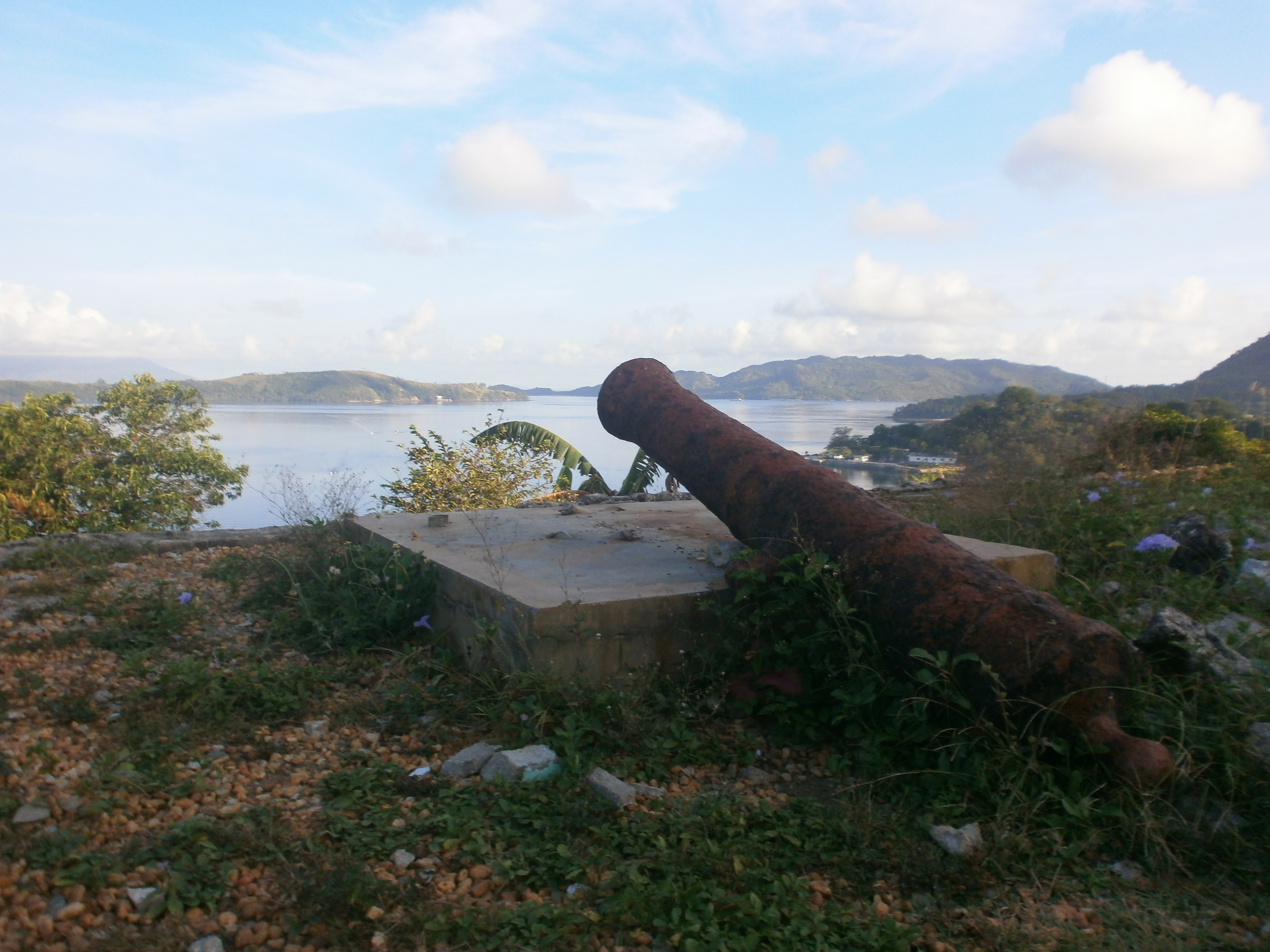
Santiago and San Andres
The forts were completed in 1650 and dedicated to Saint James the Great and Saint Andrew: Fuerza de Santiago on Calvary Hill and Fuerza de San Andres on San Antonio Hill. Fort San Andres, the survivor, is a compact quadrilateral structure covering 290 square meters, with a turret at each corner. Each wall features a parapet with three embrasures -- narrow openings designed for cannon fire toward approaching enemies. A wooden door on the southern wall serves as the only entrance. Four stone columns once supported a thatched roof over the interior section facing away from the sea, offering shade to the garrison while leaving the seaward side open for watch.
Fort Santiago has not been so fortunate. Its hilltop perch on Calvary Hill is now ruins swallowed by vegetation, the coral walls crumbled and overgrown. What the Dutch and the Moro raiders could not destroy, time and tropical growth accomplished.
Coral Stones Restored
In 2012, the National Commission for Culture and the Arts invested 2 million pesos in restoring Fort San Andres. Workers replaced missing coral stones in the interior and exterior walls, cleared earth fill from the interior chambers, reinforced foundations, and rehabilitated two of the four turrets. The local Save the Fort San Andres Movement, a grassroots organization, supported the effort alongside the municipal government. A year later, the National Museum of the Philippines declared the Twin Forts a National Cultural Treasure, grouping them with the town's Spanish colonial bridges, Saint Joseph Cathedral, and the Triada de Aguas fountain -- the full architectural record of Romblon's colonial past recognized and placed under federal protection. A plaque installed on the fort in 2013 marks the designation, a formal acknowledgment that the coral-and-limestone walls a missionary-soldier raised nearly four centuries ago still matter.
From the Air
Located at 12.58°N, 122.27°E on Romblon Island in the central Philippines. Fort San Andres sits atop San Antonio Hill overlooking Romblon town and its natural harbor. The compact fort and surrounding hilltop are visible against the town's waterfront. Nearest airport is Tugdan Airport (RPVU) on Tablas Island, approximately 25 km to the west. Best viewed at 1,500-2,500 ft to see the hilltop fortification relative to the harbor below.