Twin Peaks
The Spanish called them Los Pechos de la Chola -- Breasts of the Indian Maiden. The English-speaking settlers who followed were less poetic but more practical, naming the two hills Twin Peaks and leaving it at that. Rising 925 feet above sea level in the geographic center of San Francisco, these undeveloped summits serve as the city's weather wall, its compass point, and its most accessible panoramic viewpoint. On a clear day, you can see 143 kilometers down the Santa Clara Valley to Santa Ana Mountain. On a foggy afternoon, you can watch the marine layer pour over the western slopes and break apart on the eastern side, turning the peaks into the boundary between two different cities sharing the same name.
The Fog Wall
Twin Peaks, along with Mount Davidson and Mount Sutro, form a rugged barrier across the center of San Francisco that shapes the city's famously varied microclimates. The two summits -- North Peak (also called Eureka) and South Peak (also called Noe) -- stand about 200 meters apart, creating a saddle through which the summer coastal fog funnels in from the Pacific. Their west-facing slopes endure constant fog and battering winds. Walk to the eastern side and the air clears, the temperature rises, and the sun comes out. This is not an exaggeration or a metaphor. Residents of the Sunset District, west of the peaks, routinely wear jackets on summer afternoons when their counterparts in the Mission District, to the east, are in shirtsleeves. The peaks do not merely influence San Francisco's weather -- they create it.
From Ranch Land to Natural Area
Before the city grid arrived, the area around Twin Peaks was barren sand dunes stretching inland from Ocean Beach. The Spanish devoted the hills to ranching, and for the better part of two centuries, the peaks remained one of the few undeveloped areas on the peninsula. They remain so today. The 31-acre Twin Peaks Natural Area, managed by the San Francisco Recreation and Parks Department, preserves the summits as open grassland and native shrub habitat in the center of a dense urban landscape. No public transit reaches the top -- the 37 Corbett Muni line stops on Crestline Drive, from which visitors climb the remaining distance on foot. The lack of easy access is part of the character: Twin Peaks rewards effort with a view that makes the effort worthwhile.
The View from Christmas Tree Point
Christmas Tree Point, about 70 feet below North Peak, is the primary viewpoint and one of the most visited spots in San Francisco. The panorama encompasses the entire Bay Area: the Financial District's skyline to the northeast, the Bay Bridge stretching toward Oakland, the Golden Gate Bridge to the northwest, and the Pacific Ocean to the west. To the north, on an exceptionally clear day, Cobb Mountain is visible 120 kilometers away. A fire department reservoir sits just north of the peaks, part of the independent high-pressure water system established after the 1906 earthquake and fire destroyed the city's regular water supply. That reservoir is a reminder that Twin Peaks, for all their beauty, also serve a grimly practical purpose: ensuring that the next great fire can be fought.
Reclaiming the Summit
For decades, a figure-eight road loop around the two peaks served primarily as a scenic drive. In recent years, the city has reclaimed the eastern half for pedestrians and cyclists, reducing car traffic and opening the summit to a wider range of visitors. Construction to rebuild the eastern road as a wide promenade is underway, following improvements to the Noe Peak trail and the path down to Crestline Drive. The transformation reflects a broader recognition that the peaks belong to people on foot, not in cars -- that the best way to experience a place where the fog breaks and the whole Bay Area reveals itself is standing still, breathing the salt air, and looking.
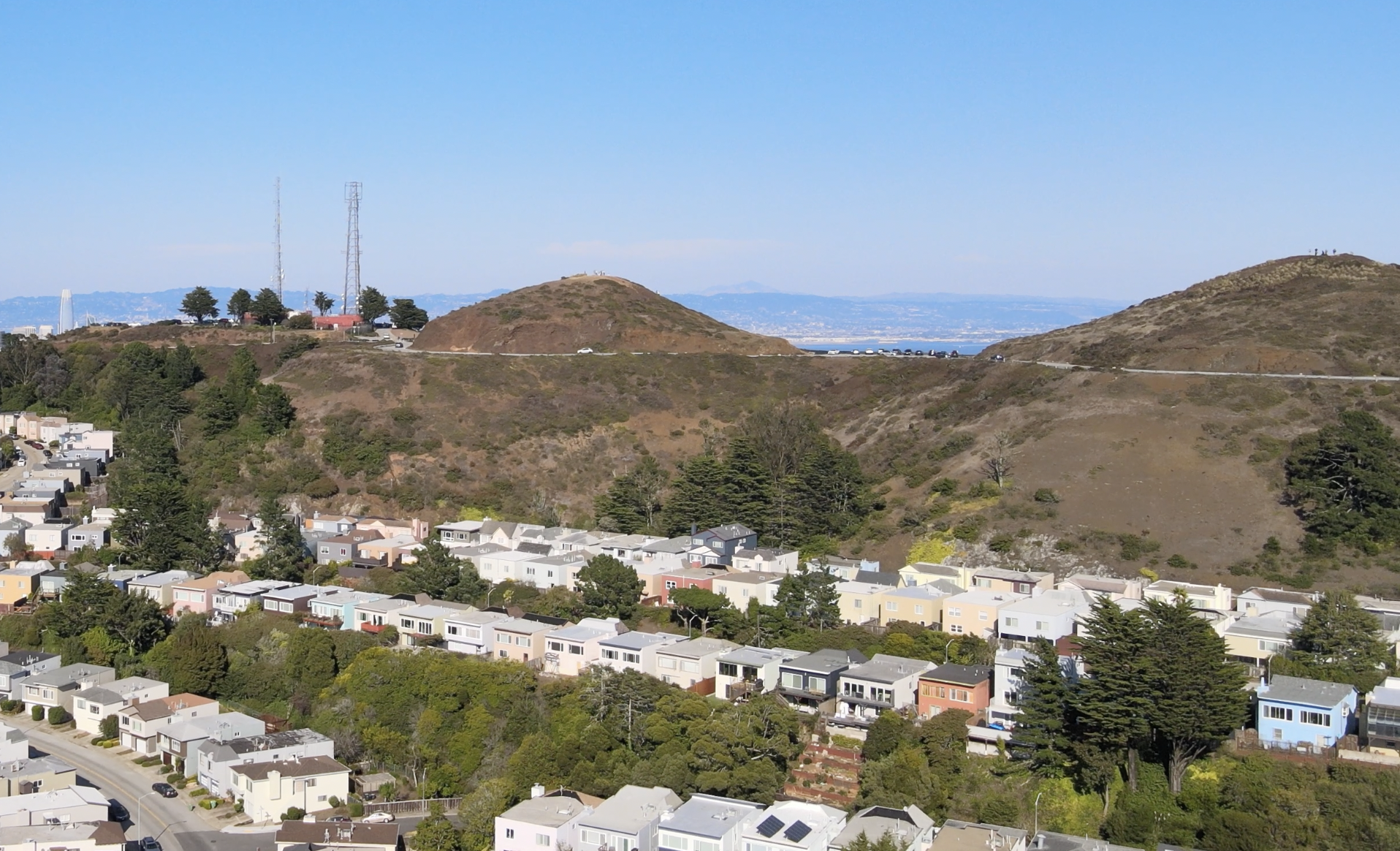
From the Air
Twin Peaks is at 37.75N, -122.45W, the most prominent terrain feature in central San Francisco. The two bare summits are clearly visible from the air, rising above the surrounding residential neighborhoods. The fire department reservoir to the north and Sutro Tower on the adjacent ridge are useful visual references. The peaks create a visible weather divide -- fog often blankets the western slopes while the eastern side remains clear. Nearest airports: KSFO 10nm south, KOAK 10nm east. Maintain safe altitude over this terrain.