Udegeyskaya Legenda National Park
The park is named for people who are still here. The Udege, an indigenous people of the Russian Far East, have hunted and fished the river valleys of the Sikhote-Alin's western slope for centuries — long before the boundaries of a national park were drawn around their territory. Udegeyskaya Legenda, which translates as "Udege Legend," was established partly to protect the habitat and partly to protect the culture. The two are not separate things. In Udege tradition, a forest managed through generations of hunting and fishing knowledge is not wilderness; it is home.
The Midpoint of Everything
Geographically, Udegeyskaya Legenda National Park occupies a remarkable crossroads. It lies midway between Vladivostok, 520 kilometers to the southwest, and Khabarovsk, 440 kilometers to the northwest. To the east are the relatively warm waters of the Sea of Japan; to the south, the Korean peninsula; to the west, China. The park sits at the junction of continental and maritime climates, of temperate and near-subtropical zones, of ancient stable geology to the west and active tectonics to the east. It escaped the glaciation that reshaped most of northern Eurasia. It escaped major industrial development. The result of these accidents of geography and history is that the Primorsky region carries the highest levels of biodiversity found anywhere in Russia — and the park lies at its center.
Rivers That Feed an Ocean
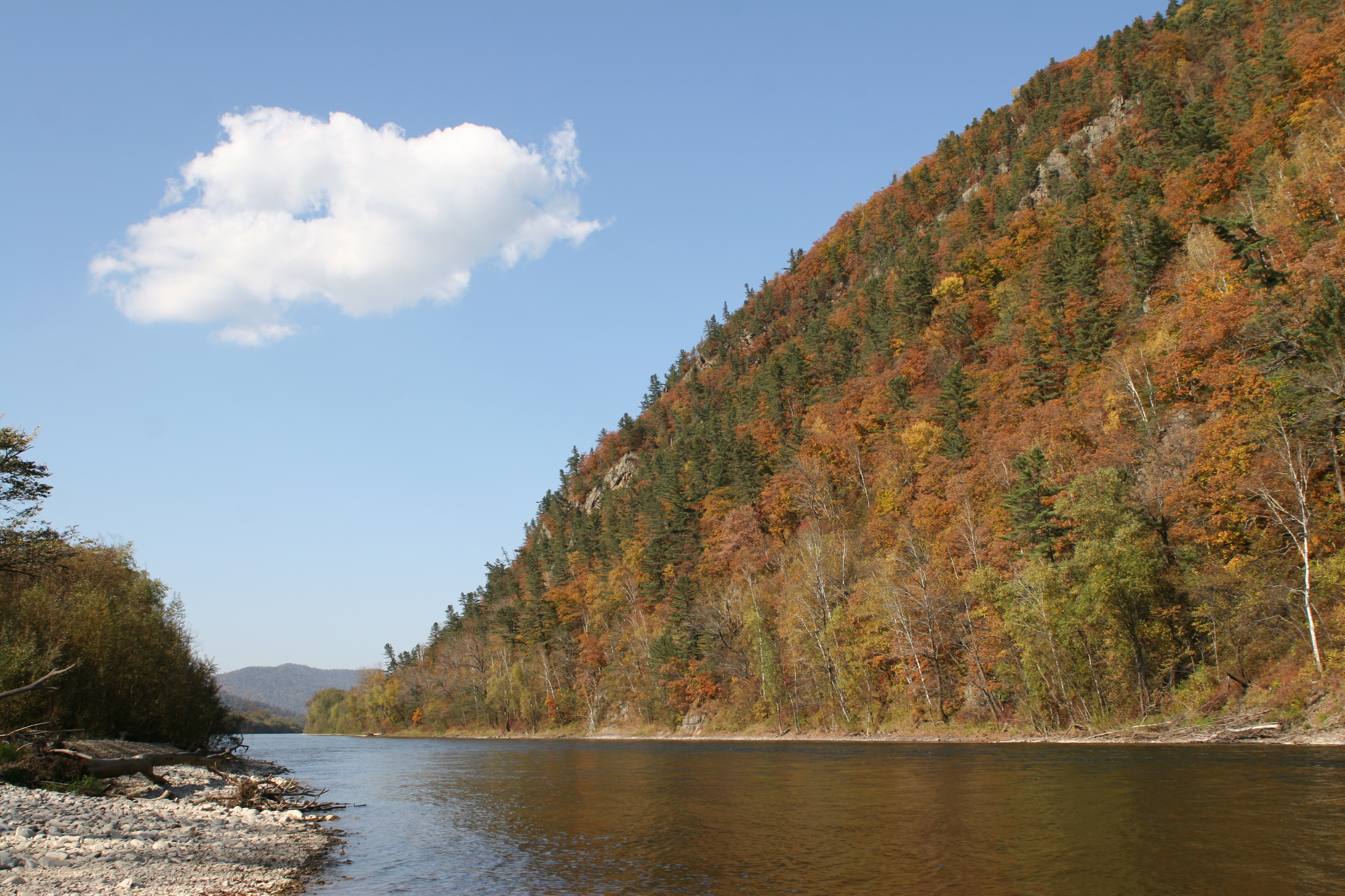
The mountain valleys here feed two rivers — the Armu and the Bolshaya Ussurka — that flow west to the Ussuri River and eventually north into the Amur, which reaches the Sea of Okhotsk. These are not placid waterways. The Armu's banks are rocky and steep, broken by rapids and waterfalls. The Ussurka's main valley runs north-northeast along the Sikhote-Alin fault, passable to small boats in the lower reaches, fringed with oxbow lakes and marshy ground. Ice closes the rivers for up to six months each year. The water cycle here connects the interior mountain forests to the Pacific coast in a chain of habitats that migrating fish and birds follow each season, generation after generation.
The Forest in Layers
Elevation organizes the forest into visible bands. In the lowlands, deciduous trees — elm, ash, Manchurian walnut — mix with cedar pine and spruce. Higher up, the canopy shifts to spruce-fir forest with birch. The park's plant inventory includes 30 protected vascular species: ginseng, Japanese mountain yam, fox nut, Pacific saxifrage, yew. The animals range across the same gradient. Amur tigers hold territories here; so do brown bears and Asian black bears, sable, marten, lynx, and leopard cats. River banks shelter mink and otter. The forests carry an estimated 10,000 insect species, including a species of longhorn beetle believed to be the largest in Russia. An ecological trail leads visitors to the Kovalevskaya yew grove, where ancient trees stand that were old when the Udege were the only people in these mountains.
Autumn, and the Art of Getting Here
Reaching Udegeyskaya Legenda requires commitment. The nearest train station is at Dalnerechensk, still 144 kilometers from the park boundary. But the park's position on the western slope of the Sikhote-Alin — rather than the more rugged eastern face — makes it more accessible than many of Russia's protected areas in the region. Eco-tourism is built into the park's stated purpose: guesthouses and campgrounds are available, guided tours can be arranged, snowmobiles and inflatable rafts are available for rental, and a geological museum sits on-site. The best time to visit, locals will tell you, is autumn. Clear skies, warm days, gradually cooling temperatures, and the forest turning gold and amber. They call it the golden Far East Autumn — and after a season in the taiga, the name feels entirely earned.
From the Air
Udegeyskaya Legenda National Park is centered at approximately 45.82°N, 135.42°E on the western slope of the central Sikhote-Alin mountains in Primorsky Krai. From altitude, the park appears as dense forested valleys cutting through the mountain ridge, with the Ussurka River valley visible as a dark line running north-northeast. The Sea of Japan coastline lies approximately 120 kilometers to the east. The nearest major airport is Vladivostok International (UHWW), approximately 520 kilometers to the southwest; Dalnerechensk has a small airfield. Mountain weather is variable with seasonal fog; autumn conditions offer the clearest visibility. Recommended viewing altitude: 15,000–25,000 feet.