Ulupo Heiau State Historic Site
According to Hawaiian legend, the menehune built it in a single night. These small, industrious people of myth were said to work only in darkness, completing enormous construction projects between sunset and sunrise, then vanishing before dawn. Whether or not you believe the legend, standing at the base of Ulupo Heiau and looking up at walls thirty feet high, assembled from stones that may have been carried more than ten miles from the cliffs of Kualoa, you understand why the story exists. Something this large, this precisely fitted, this quietly powerful demands an explanation that ordinary human labor does not quite satisfy. The heiau sits on the eastern edge of Kawai Nui Marsh in Kailua, on Oahu's windward coast, and it has been watching over the wetlands for at least six centuries.
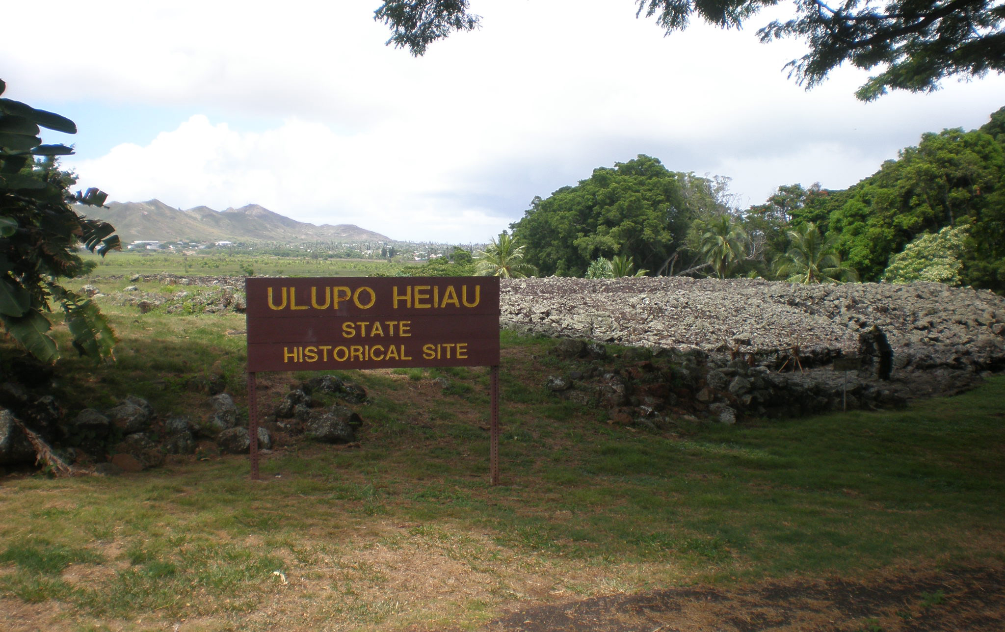
Stones from Kualoa
The platform of Ulupo Heiau measures roughly 140 by 180 feet, making it one of the largest heiau on Oahu. Its outer walls, dry-stacked without mortar, rise as high as thirty feet in places. The scale alone speaks to the chiefly power behind its construction. Moving basalt stones of this size required coordinated labor by hundreds of people, and tradition holds that many of the stones were transported from Kualoa, a sacred district more than ten miles up the windward coast. Kualoa was considered one of the most spiritually significant places on Oahu, and using its stone would have invested the heiau with additional mana. The platform's orientation and placement beside Kawai Nui, a four-hundred-acre fishpond and marshland rich with mullet, taro, banana, sweet potato, and sugarcane, suggests that the site originally served an agricultural purpose. Heiau of this type, called mapele, were dedicated to ensuring successful harvests and abundant fish catches. The springs feeding the marsh's edge would have made the surrounding land some of the most productive on the island.
From Harvest Temple to War Shrine
Ulupo Heiau did not remain an agricultural temple. As political power shifted among Oahu's chiefs, the heiau's function appears to have changed with it. The site is associated with Kakuhihewa, a fifteenth-century high chief remembered as one of Oahu's greatest rulers, whose reign was considered a golden age. By the late seventeenth century, the warrior chief Kualii may have converted the heiau to a luakini, a temple where human sacrifices were offered to the war god Ku. A luakini heiau required specific architectural elements: an altar, an oracle tower called an anuu, thatched hale structures, and carved wooden images known as kii. The conversion from mapele to luakini marked a shift from a place of abundance to a place of power, reflecting the intensifying warfare among Hawaiian chiefs as the islands moved toward the era of unification. The heiau may have reached its peak importance around 1750, a generation before the upheavals that would reshape all of Hawaii.
Conquest and Abandonment
In the 1780s, the Maui chief Kahekili defeated Kahahana, the high chief of Oahu, and took control of the island. Kahekili established himself at Kailua, within sight of Ulupo Heiau, using the windward coast as his power base. But his reign was short-lived. After Kahekili's death, Kamehameha the Great conquered Oahu in 1795, culminating in the Battle of Nuuanu, where defending warriors were driven over the Pali cliffs. Kamehameha too made Kailua one of his residences, and the area around Kawai Nui Marsh remained important. But the old religious system was crumbling. In 1819, Kamehameha's son Liholiho abolished the kapu system, and heiau across the islands were abandoned or dismantled. Ulupo fell into disuse. Its stones remained, too massive to easily repurpose, but the rituals that had given them meaning ceased. For over a century, the heiau sat quietly at the marsh's edge, overgrown and largely forgotten by all but the families who lived nearby.
Reclaiming Sacred Ground
Recognition came slowly. The Territory of Hawaii designated Ulupo a territorial park in 1954. In the early 1960s, partial restoration work cleared vegetation from the platform and stabilized sections of the walls. A bronze plaque was placed by the State Commission on Historical Sites in 1962, and in 1972, the heiau was listed on the National Register of Historic Places. Today, the site is managed by the Hawaii Division of State Parks. Visitors approach through a short path that opens onto the base of the platform, where taro and other traditional plants are cultivated in the marshy ground below the walls, echoing the agricultural origins of the site. Kawai Nui Marsh itself, the largest remaining wetland in the Hawaiian Islands, stretches out behind the heiau in a green expanse that makes it easy to imagine the landscape as it looked centuries ago. The heiau asks nothing of its visitors except attention. Stand at its base, look up at the stones, and consider the labor, the belief, and the political ambition that stacked them there. The menehune story is charming. The truth is more impressive.
From the Air
Located at 21.3858N, 157.7528W on Oahu's windward (east) side, at the eastern edge of Kawai Nui Marsh in Kailua. The marsh is a large, distinctive green wetland visible from altitude, bordered by the residential areas of Kailua to the east and the Koolau Range to the west. The heiau platform is at the marsh's southeast corner but is not individually visible from high altitude due to tree cover. Marine Corps Base Hawaii (PHNG) at Kaneohe Bay is 3 miles to the north. Daniel K. Inouye International Airport (PHNL) is 12 miles to the southwest via the Pali Highway corridor through the Koolau Range. Best viewed at 500-1,500 feet AGL on approach from over Kailua Bay, with Kawai Nui Marsh as the primary landmark.