Uncompahgre Peak
In September 1894, a detachment of the U.S. Army Signal Corps hauled 8-inch mirrors and telescopes to the broad summit plateau of Uncompahgre Peak. Over several days beginning September 10, they aimed flashing light at Mount Ellen in Utah, 183 miles away across some of the most rugged terrain in North America. The signals got through. That heliograph record for visual communication stood as the world benchmark, a fitting achievement for a peak that dominates everything around it. Uncompahgre is the sixth highest summit of the Rocky Mountains, the highest point in the San Juan Mountains, and the highest point in the entire drainage basin of the Colorado River -- the watershed that feeds the Gulf of California and sustains much of the American Southwest.
Red Water Spring
The peak takes its name from the Ute word Uncompaghre, which loosely translates to dirty water or red water spring. The name likely references the many hot springs near Ouray, Colorado, about seven miles to the west, where mineral-laden water surfaces in rusty shades. The Ute people knew this country intimately long before surveyors arrived to triangulate its summits. In 1873, the peak appeared on maps as Mount Chauvenet. It was also recorded as Unca-pah-gre Mountain and Uncompahgre Mountain before the current spelling settled into place by 1907. Each name carried the memory of a different encounter with the peak, but the Ute name endured, anchoring the mountain to the landscape and the water that flows from it.
A Volcano That Is Not a Volcano
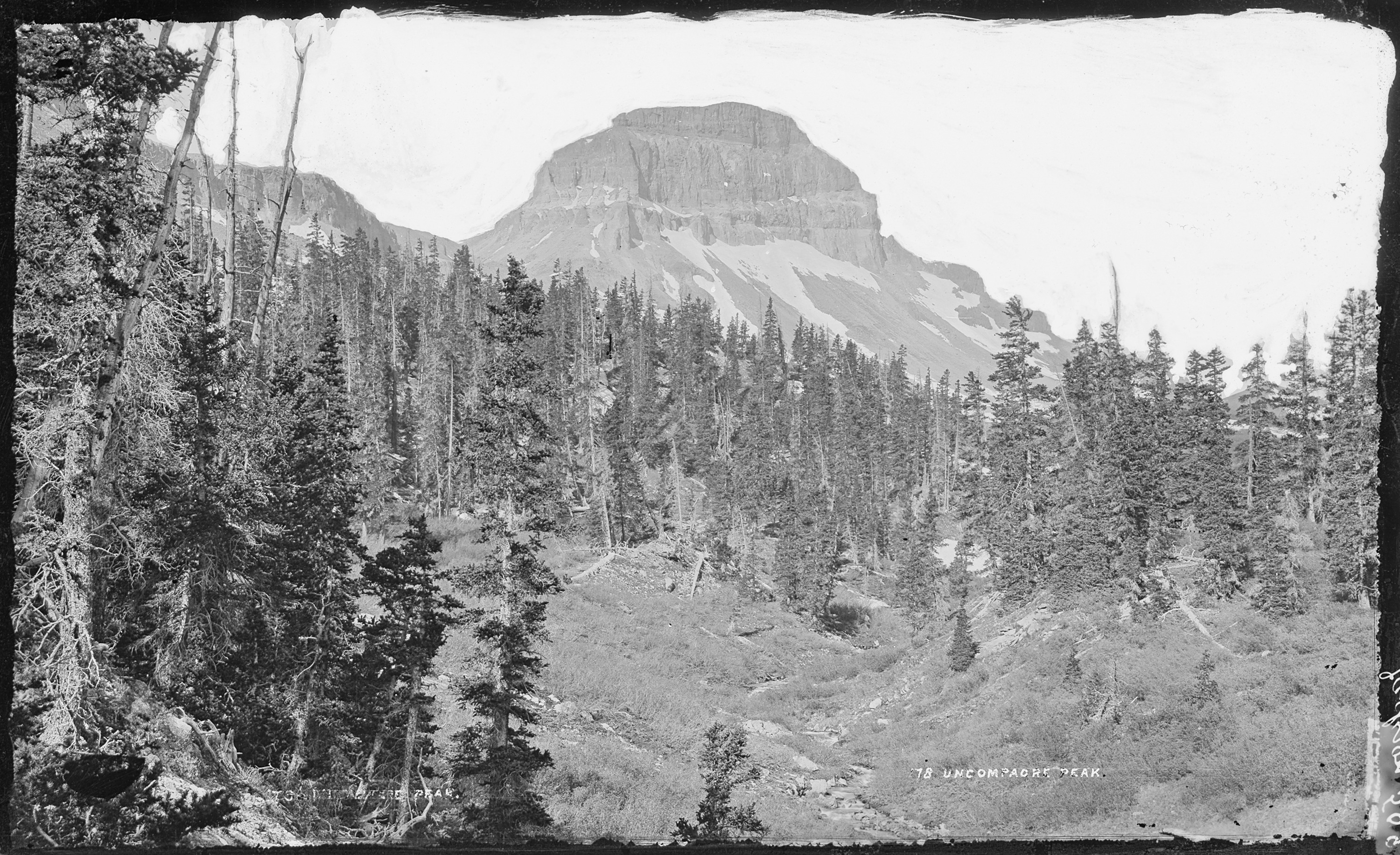
Uncompahgre Peak is of volcanic origin, but it is not a volcano. Like all peaks in the San Juan Mountains, it was built from the accumulated debris of ancient eruptions that shaped the San Juan volcanic field millions of years ago. The rock is of poor quality for technical climbing, crumbling under hand and foot in ways that discourage any attempt on the steep north face with its sheer cliff. The south, east, and west sides are gentler, and the summit itself is a broad plateau rising above wide alpine basins. The most popular climbing route follows Uncompahgre National Forest Service Trail Number 239, starting from the end of Nellie Creek Road east-southeast of the peak. The Nellie Creek Road is a four-wheel-drive track accessed from Henson Creek Road west of Lake City. The trail gains significant elevation in a winding ascent that starts from the east, passes over a south-trending ridge, and finishes on the west slopes of the summit plateau. A second route from the Matterhorn Creek trailhead attracts hikers who prefer to avoid the rough Nellie Creek approach.
Crown of the Colorado River
Among Colorado fourteeners, Uncompahgre holds a distinction no other peak can claim. It is the highest point in the drainage basin of the Colorado River, the vast watershed that stretches from the Rocky Mountains to the Gulf of California. Every drop of rain or snowmelt that falls on the summit eventually finds its way into the Colorado system, joining the flow that carved the Grand Canyon and sustains cities and farms across seven states. The peak rises in the Uncompahgre Wilderness in northern Hinsdale County, approximately seven miles west of the town of Lake City. The wilderness area preserves the alpine terrain surrounding the peak, a landscape of tundra grasses, wildflower meadows, and snowfields that linger well into summer. The isolation and elevation create conditions where weather can shift from calm sunshine to violent thunderstorms in minutes, and hikers learn quickly that an early start is essential on any fourteener in the San Juans.
Signals Across the Distance
The 1894 heliograph experiment on Uncompahgre was not a stunt. The U.S. Army Signal Corps was testing the limits of visual communication across difficult terrain, and the 183-mile link to Mount Ellen in Utah pushed the technology as far as it could go. The mirrors were only 8 inches across, the telescopes standard military issue. What made the feat possible was the extraordinary clarity of the high-altitude air and the unobstructed sightlines from Uncompahgre's broad summit. The record stood as proof that even the most remote peaks could be connected, a principle that would later find expression in radio towers, microwave relays, and the satellite links that now blanket the same mountains. Today, hikers who reach the summit on a clear day can see far enough to understand why the Signal Corps chose this spot -- the horizon extends for dozens of miles in every direction across the San Juan range.
From the Air
Uncompahgre Peak is located at 38.07N, 107.46W in northern Hinsdale County, Colorado, approximately 7 miles west of Lake City. As the highest summit in the San Juan Mountains, it is a prominent fourteener visible from great distances. The broad summit plateau is distinctive from the air. Maintain altitudes well above 14,300 feet for safe overflights. The nearest airports are Lake City-Warnock Field (CO2) and Gunnison-Crested Butte Regional Airport (KGUC) to the northeast. The Uncompahgre Wilderness surrounds the peak. Mountain wave turbulence, rapid weather changes, and high density altitude are significant considerations. The north face cliff is visible from the air as a dramatic drop contrasting with the gentler southern approaches.