Uribia, La Guajira
Uribia did not celebrate Christmas until 1942. The Wayuu people who constitute nearly 96% of the municipality's population had their own ceremonies, their own calendar, their own way of marking time. When the holiday finally arrived - brought by Capuchin friars who had spent decades building orphanages and visiting rancherias across the desert - it was less a conversion than an addition, one more layer in a place that has always absorbed outside influence without surrendering its identity. Uribia is Colombia's youngest municipality, created in 2000, but the land it occupies is ancient, and the people who live on it have been here far longer than the nation that now claims them.
Desert at the End of the Continent
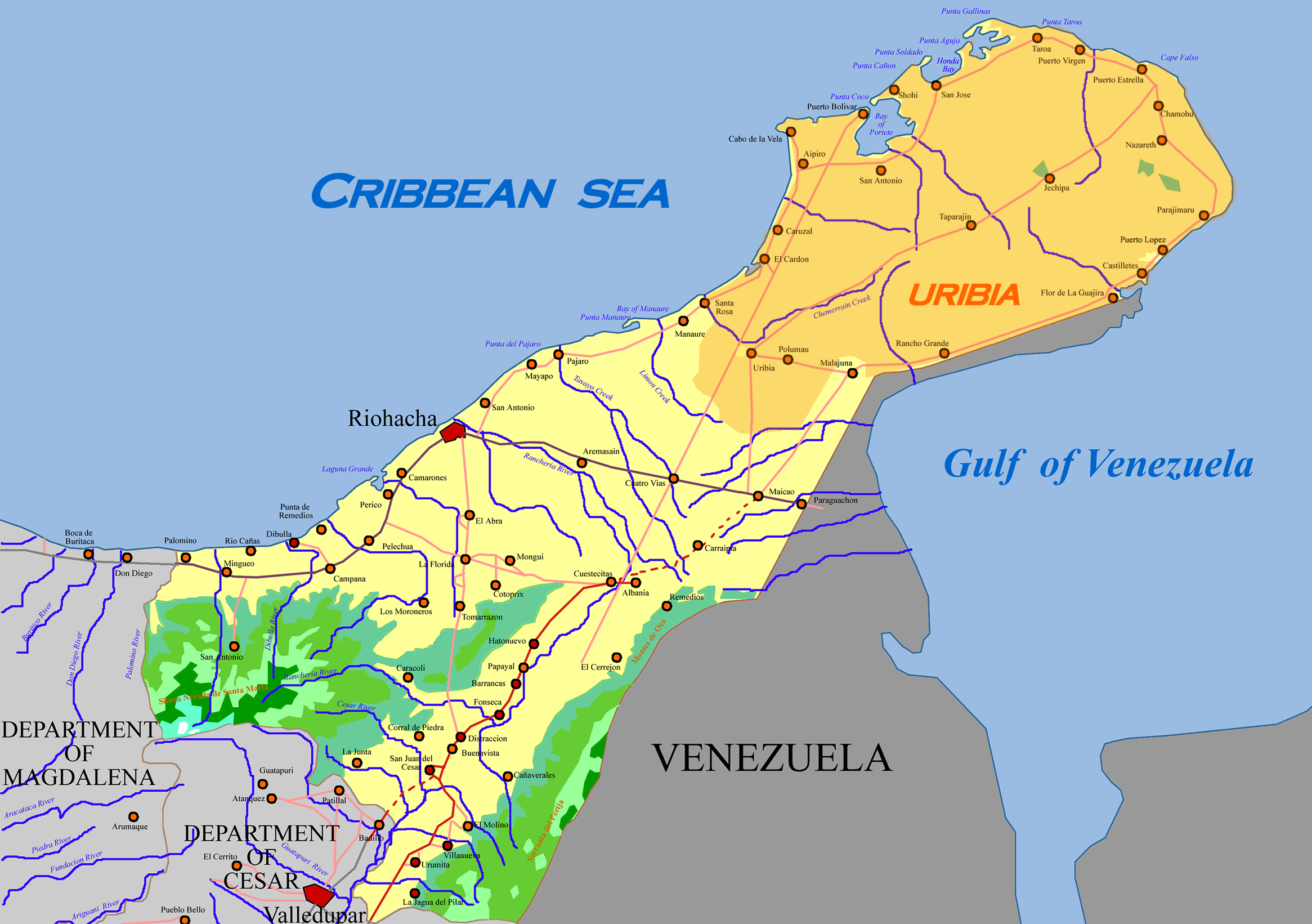
Uribia covers most of the northern Guajira Peninsula, which makes it one of the largest municipalities in Colombia and places it at the absolute northernmost point of South America. The Caribbean Sea wraps around more than half its borders. To the east lies a short frontier with Venezuela. To the south, the municipalities of Maicao and Riohacha begin where Uribia's territory ends. The landscape is punishing - an arid expanse classified as BWh under the Koppen system, meaning hot desert climate. Temperatures hover near 30 degrees Celsius year-round, and annual rainfall barely reaches 360 millimeters, not even enough to match the rate of evaporation. Cactus and xerophytic scrub dot clay formations that stretch to the horizon. Humidity hangs high enough to make the persistent heat feel oppressive. This is not a place that forgives carelessness, and the Wayuu who thrive here have earned that survival through millennia of adaptation.
A Cloud Forest in the Middle of Nowhere
Rising from the flat desert like a mirage that happens to be real, the Serrania de Macuira is an isolated mountain range in the heart of Upper Guajira. Three hills - Macuira, Jarara, and La Teta - climb to 650 meters and above, high enough to intercept the humid trade winds blowing from the northeast. The result is a pocket of cloud forest surrounded on all sides by desert, an ecosystem so improbable that one-third of the range has been designated a National Natural Park. Dwarf forests and ferns grow where cactus dominates just kilometers away. The moisture that the mountains trap sustains plant and animal communities found nowhere else in the region, creating what amounts to a biological island in a sea of dry sand. From the air, the Macuira appears as a green stain on an otherwise brown canvas, a reminder that geography can create its own exceptions to the rules imposed by climate.
The Friars and the Children They Took
In 1887, Capuchin friars returned to La Guajira with a mission to evangelize the Wayuu. By 1905, Pope Pius X had created the Vicariate of La Guajira, appointing friar Atanasio Vicente Soler y Royo as its first vicar with an explicit mandate to "civilize" the Wayuu people. The method the friars chose was orphanages. The La Sierrita orphanage went up in the Sierra Nevada de Santa Marta mountains in 1903. The San Antonio orphanage followed in 1910, by the Calancala River. The Nazareth orphanage was built in the Serrania de Macuira in 1913. In these institutions, Wayuu children were separated from their families and educated in European customs - taught to speak Spanish, to pray Catholic prayers, to live by schedules and routines that had nothing to do with the pastoral rhythms of Wayuu life. The friars visited rancherias constantly, inviting families to attend mass and urging parents to send their children. Whether these invitations felt voluntary to the Wayuu who received them is a question the historical record does not fully answer.
A Capital That Lost Its Capital
For a time, Uribia held a distinction that belied its small size: it served as the capital of the Special Commissary of La Guajira, making it the administrative center of Colombia's entire northeastern frontier. That status ended in 1954, when the National Intendency of La Guajira was created and the capital was transferred to Riohacha, a larger and more accessible city on the coast. Uribia lost the bureaucrats but kept its character. The Northern Zone of the Cerrejon coal mines operates within the municipality's boundaries, connecting this remote Wayuu town to global energy markets through one of the world's largest open-pit mining operations. The coal leaves by rail and port; the revenue, in theory, returns to benefit the community. Whether the benefits match the costs - environmental disruption, displacement, the transformation of ancestral land - remains a source of tension.
The Festival That Belongs to No One Else
Every year from May 31 to June 1, Uribia hosts the Festival of the Wayuu Culture, a celebration that draws visitors from across Colombia and beyond. The festival is a window into a way of life that predates the Colombian state by millennia - the Yonna dance, traditional music, the weaving of mochilas and chinchorros hammocks that have become iconic throughout the country. Uribia's identity as the most indigenous municipality in Colombia is not merely a demographic statistic but a lived reality. The Wayuu language, Wayuunaiki, is the dominant tongue. Social organization follows clan structures that have nothing to do with Colombian administrative categories. Disputes are settled through a system of Wayuu customary law that the Colombian constitution now recognizes. Puerto Bolivar Airport provides the municipality's air connection to the outside world, but Uribia has always been more connected to itself - to its own rhythms, its own justice, its own definition of what it means to belong.
From the Air
Located at 11.71N, 72.27W on the northern Guajira Peninsula, the northernmost point of South America. Uribia is served by Puerto Bolivar Airport (SKPB). Almirante Padilla Airport (SKRH) in Riohacha is approximately 90km to the southwest. From altitude, the municipality is dominated by flat, arid desert terrain with the Caribbean Sea visible to the north and west. The Serrania de Macuira appears as an isolated green mountain range in the midst of brown desert - unmistakable from the air. Cerro La Teta is a distinctive peak. The Cerrejon coal mining operations may be visible to the south. Best viewed at 5,000-15,000 feet to appreciate the desert-sea interface, the striking green anomaly of the Macuira mountains, and the scattered Wayuu rancherias dotting the landscape.