US Naval Base New Guinea
Fleet Post Office Number 167, codename Edur. That was the U.S. Navy's bureaucratic way of referring to Milne Bay, one of the strangest and most essential places the service ever occupied. Milne Bay was a green, drowned, mosquito-haunted inlet at the eastern tip of New Guinea, thousands of miles from anything Americans thought of as home, and in 1943 it became a major sea and air base servicing ships, submarines, PT boats, seaplanes, and crews sickened equally by combat and disease. It was one of more than thirty U.S. Navy bases eventually built along New Guinea's coasts, built fast, used hard, abandoned completely once the war moved on.
After Pearl Harbor, a Map to Rebuild
The United States entered the war on 7 December 1941 with its Pacific naval footprint already collapsing. Naval Base Manila and Naval Base Subic Bay fell during the 1941-42 invasion of the Philippines. Naval Base Guam and Wake Atoll went the same way. The American-British-Dutch-Australian Command, assembled in an effort to blunt Japan's southward advance, never had the troops or the supplies to do the job. By the time the dust settled, the United States needed new bases in the South West Pacific from which to stage attacks back northward. The first ones went into Australia. When east-coast Australian ports grew overcrowded in the spring of 1943, the pressure found a new outlet: New Guinea itself.
Seabees in the Rain
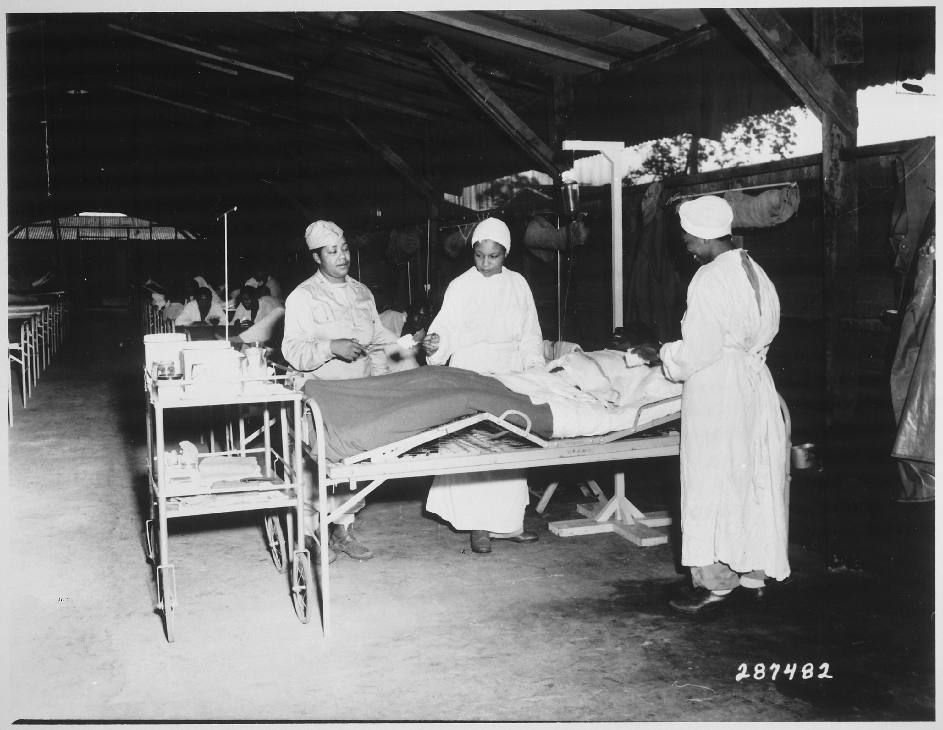
On 19 June 1943, U.S. Navy Seabees shipped out from Naval Base Brisbane to establish a new major installation at Milne Bay, in what was then the southeastern corner of the Australian Territory of Papua. What they found was tropical rainforest laid directly on the equator — no dry season worth naming, rain measured in feet rather than inches, and a full bestiary of tropical diseases waiting for newcomers. The men built anyway. Piers at Gili Gili. The Kana Kopa PT boat base at FPO 714. The Milne Bay Submarine Base, where the submarine tender USS Fulton serviced boats hunting Japanese shipping in the Bismarck Sea. A hospital at Hilimoi Bay. Recreation facilities where sailors could at least briefly pretend the jungle ended somewhere.
A Chain of Green Harbors
Milne Bay was only the beginning. As the Allied counterattack rolled up the New Guinea coast through 1943 and 1944, naval bases followed. Port Moresby. Finschhafen, codename Urom, at Dreger Harbour. Hollandia after its capture. Madang, Aitape, Wewak, Saidor, Merauke. Specialized bases on Woodlark Island, Biak, Mios Woendi, Noemfoor, and Cape Sansapor. Naval Base Manus in the Admiralty Islands, with the deep anchorage of Seeadler Harbor, became one of the greatest fleet bases in the Pacific. Scattered PT-boat posts dotted smaller islands — Tufi, Kiriwina, Amsterdam Island (also called Mios Su). Each one was a raw forest clearing transformed in weeks into a fuel dump, a pier, a seaplane ramp, a radio hut, a mess tent, an airstrip. Each had a Fleet Post Office number that allowed a sailor to receive a letter from Missouri without ever needing to know where he was.
What the Jungle Witnessed
The war around these bases was not only naval. It touched civilians and captives in ways that should not be softened. Japanese occupation of New Guinea produced massacres and executions of Allied prisoners of war. At the Tol Plantation in February 1942, 160 Australian prisoners were killed. Australian Sergeant Leonard Siffleet, captured while running a coastwatching operation, was beheaded in 1943; a photograph of his execution survives and is one of the most widely reproduced images of the Pacific war. On 18 March 1943 the Japanese destroyer Akikaze carried out the execution at sea of roughly thirty German civilians from Wewak — priests, nuns, two children — suspected of relaying ship movements to the Americans. Indigenous New Guineans suffered extensively, with many used as forced laborers — the Japanese term was romusha — and many more starved when rice stocks were diverted to Japanese troops. The naval bases existed to fight the enemy that did these things.
Rust and Forest
After 1945 the New Guinea bases closed. Some were dismantled and shipped elsewhere. Most were simply abandoned. The jungle took them back fast. Today Milne Bay Province is a quiet, lush corner of Papua New Guinea known for diving — the Gili Gili dock where the MV Anshun lay capsized in 1942 is now a small port serving local traffic. At Kana Kopa and Hilimoi Bay, rusting fittings and concrete foundations still show where the U.S. Navy lived briefly and left. Pacific Wrecks and local historians catalogue what remains. From the air, the old runways at places like Gurney Field (now Alotau's airport) and Biak's Mokmer are the clearest traces — straight lines cut into a green coast, used now mostly for short-haul island flights, maintained by people whose grandparents saw them built.
From the Air
Centered near 5.50 S, 141.00 E for the main New Guinea base network; actual installations spanned from Milne Bay (10.30 S, 150.45 E) in the east to Cape Sansapor (0.48 S, 132.14 E) in the west. Modern flying: Gurney Airport (GUR/AYGN) at Alotau serves Milne Bay; Jacksons International (POM/AYPY) at Port Moresby is the main national hub; Sentani (DJJ/WAJJ) serves the former Hollandia; Frans Kaisiepo (BIK/WABB) covers Biak. Low-altitude passes at 3,000 to 5,000 feet over Milne Bay and Manus reveal the scale of the anchorages. Morning flying beats the daily tropical buildup.