USS Shark (1821)
The cannon turned up on a beach in 1898, half-buried in sand about five miles north of Arch Cape, Oregon. It was a carronade -- a short, heavy naval gun of the kind that had not been standard equipment for decades. In 2008, two more carronades appeared on the same stretch of coast. All three are believed to have belonged to the USS Shark, a Navy schooner that sank trying to cross the Columbia Bar in September 1846. The beach where the first gun washed up was named for it: Cannon Beach. The Shark had been dead for half a century before she started naming places.
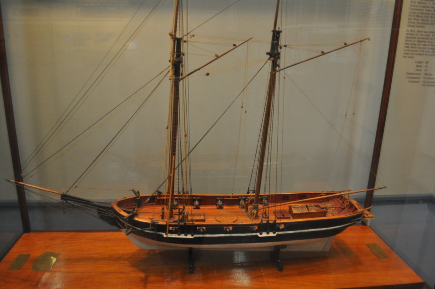
Built to Bite
The Washington Navy Yard built the Shark in 1821 to the designs of Henry Steers, a schooner purpose-built for hunting pirates in the Caribbean. She had a peculiar tendency that her sailors knew well: an inclination to lower her bow and dive under when pressed by the wind at full sail. On May 11, 1821, Matthew C. Perry -- decades before his famous expedition to Japan -- received orders to take command. The schooner launched six days later and was crewed by June 2. Her first mission carried Dr. Eli Ayers to Sierra Leone and combined it with anti-piracy and anti-slave-trade patrols through the Madeira, Canary, and Cape Verde Islands. Before she was a year old, Shark had crossed the Atlantic twice and returned to New York.
Perry's Flag at Key West
In February 1822, Shark joined Commodore James Biddle's squadron in the West Indies, tasked with suppressing both piracy and the slave trade. On March 25, Lieutenant Perry went ashore at a low island at the southern tip of the Florida Keys and formally claimed it for the United States. He named it Thompson's Island, honoring Secretary of the Navy Smith Thompson, and called the harbor Port Rodgers after Commodore John Rodgers. The island's older Spanish name would prove more durable: Key West. Over the next decade, Shark became one of the Navy's busiest small warships, shuttling between the West Indies, West Africa, and the Newfoundland fisheries. She escorted freed slaves to the new settlement of Liberia, evaluated Key West's potential as a naval base, and defended American fishing rights off Newfoundland. In 1833, she sailed for the Mediterranean and spent five years protecting American commerce across southern Europe and North Africa.
Through the Straits and Up the Coast
Shark departed Hampton Roads on July 22, 1839, bound for the Pacific -- and made history almost immediately. On December 13, she became the first American warship to transit the Straits of Magellan from east to west, threading the narrow passage at the tip of South America en route to Callao, Peru. For the next five years she patrolled the South American coast, protecting American citizens and property during Peru's civil disturbances. The Secretary of the Navy wrote in 1841 that "all who witnessed the operations of the Shark were inspired with increased respect for the American flag." In April 1846, with tensions rising over the Oregon Country, the Navy ordered Shark to Honolulu for repairs and then north to the Columbia River, charged with obtaining intelligence about the disputed territory and showing the flag to American settlers.
The River That Would Not Be Crossed
Shark reached the Columbia's mouth on July 12, 1846, and immediately encountered the problem that had defined this stretch of coast for decades: there was no regular pilot. Henry Spalding, Asa Lovejoy, and William Gray arrived by small boat and recommended James D. Saules, a local who knew the river but was most accustomed to flat-bottomed scows -- not a deep-drafted Navy schooner navigating what was already known as one of the most treacherous river entrances in the world. Saules managed to get Shark past the first shoal, and the next morning Alexander Lattie, the officer in charge of Fort George, guided her to his fur trading post. After several weeks exploring upriver near Fort Vancouver, Shark returned to the bar on September 8. The Columbia's sandbars had shifted since the last survey by Charles Wilkes, and with no pilot available, Lieutenant Neil Howison attempted the crossing on September 10. The ship struck an uncharted shoal, was caught by a swift tide, swept into the breakers, and sank. Every member of the crew survived. The ship did not.
Artifacts and Afterlives
The Shark was a total loss, but the response to her sinking revealed something about the frontier. Officers of the Royal Navy and the Hudson's Bay Company at Fort Vancouver -- technically rivals in the contested Oregon Country -- immediately dispatched a relief expedition with food, tobacco, and clothing for the American crew. Lieutenant Howison chartered a Hudson's Bay Company schooner and reached San Francisco in January 1847. A naval court of inquiry cleared him of all blame. The river kept the ship, but it could not keep her guns. The carronade that washed ashore near Arch Cape in 1898 gave Cannon Beach its name. Two more carronades discovered in 2008 were restored at Texas A&M University and now sit in the Columbia River Maritime Museum in Astoria, alongside an officer's sword believed to have come from the wreck. A rock near the site bears words and dates that survivors are thought to have carved. One hundred and eighty years after Shark sank, pieces of her are still turning up along the Oregon coast, reminders that the Columbia Bar does not easily forget what it takes.
From the Air
The wreck site of USS Shark lies near the mouth of the Columbia River at approximately 46.245N, 124.068W, on the Oregon side of the Columbia Bar. From the air, the bar is visible as a turbulent zone of white water where the river meets the Pacific. Cape Disappointment and its two lighthouses mark the Washington headland to the north. The town of Cannon Beach, named for the Shark's carronades, lies approximately 20nm south along the Oregon coast. Artifacts from the wreck are displayed at the Columbia River Maritime Museum in Astoria (visible from the river) and the Cannon Beach History Center. Nearest airports: Astoria Regional Airport (KAST) approximately 8nm north-northeast, Seaside State Airport (not towered) closer along the coast. Best viewed at 1,500-3,000 feet to see the bar's full extent and the relationship between the wreck site and the headlands.