Van Harinxmakanaal
Sometime around 2002, a Eurasian otter slipped into the Van Harinxmakanaal at the western end and swam east. The species had been functionally absent from the Netherlands for a generation, hunted out and habitat-stripped to the point of national extinction, and was only just being reintroduced. The canal — straight, slow, connecting the sea at Harlingen to the lakes east of Leeuwarden — turned out to be exactly the corridor the new otter population needed to spread. The banks, all rip-rap and bare stone, are terrible otter habitat. But as a road between better places, the Van Harinxmakanaal works beautifully. It was not what the Frisians built it for, but it is one of the things it now does.
A New Name for an Old Trekvaart
Before 1950, this waterway was called the Harlinger Trekvaart — the Harlingen tow-canal, an older route that had carried barge traffic across western Friesland for centuries. In 1950 it was renamed for Pieter Albert Vincent van Harinxma thoe Slooten, who had served as King's Commissioner — the Crown's representative in the province — from 1909 to 1945, a tenure that spanned two world wars. The honor came late; he had retired five years earlier. The canal that bears his name today is not, however, the trekvaart he knew. In 1951, the year after the renaming, engineers widened and deepened the channel and cut a few corners off the route. The result is the modern Van Harinxmakanaal: 37.5 kilometers long, running from Harlingen on the Wadden Sea east through Franeker, Dronrijp, and Deinum to Leeuwarden, then connecting at Suawoude to the Prinses Margriet Canal.
How a Canal Holds Its Level
At the western end, where the canal meets the harbor at Harlingen, sits the Tsjerk Hiddessluizen — a sea lock named for a seventeenth-century Frisian admiral. The lock's quiet, constant job is to keep the canal at the right level even as the North Sea on the other side rises and falls by meters with every tide. Behind the lock, the canal's water is plumbed into the *Friese boezem*, the great connected system of lakes and waterways that knits Friesland's flat hinterland into a single, jointly-managed body of water. Drop the level at Harlingen by accident on a stormy night and the consequences ripple inland for hours. In 2018, drought-driven shortages forced the operators to open the lock less often than usual, a small reminder that even a canal connected to the sea can run short of water.
What Floats Through
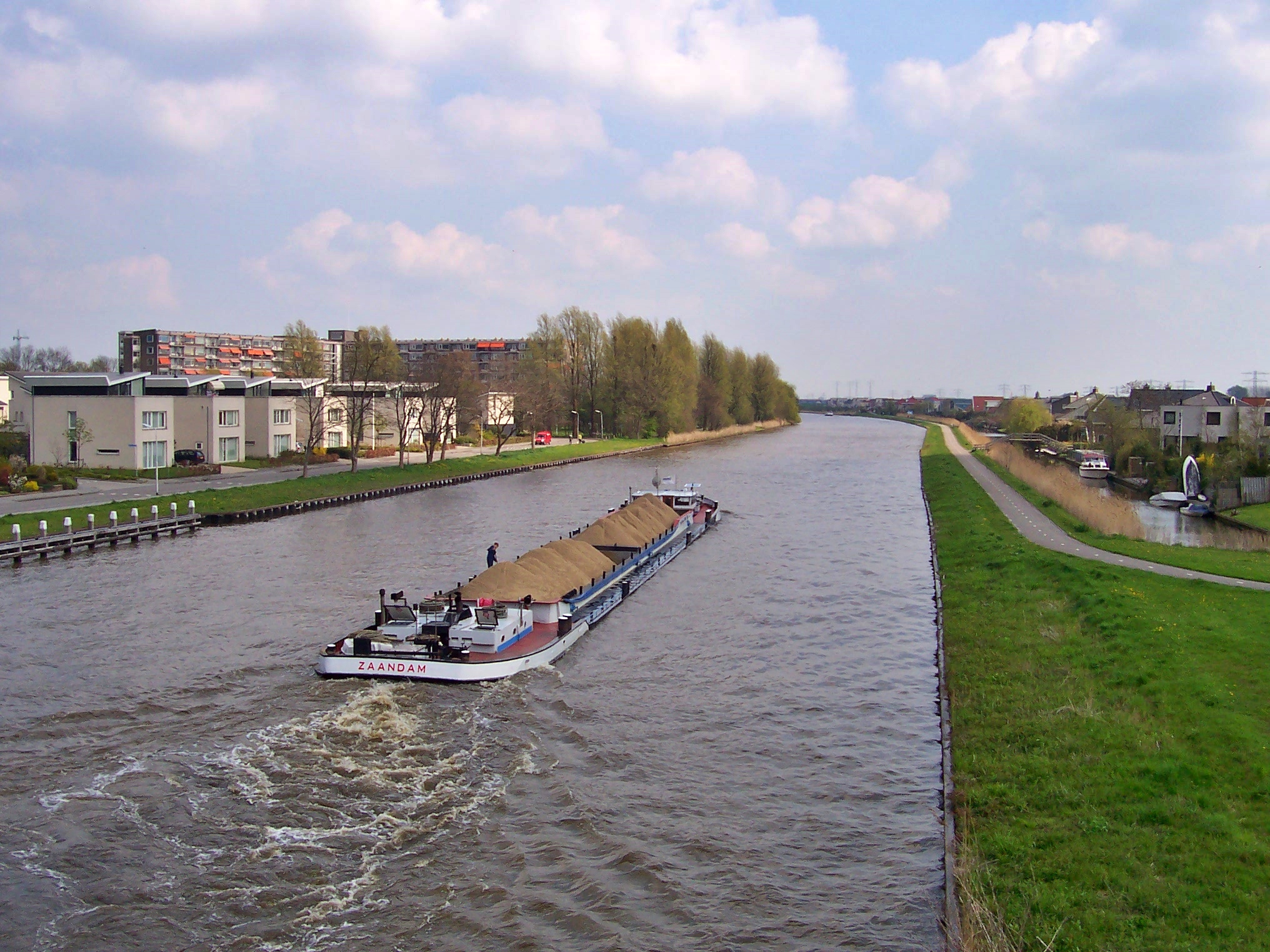
The Van Harinxmakanaal is engineered for CEMT Class IV inland-shipping vessels — barges up to 105 meters long, 9.5 meters wide, drawing 3 meters and weighing 2,000 tonnes, with a 5.45-meter clearance under the bridges. In 2009, 3,328 vessel transits passed through the Tsjerk Hiddessluizen; by 2011 the number had risen to 3,956. The 37.5-kilometer route is also threaded with feeder canals at almost every kilometer post — the Ried, the Marconihaven at Harlingen, the Arumer Feart heading southwest from Franeker, the Bolswarder Vaart branching south, the network of Franeker town canals — making it less a single channel than the trunk of a much larger circulatory system. When the railway bridge HRMK at Leeuwarden lost a hydraulic cylinder in September 2021, the canal was effectively closed at that point for almost a month until the repair was finished.
The Otter's Road
And then there is the otter. *Lutra lutra*, the Eurasian otter, recolonized Friesland after 2002 by using the Van Harinxmakanaal and the wider canal network as a movement corridor. The animals do not live on the canal itself — the engineered banks have no cover, no reeds, no soft mud, nothing an otter could call home. But they swim along it, sometimes for nights at a stretch, to reach the lakes and reed-fringed waterways further inland where they can hunt and den. A canal designed for barges turned out to be inadvertently designed for otters as well, by virtue of simply being a continuous run of water connecting better habitats. The Frisians who renamed and rebuilt the channel in 1950 and 1951 were not thinking about apex aquatic predators. The otters do not seem to mind.
From the Air
Located at approximately 53.19°N, 5.66°E along the central axis of western Friesland. The Van Harinxmakanaal cuts an unusually straight east-west line across the polders between Harlingen on the Wadden Sea coast and Leeuwarden inland — easy to follow from cruising altitude as a long bright thread among rectangular fields. The Tsjerk Hiddessluizen at Harlingen is visible where the canal meets the harbor; Franeker and Dronrijp sit on the channel. Leeuwarden Air Base (EHLW) is right at the eastern end of the canal. Best viewed at medium altitude in clear conditions, when the canal's geometry against the polder grid is most legible.