Vasse-Wonnerup Estuary
The floodgates were meant to stop flooding. Installed around 1907 at the mouths of the Vasse and Wonnerup inlets near Busselton, they regulated tidal flow to protect the growing settlement and its farmland from inundation. What nobody planned was that by controlling saltwater intrusion, the gates would create a vast freshwater wetland where none had existed before. Over the following century, that accidental ecosystem became one of the most important waterbird habitats in southwestern Australia -- home to over 20,000 birds across more than 80 species, and significant enough to earn international protection under the Ramsar Convention.
An Estuary Remade
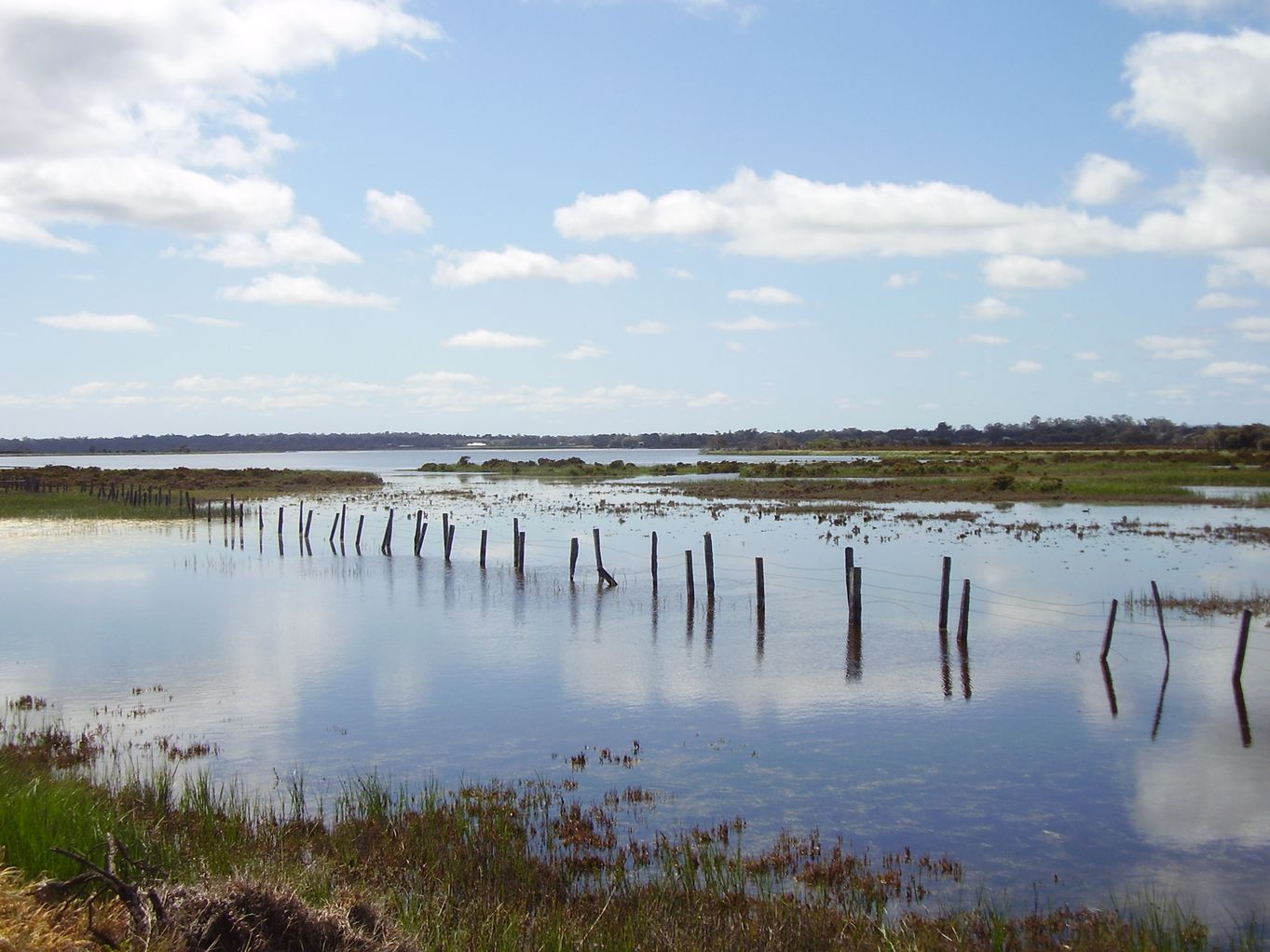
The Vasse-Wonnerup Estuary spreads across 17.8 square kilometers of coastal plain near Busselton, with a central basin covering 7.5 square kilometers. Four rivers feed it -- the Abba, Ludlow, Sabina, and Vasse -- draining a catchment of 961 square kilometers that is part of the broader Geographe Bay watershed. The estuary has been severely modified from its natural state. More than half the catchment has been cleared for crops, pastures, and timber plantations, and an extensive drainage network was built to protect Busselton and the nearby settlement of Wonnerup from seasonal flooding. The Vasse and Wonnerup Floodgates, listed on the Western Australian Register of Heritage Places since 2005, sit at the hinge point between salt and fresh water. In winter, wide areas of open water fill the basin. Samphire and rushes fringe the shallows, paperbark woodland rises behind the samphire belt, and eucalypt forest covers the higher ground beyond.
Twenty Thousand Wings
What draws the birds is the dry-season freshwater habitat -- a scarce resource in a Mediterranean climate where most wetlands shrink or vanish by summer. An estimated 20,000 waterbirds use the estuary annually, representing more than 80 species. Black-winged stilts wade the shallows on impossibly thin red legs. Banded stilts, more reclusive, appear when inland salt lakes dry out and force them coastward. Australasian shovellers sweep the surface water through their broad, filtering bills. Red-necked avocets swing their upturned beaks through the mud in scything arcs. The estuary also hosts the largest breeding colony of black swans in Western Australia, with more than 150 nesting pairs. This concentration of birdlife earned the wetland recognition as Ramsar Site 484 on 7 June 1990, and it forms the core of the Busselton Wetlands Important Bird Area.
Nutrients and Suffocation
The same agricultural clearing that shaped the catchment now threatens the estuary's health. With 52 percent of the surrounding land cleared, nutrient-laden runoff pours into the waterway -- phosphorus in particular, washed from fertilized pastures and the sandy, easily waterlogged soils of the coastal plain. In warm, low-flow conditions, those nutrients fuel explosive algal growth. The algae bloom, die, and decompose, stripping dissolved oxygen from the water in a process called eutrophication. Fish kills have struck the estuary in 2009, 2011, and 2013. The 2013 event was the worst: an estimated 7,000 fish died over two days after rainfall flushed nutrients downstream and a warm spell triggered a bloom. The sight and smell of thousands of dead fish floating in a Ramsar-listed wetland made vivid the tension between the estuary's ecological value and the agricultural economy surrounding it.
Seen from Above
From the air, the Vasse-Wonnerup Estuary is a patchwork of water, green, and brown spreading east of Busselton's town grid. In winter, the basin gleams with open water, its edges soft with vegetation. By late summer, the water contracts, concentrating birds into smaller pools and mudflats where the feeding is richest. Houses crowd the estuary's western fringe -- Busselton has grown right up to the waterline in places, a proximity that contributes to the runoff problem but also means that one of Australia's most important wetlands sits within walking distance of suburban backyards. The accidental nature of the whole system is its most remarkable quality. A pair of floodgates installed to prevent flooding created a freshwater wetland that drew tens of thousands of birds, which attracted international conservation attention, which now constrains the development pressures that the original floodgates were built to enable. Engineering reshaped nature, and nature reshaped the meaning of the engineering.
From the Air
Located at 33.63S, 115.40E, immediately east of Busselton, Western Australia. From the air, the estuary appears as a large, irregular wetland spreading inland from the coast behind the town grid of Busselton. The Vasse and Wonnerup Floodgates are visible at the estuary's coastal outlets. In winter, extensive open water is visible; in summer, the system contracts to smaller pools and mudflats. Busselton Margaret River Regional Airport (YBLN) is approximately 8 km to the southeast. Geographe Bay stretches to the north and west. Best viewed at 2,000-4,000 ft to appreciate the full extent of the wetland system and its relationship to the surrounding farmland and town.