Vijzelgracht
On the morning of 10 September 2008, six monumental 17th-century houses on the Vijzelgracht in central Amsterdam dropped by as much as 23 centimetres in the space of a few hours. Residents were evacuated into hotels. Engineers stared at the cracks in the brick. Three months earlier, four other houses on the same street had already dropped 15 cm. The cause was the same: a leak in one of the deep slurry walls that workers were building below ground to enclose the new Vijzelgracht metro station, part of the long-delayed Noord-Zuidlijn. A canal that had been filled in 75 years before was being dug out again, more than 30 metres deeper than it had ever been, and the houses above were paying for the new tunnel one centimetre at a time.
A Canal That Was, Then Wasn't, Then Almost Was Again
The Vijzelgracht dates from the great expansion of Amsterdam in 1658, when the city pushed its canal belt outward to accommodate a population the medieval walls could no longer hold. The 1662 map by Daniel Stalpaert already shows it, a short canal running north from the city wall ramparts to the Prinsengracht. It took its name from two 17th-century residents, Cornelis and Jan Vijselaar, although the spelling was not made official until 1874. The neighborhood around it was nicknamed the Noortse Bosch, a name still attached to two modern buildings nearby. In 1933, in the bottom of the Depression, the city decided the canal was no longer useful and filled it in. Seventy years later, when the metro station was being dug, residents organised a committee - Vijzelgracht: Entree met Kracht - and proposed digging the canal back out. The street was already torn up, after all. The Amsterdam-Centrum district council was initially supportive. The city council killed the idea in April 2006 because it would cost too much.
Houses Built for Weavers
Between August 1670 and March 1671, a row of houses went up on the Vijzelgracht from number 20 onward. The architect was Philips Vingboons, one of the great names of the Dutch Golden Age. The houses were designed to a single template: a living cellar at street level, a kitchen at the back with its own basement, a first floor with a hood at the front. The looms were on the first floor; the spinners worked below in the basement. The corner houses were bigger and served as shops or pubs. They were not built for rich merchants. The city had set aside the land to encourage textile industry and granted it to charities - the Burgerweeshuis (the city orphanage), the Gasthuizen (the city hospitals), and the Leprozenhuis (the city's leper-house). These charities built the weaver houses and used the rent to feed and clothe their orphans, sick, and patients. The neighborhood had more than 200 weaver houses at its peak. Several of them, including some of those Vingboons drew in 1670, still stand today - some carrying scars from the metro work.
The 23-Centimeter Drop
Work on the Noord-Zuidlijn ran from 2002 to 2018, with Vijzelgracht station the deepest and most fraught part of the project. The first warning came in October 2004, when seven buildings near the worksite settled by about 2.5 cm. On 19 June 2008, four monumental weaver houses sank 15 cm because a deep slurry wall failed. Work stopped on 23 June. The municipality and the project office investigated, concluded that work could safely resume, and started again on 9 September. The next day, 10 September, six different houses sank 23 cm in a matter of hours. The cause was, again, a leak in a deep wall. In January 2009 a concrete truck driver went to the press claiming that the concrete used in the diaphragm walls had been hours past its shelf life when poured. Deltares, the research agency the city hired, found 114 weak spots and one outright hole in the sheet piles, blaming bad, polluted concrete and inadequate reinforcement. The houses were eventually stabilised. The metro station opened in 2018. The cracks in the bricks remain, repaired but visible if you know what to look for.
A Walloon Orphanage and a French Consulate
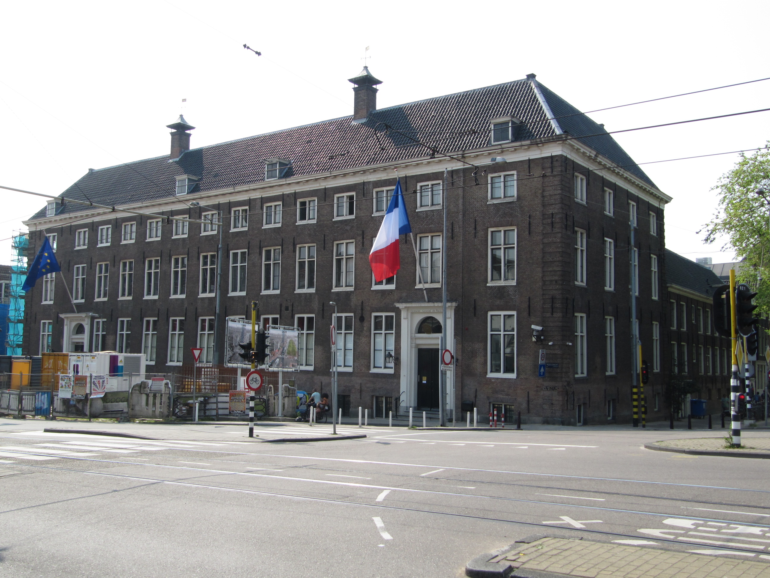
At Vijzelgracht 2a stands the 17th-century Walloon orphanage, designed by Adriaan Dortsman, the architect of so many of Amsterdam's sober classical-style canal houses. The orphanage opened in 1683 and remained an orphanage until 1967, taking in children of the French-speaking Protestant community that had fled to Amsterdam from southern Belgium and northern France. Since 1971, the building has housed the Maison Descartes - the French cultural institute named for the philosopher who lived and died in Amsterdam - and the Consulate of France. The orphans are gone, but a French diplomatic flag flies from a window that has looked out over the same canal-bridge-now-street for more than three centuries. The bridge in front of the orphanage, once part of a series of crossings over the canal, disappeared with the filling-in. Bridge 86, at the Lijnbaansgracht crossing, and bridge 70 over the Prinsengracht, are the only two of the original Vijzelgracht bridges still standing.
Living on Top of a Tunnel
Tram lines have run along this route since 1883, when the first horse trams clattered down the Vijzelstraat and Vijzelgracht. The electric tram arrived in 1904. Line 4 ran this corridor until 1948, when it was shifted to the Utrechtsestraat. Line 16 joined in 1913; lines 24 and 25 followed in 1929 and 1930. After tram 25 was lifted in 2013 and tram 16 in 2018, only tram 24 still runs the route, slipping past the sunken weaver houses on its way south. Below the street, the Noord-Zuidlijn trains pulse north and south at three-minute intervals. The 17th-century houses above the tunnel, some of them braced and stitched together with reinforcement, are still occupied. Some have shops on the ground floor. The residents who were evacuated in 2008 came back. The neighborhood is quieter than its near-disaster suggested - a street, a tram, a metro tunnel, and a long row of houses built to keep orphans fed.
From the Air
The Vijzelgracht sits at 52.361 N, 4.891 E, in central Amsterdam between the Prinsengracht in the north and the Singelgracht in the south, parallel to and just east of the Reguliersgracht. From the air it appears as a wide tree-lined street rather than a canal, running roughly north-south. The Vijzelgracht metro station, on the Noord-Zuidlijn, opened in 2018; the Vingboons-designed weaver houses run along the eastern side. Nearest airport is Amsterdam Schiphol (EHAM), 13 km southwest; the area lies under the Buitenveldertbaan approach corridor at 2,000-3,000 feet on calm days.