Wadi Hayl
Before the road was built, it took three hours by donkey to travel from the village of Hayl to the coast at Fujairah. The wadi -- a seasonal watercourse carved through the Hajar Mountains -- was the path. Water flowed through it when the rains came, and people traveled along it when the water didn't. The journey traced the same route that inhabitants had walked for thousands of years, past stones marked with Iron Age petroglyphs and an Umm Al Nar tomb dating back to the third millennium BCE.
A River That Comes and Goes
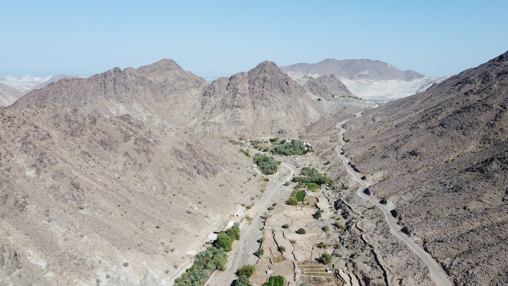
Wadi Hayl runs from the Fujairah industrial suburb of Al Hayl westward into the mountains, eventually meeting Wadi Helo and Wadi Al Saifiyah. From there, the watercourse connects to Wadi Saham -- notable for its extensive petroglyphs -- and Wadi Miduk. Above the village of Hayl, a dam impounds the seasonal flow, creating a reservoir. The dam and the road changed the wadi's relationship to the people who live along it. What was once a lifeline and a highway became something more like a park, its ancient function absorbed by infrastructure.
The Tobacco Village
Hayl was traditionally a Kunud village, its economy built on agriculture sustained by mountain springs channeled through a falaj irrigation system. The principal crop was tobacco, which provided a lucrative income for villagers. The nearby Sharjah village of Al Helo shared this agricultural character. When the old village of Hayl was deemed uninhabitable, the government built a new village to rehouse the residents -- a common pattern across the UAE, where modernization often meant relocating entire communities from ancient settlements to planned developments. The old village has since been restored as a heritage site.
The Sheikh's Fort
In 1932, Sheikh Abdullah bin Hamdan Al Sharqi built a fort at Hayl, along with a majlis -- a gathering hall -- and a mosque. The fort is often described as a summer house, but this is incorrect. It was Sheikh Abdullah's principal residence for more than two decades. The distinction matters: this was not a retreat from the coast but a deliberate choice to live in the mountains, among the wadi's agricultural lands and the communities that worked them. The fort and its watchtower look northwest up the wadi, commanding views of the approach from the mountains.
Stones That Remember
The petroglyphs scattered throughout Wadi Hayl are among its most remarkable features. Iron Age carvings dot stones along the watercourse, placed by people who lived here long before the forts, the falaj systems, or the tobacco crops. An Umm Al Nar tomb found at Hayl dates to the third millennium BCE, connecting this remote mountain wadi to the broader Bronze Age civilization that flourished along the coasts and in the wadis of the Arabian Peninsula. The Wadi Hayl petroglyphs have been studied since at least 1998, though concerns have been raised about development threatening the rock drawings. Today, the Mohammed bin Zayed City development at the Fujairah end of the wadi represents the latest chapter in the ongoing negotiation between preservation and progress.
From the Air
Located at 25.09N, 56.27E in the Hajar Mountains of Fujairah, UAE. The wadi is visible as a valley cutting westward from the Fujairah coastal plain into the mountains. Hayl Fort and the dam are visible from lower altitudes. Nearest airport is Fujairah International (OMFJ). Terrain rises steeply to the west.