Waiheke Island
Seventeen thousand years ago, you could have walked here. During the Last Glacial Maximum, sea levels dropped more than 100 metres, and what is now the Hauraki Gulf was a vast coastal plain. Waiheke was a hill on the mainland. Then the ice melted, the ocean rose, and roughly 7,000 years ago the hill became an island. Today Motu-Wai-Heke, the "island of trickling waters," sits 21.5 kilometres from Auckland's central ferry terminal, close enough for a daily commute and far enough to feel like an escape. Lonely Planet ranked it the fifth-best region in the world to visit in 2016, but Aucklanders had known the secret for over a century before that.
Canoes, Muskets, and Steamers
Maori settled the Hauraki Gulf islands during the archaic period, arriving on migratory canoes including Aotea, Takitimu, and Mataatua. Only the largest islands sustained permanent communities, and Waiheke was one of them. Ngati Paoa held mana whenua, but the island saw repeated conflict with Ngapuhi from the Bay of Islands throughout the eighteenth century. During the Musket Wars, Ngati Paoa and other Tamaki Maori were driven from their lands and sought refuge in the Waikato. When they returned to Tamaki Makaurau, they resettled primarily on Waiheke. In the 1790s, European sealing and whaling ships used the island for repairs. By the 1880s, shipping companies were offering occasional passenger trips, and Waiheke began its transformation into a seaside resort. Steamers ran day excursions from Auckland, and boarding houses sprang up along the southeastern bays.
Ninety-Two Square Kilometres of Edge
Waiheke stretches 19.3 kilometres from west to east, with a surface area of 92 square kilometres and a coastline of 133.5 kilometres that includes 40 kilometres of beaches. Much of the eastern half is the remains of a Miocene volcano that erupted roughly 15 million years ago. Geologists come for an argillite outcrop in Omiha and a folded chert stack at Pohutukawa Point, described as one of the best exposures of its kind in Auckland. The island's subtropical climate brings warm, humid summers and mild winters where frost is rare. Locals claim Waiheke receives over 100 hours more sunshine per year than the Auckland isthmus, and NIWA data appears to support the boast. Most residents rely on rainwater harvested from rooftops, and during dry spells between December and March, water-delivery trucks make the rounds, refilling tanks that have run dry.
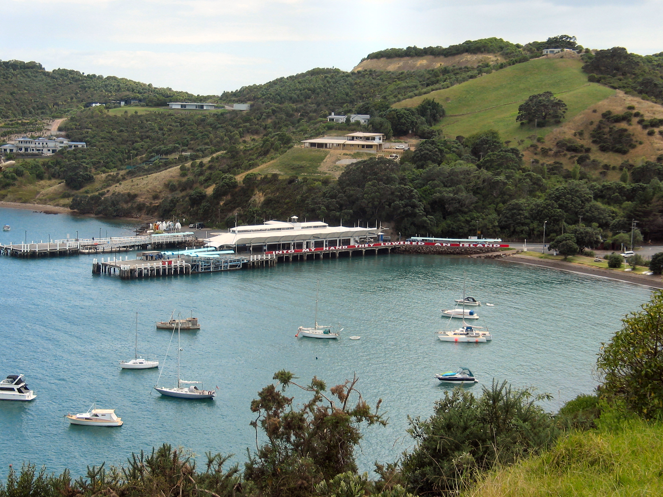
Onetangi and the Weeping Sands
The beaches define Waiheke's character. Oneroa is the main beach, backed by the island's commercial centre. Palm Beach takes its name from mature phoenix palms at its eastern end. Onetangi, at 1.87 kilometres, is the longest, its Maori name meaning "weeping sands." That poetic name carries weight: Onetangi was the site of a battle between Ngapuhi raiders from Te Tai Tokerau and Ngati Paoa defenders, during which many villagers died on the beach. Today the same shore hosts annual horse races and sandcastle-building competitions. Cactus Bay, considered by many islanders the most perfect beach, is accessible only by boat or kayak after a private landowner blocked the overland path. Each beach has its own personality, from Blackpool's south-facing kayaking waters to Surfdale's kitesurfing winds.
Kiwi on the Island
Native birds on Waiheke include kereru, tui, piwakawaka, and pukeko, alongside coastal species like variable oystercatchers, New Zealand dotterels, and little penguins. In a milestone for conservation, ten North Island brown kiwi were released on Waiheke in May 2025, and in October 2025 the first kiwi chick hatched on the island, captured on video via a transmitter linked to an incubating male. The reintroduction was made possible by years of predator control across the island. Waiheke's community board declared the island a genetic engineering free zone in 1999, a symbolic gesture with no legal force but one that reflected the island's environmentally conscious identity. That same instinct now drives habitat restoration and pest eradication programs aimed at making Waiheke safe for species that once thrived here.
The Housing Paradox
Waiheke is the most densely populated island in the Hauraki Gulf and the third most populous in New Zealand. Most residents cluster near the western end, around the isthmus between Huruhi Bay and Oneroa Bay, which narrows to just 600 metres. During summer, the population swells as holidaymakers fill every bach and rental. But the tourism that sustains the island's economy has created an acute housing crisis. Over a third of the island's houses sit empty much of the year, consented as short-term visitor accommodation rather than long-term rentals. More than 250 properties operate as visitor accommodation units. Despite having one of Auckland's lowest overall populations, Waiheke has its fourth-highest rate of homelessness per capita. The island that everyone wants to visit has become, for some of the people who live there, a place that is increasingly difficult to afford.
From the Air
Located at 36.80°S, 175.10°E in the Hauraki Gulf, 21.5 km east of Auckland CBD. The island is 19.3 km long and clearly visible from altitude as the largest landmass in the inner gulf. Nearby airports: Auckland International (NZAA) 30 km southwest, Ardmore (NZAR) 25 km south. Waiheke has a small grass airstrip at Stoney Batter on the eastern end. Recommended viewing altitude: 2,000-4,000 ft for the full island outline and its relationship to Auckland, the Coromandel Peninsula to the east, and Rangitoto Island to the northwest.