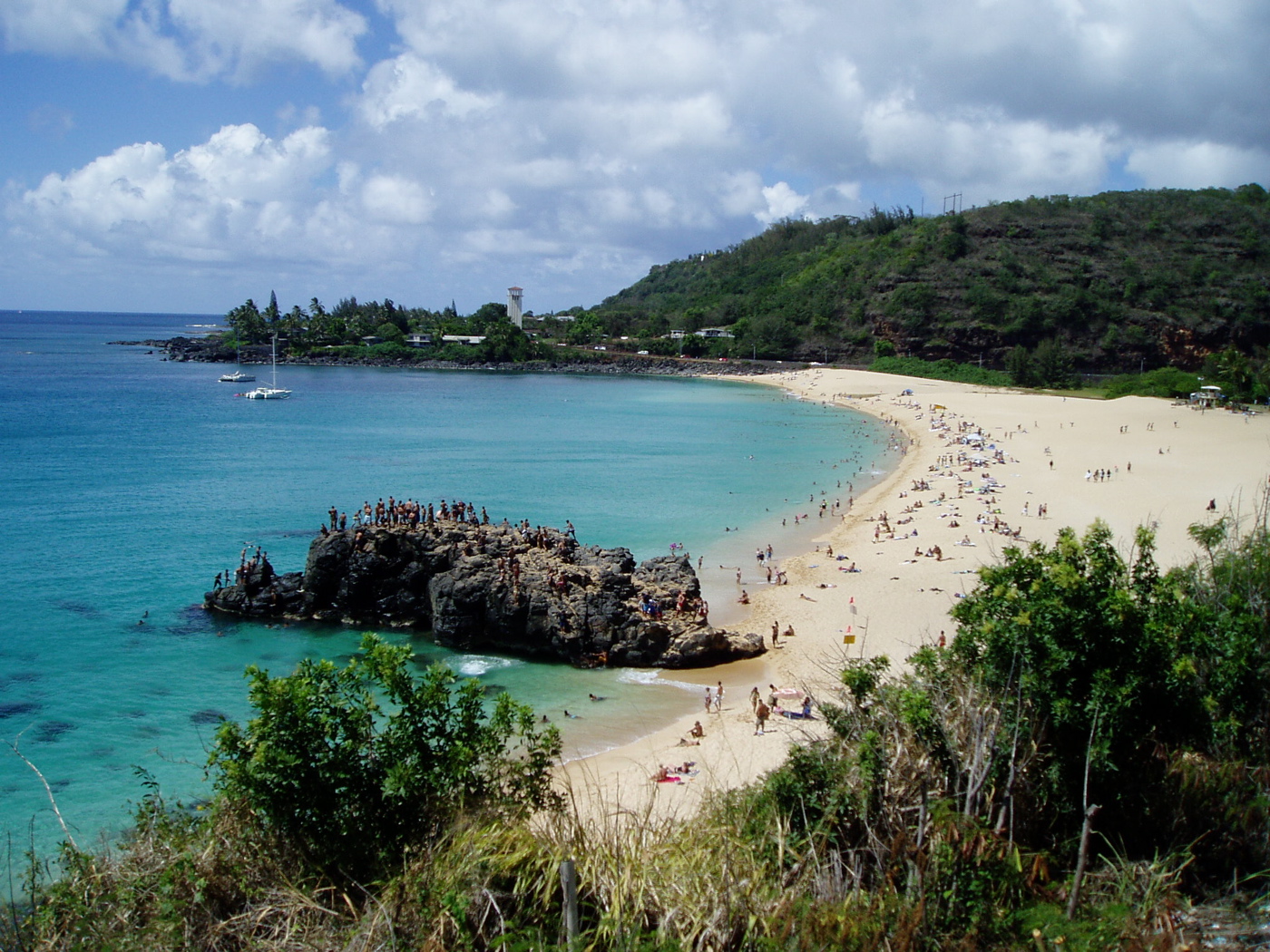
Waimea Bay
For years, everyone knew the waves at Waimea were enormous. Nobody rode them. The massive winter swells that rolled in from North Pacific storms broke with such violence against the bay's northern point that the surf community treated Waimea as a spectacle, not a destination. Then on November 7, 1957, a handful of surfers finally paddled out and dropped into the giant faces. Big wave surfing, as a discipline and an obsession, was born in this crescent-shaped bay whose Hawaiian name -- Waimea, meaning "reddish water" -- speaks not of surf but of the river that stains the sea where it meets the shore.
Before the Surfers
Waimea Valley was densely populated when Europeans first arrived. On February 27, 1779, Captain Charles Clerke -- second in command during James Cook's third Pacific voyage -- anchored briefly in the bay. Clerke had assumed command of the expedition just two weeks earlier, after Cook was killed at Kealakekua Bay on the Big Island. Waimea Bay was the only Oahu anchorage the expedition visited. Above the bay, on a ridge overlooking both the ocean and the valley, stands Pu'u o Mahuka, the largest heiau on Oahu, a temple complex where Hawaiian priests once conducted ceremonies and, according to archaeological evidence, likely offered human sacrifices. The bay's history stretches back centuries before any European sail appeared on the horizon.
The Break That Changed Everything
In summer, Waimea is deceptively gentle -- clear water, a calm crescent of sand. Winter transforms it. Storms forming thousands of miles away in the North Pacific send swells that travel for days before detonating against the North Shore. Waimea, along with neighboring Pipeline and Sunset Beach, became the proving ground for a generation of surfers in the late 1950s and 1960s. For decades, Waimea was the most prestigious big wave break in the world, the place where reputations were made or destroyed in a single drop. The advent of tow-in surfing eventually opened up breaks that were bigger and more technically demanding, but Waimea never lost its stature. It remains the spiritual home of the sport's most consequential leap forward.
Waiting for Eddie
The Eddie Aikau Big Wave Invitational (formerly the Quiksilver Big Wave Invitational, now sponsored by Rip Curl) honors the legendary waterman who served as the first lifeguard on Oahu's North Shore. Since its inception in 1984, the contest has only been held eleven times -- the precondition requires open-ocean swells to reach a minimum height of 20 feet before competition can begin. Swells that size translate to wave faces in the bay of 30 to 40 feet. The most recent running was in December 2024. When the contest does not run, it simply waits. On January 28, 1998, Hawaii issued its first-ever "condition black," legally closing all North Shore beaches, including Waimea Bay. Even the Eddie was cancelled that day -- the surf was too large for anyone's definition of safe.
Reddish Water, Silver Screen
Waimea's fame spread far beyond the surfing world. The Beach Boys name-checked it in their 1963 hit "Surfin' U.S.A.," and the 1964 film Ride the Wild Surf, accompanied by Jan and Dean's title song that became a Top 20 hit, introduced the bay to mainland audiences who would never come close to paddling out. Jimmy Buffett mentioned it in his 2009 song "Beautiful Swimmers." The bay has often been confused with the primary filming location for the television series Lost, though most of that show was actually filmed at Kawailoa Beach, about half a mile up the coast. Meanwhile, the Waimea Bay shoreline itself has been experiencing erosion from both natural forces and human activity -- a reminder that even the most storied landscapes are not permanent, and that the reddish water the Hawaiians named keeps carrying the land away, grain by grain.
From the Air
Located at 21.640N, 158.064W on Oahu's North Shore, along Kamehameha Highway. The crescent bay is unmistakable from the air, flanked by rocky points with the Waimea River mouth at the eastern end and Waimea Valley extending inland. In winter, massive surf breaking across the bay is visible from considerable altitude. Nearest airport: Dillingham Airfield (PHDH), approximately 10 nm west. Honolulu International (PHNL) is roughly 28 nm south-southeast. The prominent ridgeline of Pu'u o Mahuka heiau above the bay and the Waianae Range provide orientation.