Waipoua Forest
On 25 September 1947, the Member of Parliament for Marsden, AJ Murdoch, wheeled thirteen volumes of signatures into New Zealand's parliament in a wheelbarrow. The 43,000 names demanded that the Waipoua State Forest be declared a national park and that all milling cease immediately. Five years later, on 2 July 1952, over 80 square kilometres of forest was proclaimed a sanctuary. Inside that sanctuary stand trees that were already ancient when the Treaty of Waitangi was signed, already old when the first Maori migration canoes arrived from Hawaiki. Tane Mahuta, Lord of the Forest, and Te Matua Ngahere, Father of the Forest, are the two largest living kauri trees in New Zealand, and together they anchor a remnant of primeval forest on the west coast of Northland that draws 200,000 visitors a year.
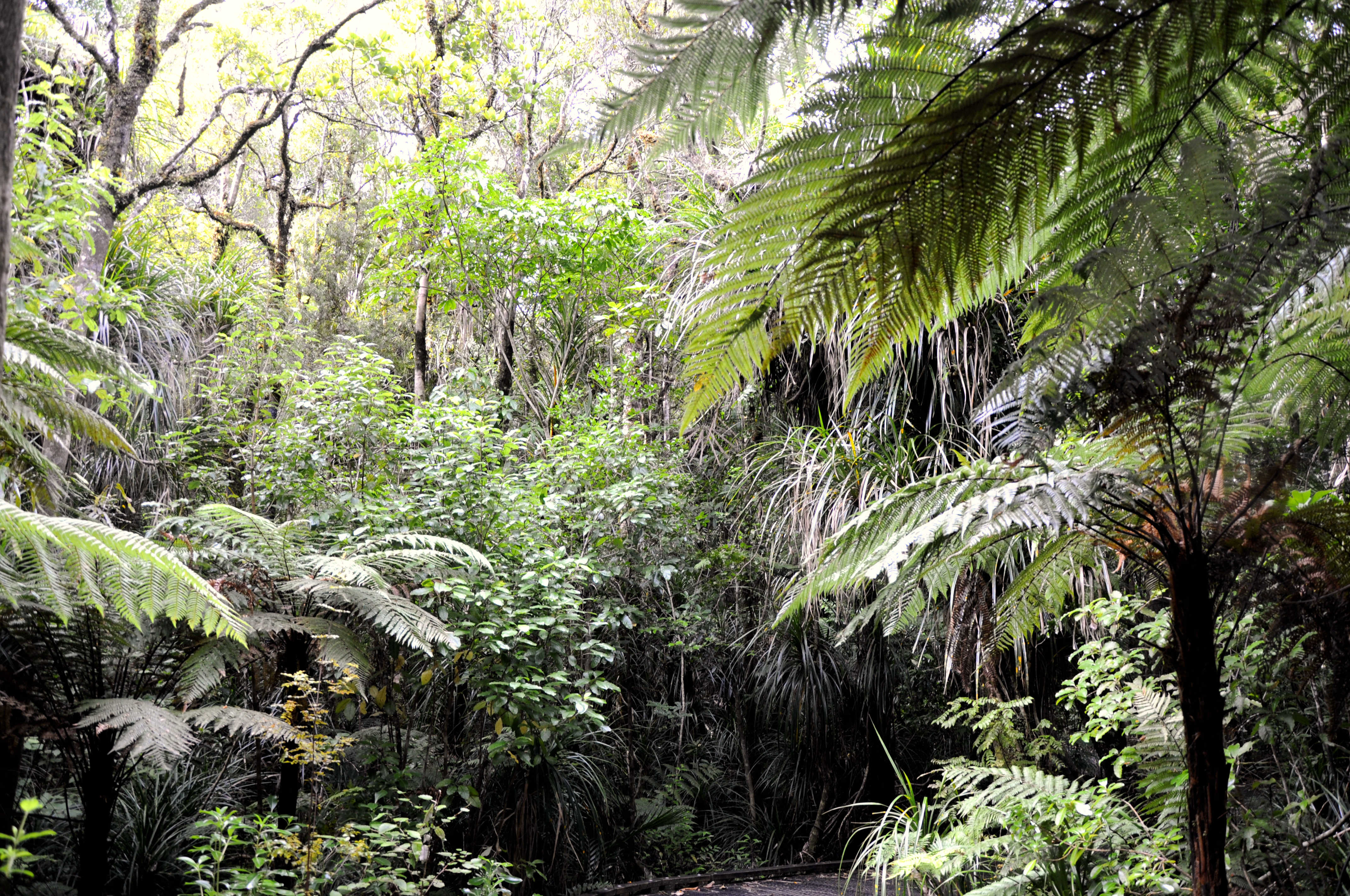
Last Giants Standing
The Waipoua, Warawara, and Puketi forests together hold about three quarters of New Zealand's remaining mature kauri trees, and Waipoua contains the largest single stand. These are not ordinary trees. Kauri grow slowly and massively, their trunks pushing skyward in smooth grey columns that shed bark and branches to discourage climbing plants. Tane Mahuta, named after the Maori god of the forest, stands with a presence that silences most visitors on first encounter. Te Matua Ngahere, shorter but broader, has a trunk circumference so large that photographs require a person standing beside it for scale. The forest canopy they support creates a world underneath: dense understory, ferns climbing over deadfall, North Island brown kiwi foraging at night in the largest Northland population of the species. Endangered North Island kokako can be found in the high plateau country above.
Saved by Remoteness and Rain
The Waipoua Forest was purchased from Maori, specifically Tiopira Kinaka of Te Roroa and Parore Te Awha of Te Kuihi, as part of the Waipoua Block No. 1 in 1876 for a little over two thousand pounds. By 1907, Waipoua and Warawara were the only virgin kauri forests still belonging to the state. What saved them was geography. The forest's remoteness made timber extraction impractical, and unlike the Kaihu, Puhipuhi, and Coromandel forests that burned in the 1870s and 1880s, Waipoua's more consistent rainfall kept fire at bay. In 1885, the area came under the State Forests Act as a reserve. A Royal Commission on Forestry recommended preservation in 1913, but the real threat came in the 1940s when the State Forest Service quietly began logging kauri at Waipoua, triggering the public outcry that culminated in the wheelbarrow petition.
The Road Through the Forest
In July 1926, the government announced a road would be cut through Waipoua Forest to give neighbouring settlers access to their land. Work began that same month with 15 men. On 13 January 1928, Prime Minister Joseph Gordon Coates opened the road, and more than 100 vehicles reportedly drove from Dargaville for the ceremony. The road brought visitors face to face with the kauri for the first time, and that visibility proved a double-edged sword. While it exposed the forest to the risk of disturbance, it also created the constituency that would fight to save it. When the government tried to log the forest in the 1940s, people who had driven through Waipoua and stood beneath Tane Mahuta knew exactly what was at stake. The zoologist William Roy McGregor channelled that awareness into an 80-page illustrated pamphlet that became an effective manifesto for conservation.
A Disease Without a Cure
The fungus Phytophthora taxon Agathis is killing kauri trees, and there is no known cure. Kauri dieback, as the disease is called, spreads through soil movement, which means a single contaminated boot can carry it from tree to tree. The Waipoua Forest Trust, a joint partnership between the Native Forests Restoration Trust and Te Roroa, the Maori guardians of Waipoua, has called for urgent government action. The irony is painful: the 200,000 annual visitors who come to admire the trees may be spreading the pathogen that destroys them. Boot-cleaning stations have been installed at trailheads, and boardwalks keep feet off the root zones, but the disease continues to advance. A 2007 forest fire, started by someone cooking mussels on a nearby beach, burned through adjoining pine plantation and ecologically significant wetland, killing an estimated 20 North Island brown kiwi and coming within three kilometres of Tane Mahuta.
Guardians Old and New
Te Roroa have been the kaitiaki, guardians, of Waipoua for centuries, and the modern conservation effort honours that relationship. The Waipoua Forest Trust was established in 1999 as a partnership between Te Roroa and the Native Forests Restoration Trust. In 2000, the government launched the Millennium Kauri Forest to the south of Waipoua with a $1.4 million lottery grant and land title gifted to the trust. By 2007, the trust had invested more than four million New Zealand dollars in land protection and restoration. Volunteers weed, collect flax seed, and eradicate pests like rats and possums. In 2009, the trust's chairman Alex Nathan met with counterparts from the Yakushima community in Japan, which faces similar challenges protecting its ancient cedar trees. The two groups launched the Family of Ancient Trees project, linking kauri and cedar conservation across the Pacific. Ancient trees, it turns out, inspire the same devotion regardless of hemisphere.
From the Air
Waipoua Forest is located at approximately 35.615S, 173.558E on the west coast of New Zealand's Northland Region. The forest covers over 80 square kilometres of dense native bush, appearing as a dark green block distinct from surrounding farmland and pine plantation. State Highway 12 runs through the eastern edge of the forest. Tane Mahuta is near the highway on the eastern side. Nearest airport is Dargaville Aerodrome (NZDA), approximately 40 km to the south. The Hokianga Harbour is visible to the north, and the Tasman Sea coast lies to the west. Best viewed at 2,000-4,000 feet AGL. The contrast between the ancient kauri canopy and surrounding cleared farmland is particularly dramatic from altitude.