Waldo Canyon Fire
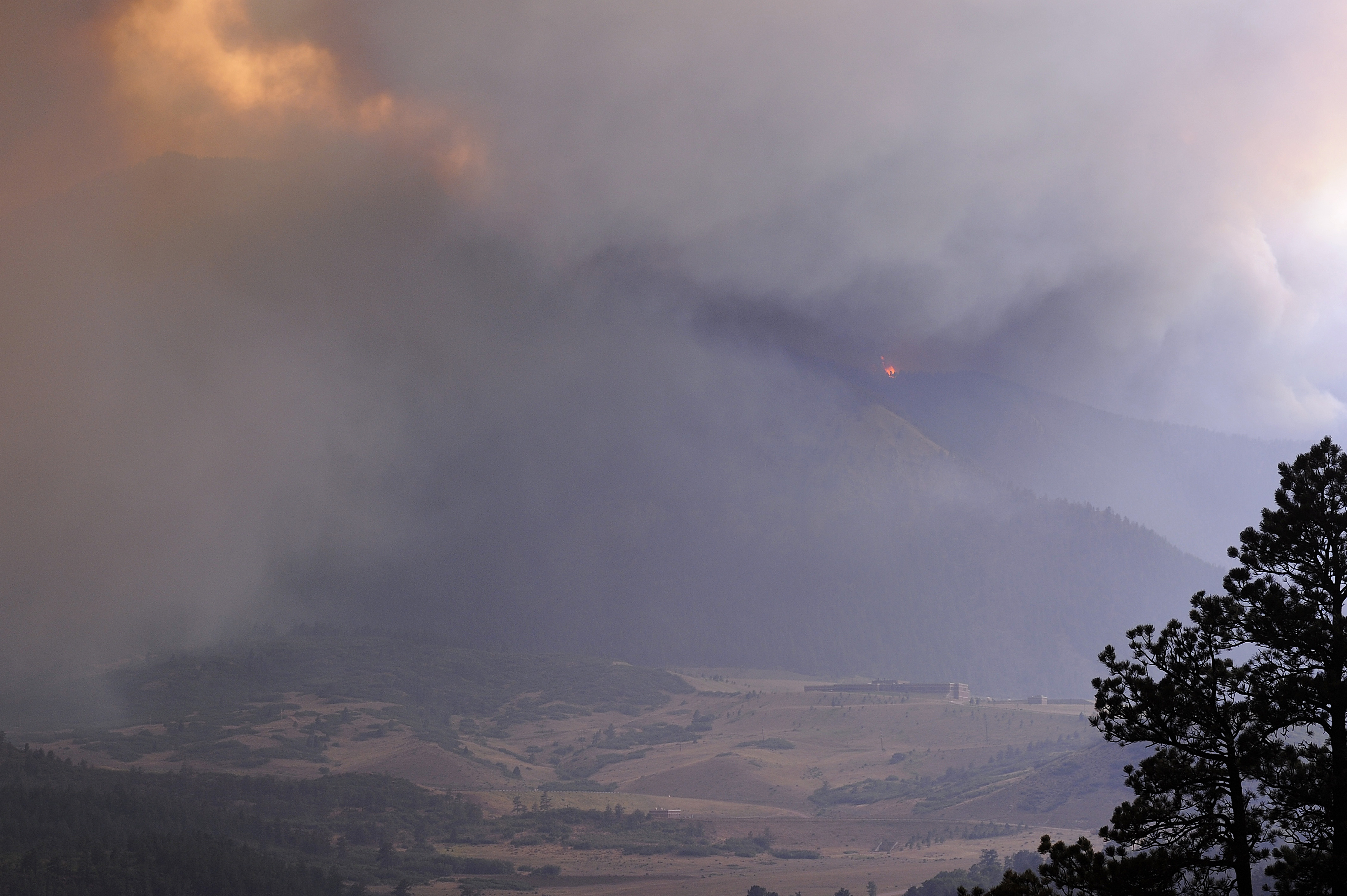
The smoke appeared on June 23, 2012, rising from a valley near the Waldo Canyon Trailhead just off Highway 24, about three miles west of Colorado Springs. For three days, firefighters worked to contain what seemed like a manageable blaze in the Pike National Forest. Then June 26 arrived. Colorado Springs had already set nine consecutive daily high-temperature records that month, peaking at 101 degrees Fahrenheit on the 26th - an all-time record for the city. Whipped by erratic winds and fueled by bone-dry vegetation, the fire exploded out of its containment lines, roared through Queens Canyon, and slammed into the Mountain Shadows neighborhood on the western edge of the city. By nightfall, 347 homes were destroyed, two residents were dead, and 32,000 people had been forced to evacuate. The Waldo Canyon Fire had become the most destructive wildfire in Colorado history - a record that would hold for barely a year before the nearby Black Forest Fire surpassed it.
The Day the Fire Ran
The El Paso County Sheriff's office first received reports of smoke near the Waldo Canyon Trailhead on June 22, 2012. Bulldozers dug fire breaks the next day to protect nearby neighborhoods, and voluntary evacuation notices quickly became mandatory orders. By the morning of June 24, the fire was a quarter mile from structures in the Cedar Heights community, where firefighters concentrated their resources. But the fire had other plans. On June 26, it shifted direction and charged into Mountain Shadows, a subdivision that had received little defensive preparation. Investigators later determined that local fire crews had concentrated on what they believed was the most likely path - south into Cedar Heights - leaving Mountain Shadows exposed. The city had also failed to issue evacuations when the fire entered Queens Canyon, a previously agreed-upon trigger point. By June 27, the fire had burned 15,517 acres and was only 5 percent contained. It would not reach full containment until July 10, by which time 18,247 acres had burned.
What the Fire Left Behind
The destruction was staggering in its specificity. Of the 347 homes reduced to ash, most were concentrated in the Mountain Shadows neighborhood. But the damage extended far beyond the structures that burned. Over 450 houses that survived the flames showed hidden damage from exposure to temperatures reaching 2,000 degrees Fahrenheit - warped foundations, corroded systems, and ash infiltration that would take months to discover. Insurance losses totaled 53.7 million. Tourism businesses lost up to 50 percent of their revenue for 2012. The historic Flying W Ranch, a beloved Colorado Springs attraction, burned to the ground. Nearly 50 families formed the Waldo Canyon Fire Victims Association after their insurance companies refused to pay full claims until homes were rebuilt - a deadline of just one year after the fire. The Waldo Canyon Fire Assistance Fund distributed 40,299 to twenty local nonprofits, seeded by a 25,000 grant from the El Pomar Foundation.
Rising from the Burn Scar
The rebuilding was slow but remarkably thorough. By June 2014, almost 250 replacement houses had been built. In Mountain Shadows, 77 percent of the destroyed homes were rebuilt - on average 13.8 percent larger than the originals, an irony not lost on fire scientists who noted that bigger houses simply create more fuel. Many returning residents implemented fire mitigation plans, clearing vegetation and choosing fire-resistant materials. Those who chose not to rebuild put their lots up for sale. The U.S. Forest Service gradually reopened the burned forest land, with Rampart Reservoir and neighboring campgrounds accessible again by May 2013. Wildlife recovered with surprising speed. Bighorn sheep that had fled the flames returned within days. Aspens began sprouting in the burn scar within a month. The Colorado Springs Pioneers Museum opened an exhibit called From the Ashes: The Waldo Canyon Fire in June 2013, collecting artifacts and residents' stories to document the event's historical significance.
Lessons Written in Ash
The Waldo Canyon Fire forced Colorado to confront an uncomfortable truth about its growth patterns. A 2013 study by the state Forest Service and Colorado State University found that 20 percent of Colorado's population and 25 percent of its homes sat in a "red zone" - areas with high wildfire likelihood. El Paso County ranked among the top three counties for fire danger, with 45 percent of its residents in the red zone. Colorado had seen a 300 percent increase in wildfires between 2003 and 2013. The National Institute of Standards and Technology launched a two-year study of the burn site, and multiple after-action reports exposed failures in communication, evacuation planning, and resource allocation. A Fire Adapted Communities Coalition report highlighted the success of neighborhoods that had participated in a decade-long fire mitigation program. The fire's legacy is visible from the air today: new rooftops where old ones burned, defensible space cleared around homes, and a landscape still bearing the marks of the day the hills caught fire.
From the Air
Located at 38.89N, 104.87W on the western edge of Colorado Springs. The burn scar from the 2012 fire is still visible from altitude as a lighter-colored area on the hillsides northwest of the city, particularly in the Mountain Shadows and Waldo Canyon areas. Rampart Reservoir is visible to the northwest. The U.S. Air Force Academy lies just to the north. Colorado Springs Airport (KCOS) is approximately 12 miles to the southeast. Garden of the Gods park is visible at the base of the Front Range nearby. Pikes Peak (14,115 ft) rises to the west.