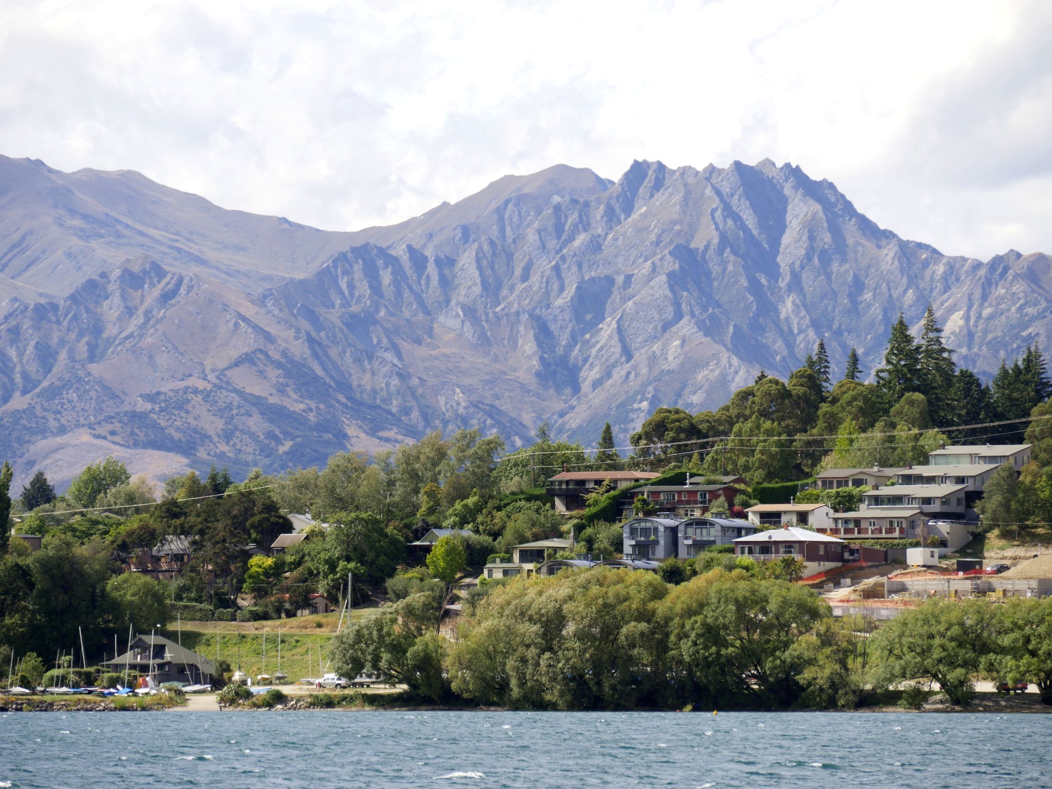
Wanaka
Say it wrong and they'll know you're not from here. Wanaka rhymes with "won a car," not "tanker," and the distinction matters to locals who have watched their town balance on the knife edge between discovery and overrun for decades. Sitting on the southern shore of its namesake lake - New Zealand's fourth largest - Wanaka has the same mountains, the same crystal water, the same adrenaline-grade outdoor access as Queenstown, just an hour's drive south. What it doesn't have is Queenstown's crowds, Queenstown's bar scene, or Queenstown's willingness to turn every natural feature into a commercial experience. Wanaka is the place Kiwis go when they want the scenery without the circus.
The Ski Town That Summer Forgot
Winter defines Wanaka's identity. Four ski resorts cluster within striking distance: Cardrona and Treble Cone draw the serious skiers, while Snow Park and Snow Farm cater to freestyle riders and cross-country purists. The town fills with seasonal workers, instructors, and athletes who train here year after year. Half of New Zealand's Olympic skiers and snowboarders call Wanaka home, a statistic that makes sense once you see the terrain - steep, varied, and close enough to town that you can be on a chairlift within thirty minutes of finishing breakfast. The ski town vibe persists even through the shoulder seasons, when the lifts stop turning but the mountain bikes come out, the rock climbers head for the crags, and the hiking tracks through Mount Aspiring National Park open for business. Wanaka doesn't do idle well. Even its rest days involve a walk.
A Lake of Islands and Depths
Lake Wanaka plunges more than 300 meters at its deepest point, a fact that means nothing from shore and everything from a kayak, where the water below shifts from turquoise to ink-black in the space of a paddle stroke. The lake stretches 45 kilometers into the mountains, dotted with islands that serve as wildlife sanctuaries. Mou Waho, the largest, holds its own small lake at its summit - a lake on an island in a lake, a geographic nesting doll that delights visitors who make the guided boat trip out. Stevenson's Island shelters rare native birds. The water is warmer than Queenstown's Lake Wakatipu, warm enough for swimming at the town beaches in high summer, which makes it a magnet for boaters, windsurfers, and families who arrive in December and don't leave until March. Many houses in town sit empty most of the year - baches, the Kiwi holiday homes that multiply wherever a lake meets a mountain.
The Gateway at the End of the Road
Mount Aspiring National Park begins where Wanaka's paved roads end, and the visitor centre sits right in town - a practical arrangement that positions this small settlement as the launch point for some of New Zealand's most dramatic backcountry. The Rob Roy Glacier track, probably the most popular day hike in the park, delivers hikers to the base of a hanging glacier within a few hours. Gillespie Pass, French Ridge, and Cascade Saddle offer multi-day routes for those willing to carry their shelter. Diamond Lake provides a shorter circuit with panoramic rewards. And then there's Mount Roy, whose summit track has become an Instagram pilgrimage - a steep, relentless climb rewarded with a view that makes the suffering feel like a fair exchange. Wanaka's relationship with the national park is symbiotic: the park provides the wilderness, the town provides the beds and the pies.
Crown Range and the Road Between Worlds
Two roads connect Wanaka to Queenstown, and they could not be more different. State Highway 6 takes the long way around, looping through Cromwell and along the Kawarau Gorge in a comfortable 112 kilometers. The Crown Range Road cuts straight over the mountains in 70 kilometers, climbing to the highest sealed road in New Zealand, where the switchbacks tighten and the views open until the entire Wakatipu Basin unfolds below. In winter, the Crown Range can close without warning when snow hits. In autumn, the drive through the Cardrona Valley below is lined with willows turning gold. Either route makes the journey part of the destination, passing Lake Hayes - one of the most photographed lakes in Otago - and the historic settlements that dot the basin. Wanaka sits at one end, Queenstown at the other, and the road between them is the argument for why you should visit both.
From the Air
Located at 44.70°S, 169.14°E on the southern shore of Lake Wanaka. Wanaka Airport (NZWF) lies 10 km southeast of town with a sealed runway suitable for light aircraft and charter flights. Queenstown Airport (NZQN) is the nearest major international terminal, approximately 70 km via Crown Range or 112 km via SH6. From altitude, Lake Wanaka is the dominant visual feature - a long, narrow lake stretching northwest into Mount Aspiring National Park. Lake Hawea is visible to the northeast, separated from Wanaka by a narrow isthmus called The Neck. The Crown Range is clearly visible as the high ridge separating the Wanaka and Wakatipu basins. Elevation approximately 280 m at the lakeshore. Weather can change rapidly with nor'west conditions bringing cloud and wind from the Tasman Sea.