Wangapeka Track
Cecil King was a sailor who gave up the sea for gold. During the Depression, he built a small hut in the Wangapeka Valley and spent his days prospecting the river gravel, alone in a forest that receives enough rain each year to fill a two-story building. His hut still stands, a five-minute detour off the track that now bears the valley's name. It is one of those places where the walls have absorbed so much damp and solitude that stepping inside feels like entering someone else's memory. The Wangapeka Track crosses Kahurangi National Park in New Zealand's northwest South Island, connecting the Nelson Bays region to the West Coast over four to six days of hard walking. The Department of Conservation classifies most of it not as a track but as a route, a distinction that matters: it means mud, unmarked junctions, unbridged rivers, and the expectation that anyone who enters can find their way back out.
Surveyor's Gamble
Before this was a tramper's challenge, it was a surveyor's obsession. Jonathan Brough mapped the route and led the construction gang that benched the early sections into the valley walls. In 1898, he built a framed slab hut at a bend in the river, a structure his crew called Brough's Tabernacle. A monument near the site still marks his contribution. The benched sections he engineered remain some of the easiest walking on the track, a gift from the nineteenth century that holds up against everything the weather has thrown at it since. Beyond those sections, the track reverts to something closer to what Brough first encountered: steep, rough, and indifferent to the comfort of travelers. The Department of Conservation has downgraded the route over the years, and the extended walking times they publish often prove optimistic.
Between Two Saddles
The Wangapeka crosses two mountain saddles above 1,000 metres, and the character of the walk changes completely at each one. The first saddle tops out at 1,009 metres, where a side track branches north toward Big Top and the views open across the rugged interior of Kahurangi. The real test comes later, at Little Wanganui Saddle, 1,087 metres up and flanked by old and new landslips that have rerouted the path more than once. Fallen trees block the way. In winter, snow buries the saddle entirely. Emergency shelters sit on either side, each with two bunks, a recognition that this is the kind of place where plans go wrong. Between the saddles, the landscape shifts from beech forest to alpine tussock and back again, and the rivers change from crossable to dangerous with a single afternoon of rain.
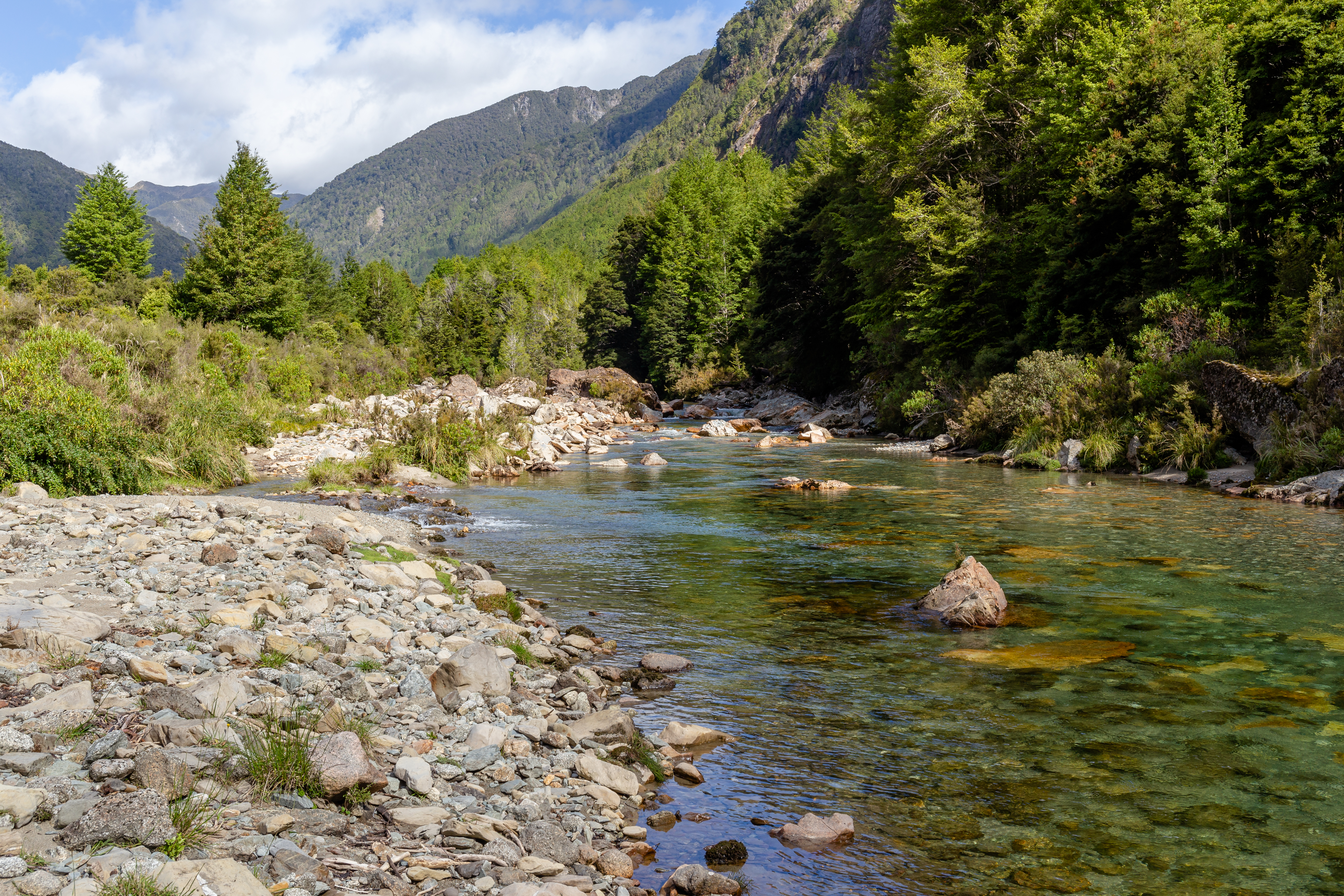
The Rain and the Rivers
Kahurangi National Park receives roughly four metres of rainfall per year, and the Wangapeka Track absorbs every drop. Rivers that seem manageable at breakfast can become impassable by lunch. The Department of Conservation's advice is blunt: if you can hear stones rolling along the riverbed with the current, do not cross. Wait. The rivers fall as fast as they rise, sometimes within hours, sometimes taking a day or two. Patience is not optional here; it is a survival skill. The six standard huts and three shelters along the route operate on a first-come, first-served basis with no booking system, which means that weather delays can leave trampers sleeping on floors or pitching tents in the rain. Cotton clothing is useless in these conditions. Wool and synthetics are the only fabrics that will keep you warm when everything is wet, which is most of the time.
Company You Keep
The Wangapeka is not a social trail. Because the route classification deters casual hikers, the people you meet out here tend to be experienced backcountry travelers who carry personal locator beacons and know how to read a topographic map. Transport to either end of the track requires advance booking with shuttle services, and since so few people walk the route at any given time, those shuttles often need a minimum group size to run. Walking as a group improves your odds of arranging pickup. The old-growth temperate rainforest that lines the lower valleys is dense enough to block GPS signals in places, and the track markers, triangular blazes and rock cairns, can be hard to spot when moss and weather have had their way. Sandflies and midges patrol every river crossing and hut clearing, relentless enough that the Department of Conservation recommends bringing a book for the evenings when the insects drive you indoors.
The Crossing
To walk the Wangapeka is to cross the South Island on foot, from the pastoral edges of the Waimea Basin to the wild coast near Little Wanganui and Karamea. The eastern approach from Tapawera begins gently, following the river through easy valley terrain before the landscape tightens and steepens. The western end deposits you at a parking area 20 kilometres from Karamea, where a small airport serves the isolated community. In between lies some of the most pristine wilderness remaining in New Zealand, country so remote that the Department of Conservation has opted to maintain it lightly rather than tame it. The track's difficulty is, in a sense, its preservation. The same mud, the same unmarked crossings, the same four metres of rain that make it hard also keep it wild. Cecil King's hut still stands because so few people pass by to disturb it.
From the Air
Located at 41.43S, 172.42E in the heart of Kahurangi National Park, northwest South Island, New Zealand. Best viewed from 5,000-8,000 ft to see the track's traverse between two saddles above 1,000m. The dense temperate rainforest canopy is visible as unbroken green stretching across the ranges. Nearby airports include Karamea Aerodrome (NZKM) to the west and Nelson Airport (NZNS) to the east. Weather is frequently overcast with heavy rain; clear days offer views of the Tasman Sea to the west and the ranges of the Richmond Range to the east.