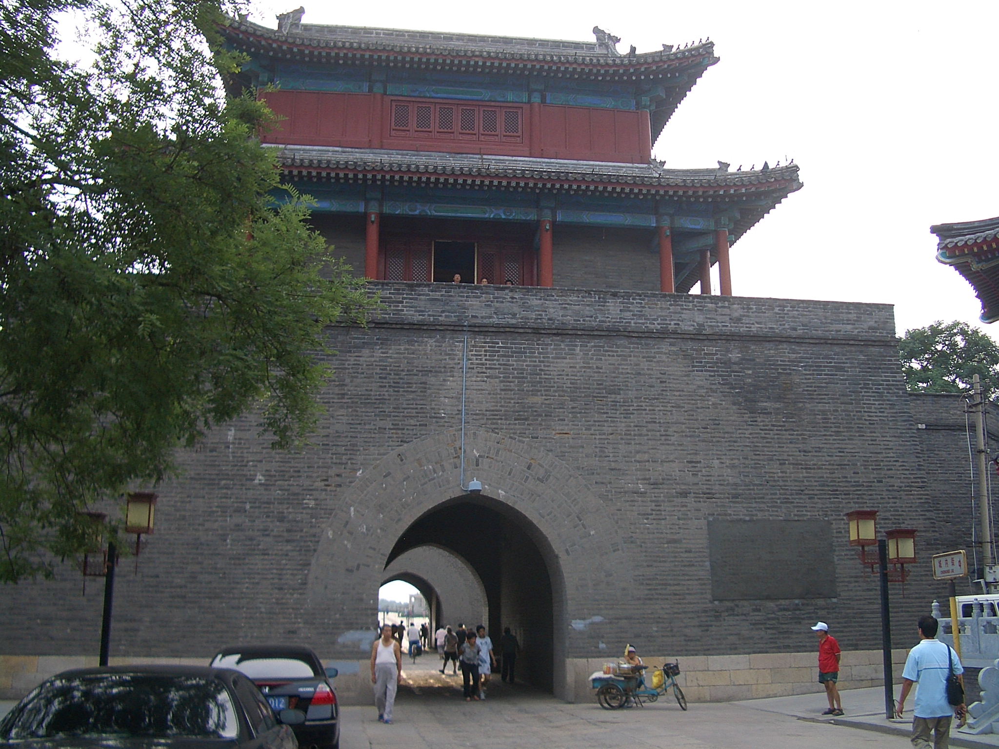
Wanping Fortress
A missing soldier. That was all it took. On a night in July 1937, a Japanese soldier failed to return to his post near the ancient Lugou Bridge, and his unit demanded access to the walled fortress of Wanping to search for him. The Chinese garrison refused. Shots were exchanged. Within weeks, two nations were at full-scale war. The fortress that was built to keep out one kind of invader became the place where another forced his way in.
A Wall Against the Peasant Tide
Wanping Fortress was erected between 1638 and 1640, during the final desperate years of the Ming dynasty. Its purpose was specific: to defend Beijing against Li Zicheng, the rebel leader whose peasant uprising was sweeping across northern China. The fortress measures 640 meters from east to west and 320 meters from north to south, creating a distinctive half-square shape that functioned as a military checkpoint rather than a city. It had two gates -- the east gate, originally named Ever Prosperous Gate before being renamed Majestic Gate, and the west gate, called Favorably Govern Gate. The names carried the confident authority of an empire that, within four years of the fortress's completion, would cease to exist. Li Zicheng took Beijing in 1644, and the Ming dynasty fell.
The Bridge That Started a War
Just west of the fortress walls, the Yongding River flows beneath the Lugou Bridge -- known in the West as the Marco Polo Bridge, after the Venetian explorer who described it in the 13th century. By the 1930s, Japanese troops had been stationed in the area under the terms of the Boxer Protocol. On the night of July 7, 1937, a Japanese soldier went missing during exercises near the bridge. His commanding officers demanded entry to the walled town to search for him. The Chinese garrison commander refused. What followed -- the Marco Polo Bridge Incident -- escalated from a local confrontation into the opening battle of the Second Sino-Japanese War. Japanese artillery shells pocked the fortress walls, and the scars remain visible today, deliberately preserved as historical evidence.
Memory Inside the Walls
The Museum of the War of Chinese People's Resistance Against Japanese Aggression now occupies a large portion of the space inside Wanping's walls. Surrounded by a plaza and park dotted with sculptures, the museum transforms the fortress from a military installation into a memorial landscape. The shell-damaged southern wall stands as both architectural artifact and accusation -- proof that what happened here was not abstract history but physical violence that marked the stone. The fortress's compact dimensions make the museum feel enclosed and deliberate, a curated experience within the same walls that once housed soldiers.
Three Centuries of Watching the River
Wanping has spent nearly four hundred years guarding the same crossing. The Yongding River still flows past its western wall, and the Lugou Bridge still spans it, its stone lions worn smooth by centuries of weather and foot traffic. Beijing Subway Line 16 now stops at Wanpingcheng station, threading modern transit infrastructure through a Ming-era military site. The fortress remains remarkably intact for a structure that has been shelled, occupied, and absorbed into a sprawling modern metropolis. It endures not because it was the grandest fortification of its era -- it was not -- but because what happened within its walls in July 1937 made it impossible to forget.
From the Air
Located at 39.85N, 116.22E in Fengtai District, southwest Beijing. The fortress sits on the east bank of the Yongding River, adjacent to the Lugou Bridge (Marco Polo Bridge). From altitude, the rectangular fortress outline is visible against the surrounding urban area. The Lugou Bridge extends westward across the river. Nearest airports: Beijing Daxing International (ZBAD) approximately 35 km south-southeast, Beijing Capital International (ZBAA) approximately 40 km northeast. Best viewed at 2,000-4,000 ft AGL for fortress detail.