Warangal Fort
Somewhere in the treasure that Malik Kafur loaded onto 2,000 camels and marched north to Delhi in March 1310 was a gemstone described by a court messenger as "unrivaled in the world." Later chroniclers identified it as the Koh-i-Noor diamond. It had been pried from the Deccan -- from this fort, from the Kakatiya kings who had ruled here for over a century, from a civilization that carved stone with the precision of jewelers and defended its walls with a stubbornness that required three separate invasions to overcome. Warangal Fort, visible from the air as three concentric rings on the Telangana plateau, is the ruin of that civilization.
Rings of Stone and Earth
From above, the fort's layout reads like a target: three concentric circles of diminishing diameter, each representing a different layer of defense. The outermost ring is an earthen embankment roughly 1.5 miles across, built during the reign of Queen Rudrama Devi in the late thirteenth century. A moat 150 feet wide once surrounded this wall, forming the first barrier any attacker would face. Inside that lies the stone wall -- about three-quarters of a mile in diameter, constructed from massive dressed granite blocks fitted together without mortar, their irregular shapes locked into place by weight and geometry alone. Rudrama Devi raised this wall to 29 feet, building on foundations laid by her father Ganapatideva. Forty-five rectangular bastions project from the wall face, each measuring roughly 40 feet per side. At the innermost circle stood the royal enclosure and the great Swayambhusiva Temple, where a self-manifested four-faced Shiva linga had been worshipped since the early eleventh century.
Three Sieges and a Diamond
The fort's story is written in sieges. In 1309, Alauddin Khalji sent Malik Kafur south with 100,000 men. For months, Prataparudra II held the stone walls while Kafur's army filled the moat with dirt and swam across the inner defenses. The poet Amir Khusrow, who chronicled the campaign, described the attackers surmounting the outer earthen wall before confronting the stone fortress within. When Prataparudra finally agreed to terms, the price was staggering -- precious stones, gold, and the bounty that required those 2,000 camels. A second siege in 1318, under Khusro Khan, breached the walls using a 450-foot earthen ramp across the moat. The third and final assault came in 1323, when Ulugh Khan returned with 63,000 cavalry. After five months of brutal fighting, with the Kakatiya forces reduced to a fraction of the invaders' numbers, Prataparudra surrendered. He was marched toward Delhi but never arrived -- tradition holds he died by his own hand on the banks of the Narmada River.
Destruction and Defiance
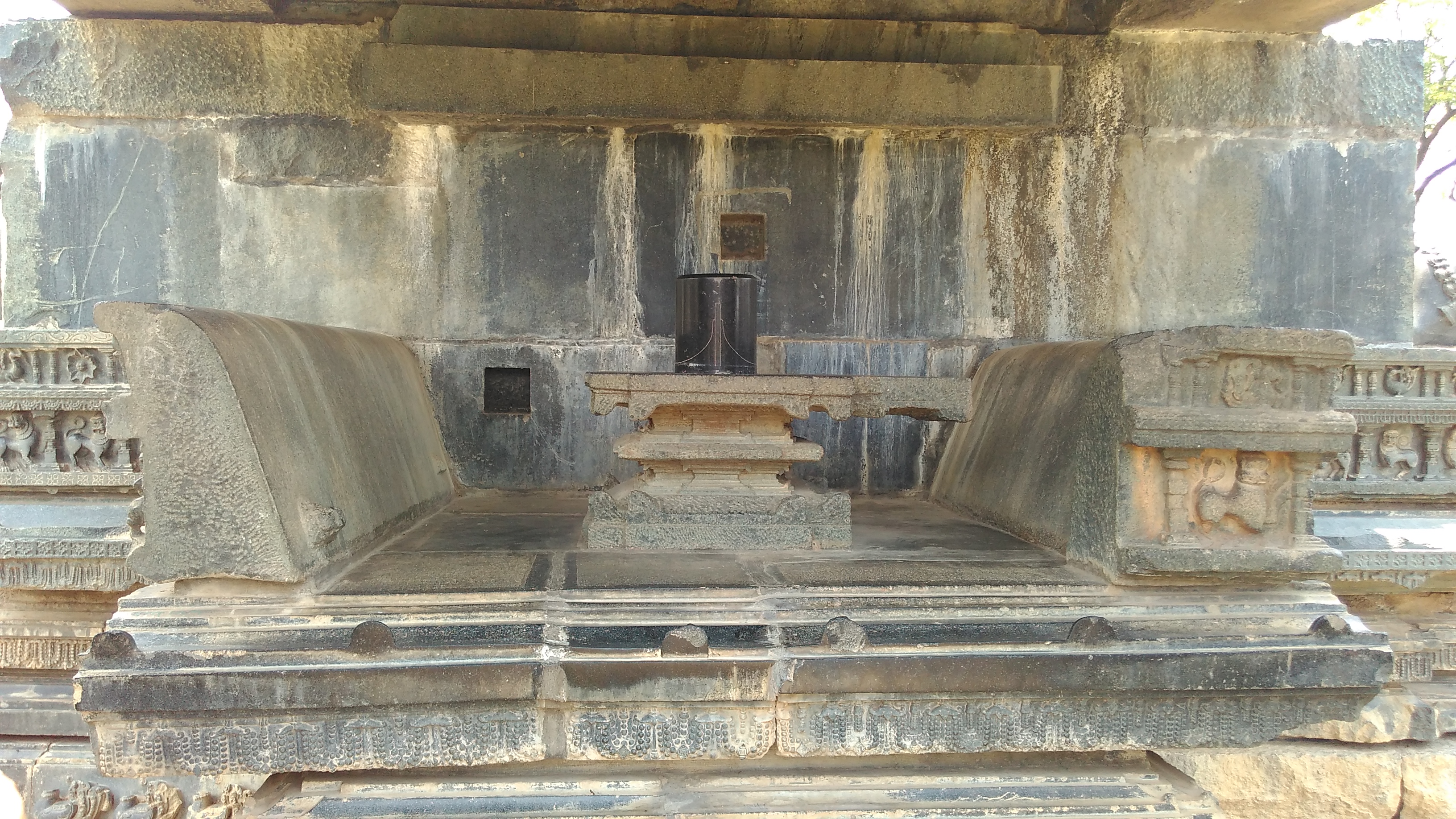
What followed the final siege was systematic destruction. The Sultanate forces demolished the Swayambhusiva Temple, scattering its carved remnants across the fort's interior, where they lie today as fragments of extraordinary beauty amid overgrown rubble. The city was renamed Sultanpur. Imperial coins were minted there from 1324 to 1332. But Delhi's grip on the Deccan was never secure. In 1336, a coalition of 75 local Nayaka chieftains, led by Kapaya Nayaka of the Musunuri clan, united and drove the Sultanate garrison out of Warangal. They demolished the mosque the Tughluqs had built inside the fort grounds. The recapture was brief in historical terms -- the Bahmani Sultanate, then the Qutb Shahi dynasty of Golconda, and finally the Nizam of Hyderabad would each claim the fort in turn. But those thirteen years of Nayaka rule remain a point of fierce pride in Telangana's historical memory.
What the Gateway Means Now
The four ornamental gateways of the fort -- the Kakatiya Kala Thoranam -- originally formed the entrances to the great Shiva temple. They survive as freestanding arches, their carved surfaces still bearing the intricate geometric and floral patterns that defined Kakatiya art. When Telangana became India's 29th state in 2014, the new government adopted the Kala Thoranam as its official emblem, reaching past centuries of Sultanate, Mughal, and Nizam rule to claim the Kakatiya dynasty as the state's founding identity. The Archaeological Survey of India lists the fort as a Monument of National Importance, and it sits on UNESCO's tentative World Heritage list. Walking the ruins today, you pass the Kush Mahal -- a hall built during the Sultanate period -- alongside Kakatiya pillared mandapas and a Nandi bull weathered by seven hundred years of Deccan sun. Every dynasty that held this fort left something behind. Every dynasty that lost it left something too.
From the Air
Located at 17.957°N, 79.614°E near the city of Warangal, Telangana. The fort's three concentric circular walls are clearly visible from altitude, forming a distinctive target-like pattern on the plateau. Best viewed at 5,000-10,000 feet for the full layout. Warangal Railway Station is nearby. Rajiv Gandhi International Airport (VOHS) in Hyderabad is approximately 150 km southwest. The Deccan Plateau terrain is flat with scattered granite outcrops, providing excellent visibility in clear conditions.