Washington Park Arboretum
The Duwamish called this place Sxwacugwit -- the narrow passage. Long before Lake Washington Boulevard carved its asphalt path through the canopy, this strip of land between Union Bay and the hills to the south served as a portage route, a vital link between the coast and the inland waterways that fed the lake. The village of Slalal stood at the mouth of what is now Arboretum Creek. Today, 230 acres of cultivated and wild landscapes occupy that same corridor, and if you walk the boardwalks beneath the State Route 520 overpasses, you can still feel the logic of the old route -- water on one side, rising ground on the other, and a narrow green thread connecting them.
From Racetrack to Rhododendrons
The Treaty of Point Elliott opened this land to white settlement in 1855, and Fred Drew, a timber surveyor for the Puget Mill Company, purchased the parcel from the federal government. For decades it sat largely undeveloped. Then in 1920, the land was split: the eastern 200 acres became the Broadmoor Golf Club, bankrolled by a group of businessmen including E. G. Ames, Puget Mill's general manager. The western 230 acres went to the city. A horse racing track that had occupied part of the site was converted into a wide pedestrian promenade, and in 1934 the University of Washington and the City of Seattle formalized their partnership to create the Washington Park Arboretum. That former racetrack became Azalea Way, and every spring it erupts in a tapestry of color that draws photographers, painters, and anyone who needs proof that Seattle has seasons beyond gray.
The Hidden Creek
Arboretum Creek runs the entire length of the park, spring-fed from the Alder Creek Natural Area at its southern end. The stream is easy to miss -- it slips through culverts beneath Lake Washington Boulevard, collects runoff from Rhododendron Glen and the Woodland Garden, and absorbs subsurface drainage from Broadmoor's fairways before emptying into Lake Washington through Willow Bay, a quiet arm of Union Bay. Along the way, it feeds the koi pond in the Japanese Garden and sustains the wetlands that gadwalls and other waterfowl depend on. The creek is the park's circulatory system, invisible from most vantage points but essential to everything that grows here. The wild, heavily canopied sections of the Arboretum -- dense enough to forget you are minutes from downtown Seattle -- owe their lushness to this modest watercourse.
Shizensa at the Southern Gate
Tucked into the Arboretum's southwest corner, the Seattle Japanese Garden is one of the oldest Japanese gardens in North America and widely regarded as one of the most authentic in the United States. World-renowned designer Juki Iida planned it in 1959 faithful to the principle of shizensa -- the essence of nature. Construction began in March 1960, and Iida personally scouted 580 large granite boulders from Snoqualmie Pass to anchor the composition. The garden was completed in just four months, yet it carries the stillness of something that has always been there. Iida used both traditional Japanese plant materials and Pacific Northwest natives, and over the decades the two have grown together so completely that the boundary between imported design and local ecology has dissolved. The 3.5-acre space is the Arboretum's most composed landscape, a counterpoint to the wild corridors just outside its walls.
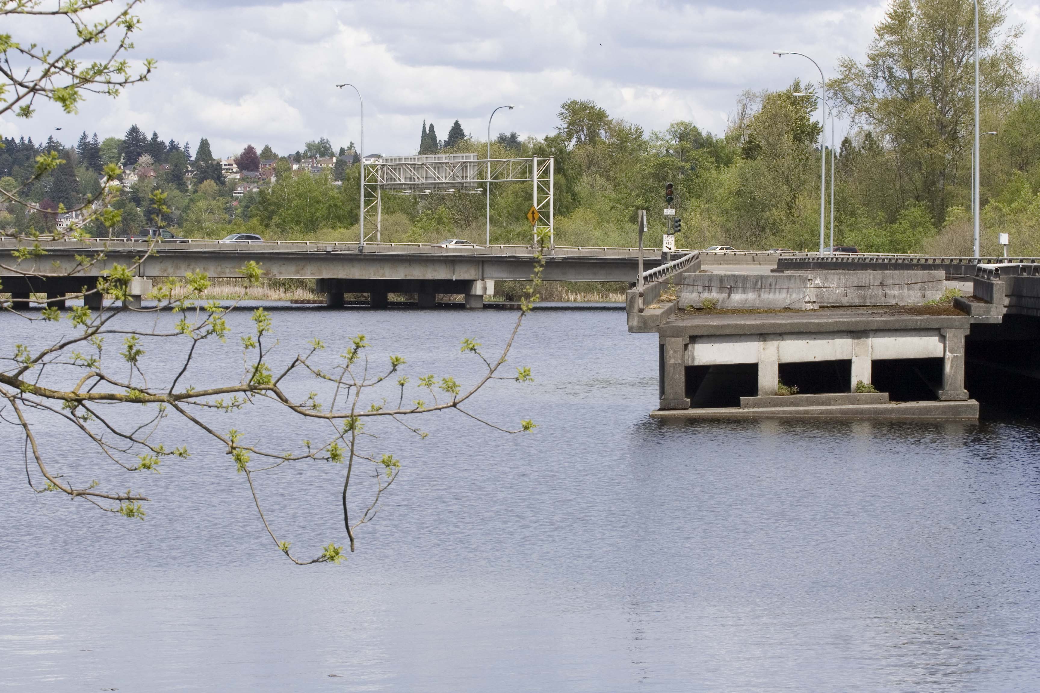
Ramps to Nowhere
State Route 520 has cut through the Arboretum's northern reaches since the 1960s, and for decades a set of unfinished freeway ramps -- relics of a highway expansion that community opposition halted -- loomed over the park like concrete question marks. Seattleites called them the ghost ramps. In 2014, as demolition was announced, a local art collective wrapped a pair of support columns in reflective acrylic for an installation called Gate to Nowhere, commemorating the structures and the freeway revolt that left them stranded. Removal began in 2016 as part of the 520 Bridge Replacement Project and was largely complete by 2017. The final section came down in 2024, but a single four-column support beam was allowed to remain as a monument. The bridge project itself brought eight ecological restoration efforts and a new multiuse trail connecting East Madison Street to Montlake and the University District -- a modern echo of the portage route the Duwamish used centuries before.
From the Air
Located at 47.636°N, 122.296°W along the western shore of the Lake Washington Ship Canal approach to Union Bay. The Arboretum's 230-acre canopy is visible as a distinctive green wedge between the SR-520 corridor (with its new floating bridge) and the Broadmoor Golf Club to the east. Boeing Field (KBFI) lies approximately 6nm to the south-southwest; Seattle-Tacoma International (KSEA) is about 12nm to the south. Renton Municipal (KRNT) is roughly 8nm southeast. Best spotted at lower altitudes on clear days when the dense tree canopy contrasts sharply with surrounding residential neighborhoods and the geometric lines of the golf course. The SR-520 floating bridge extending east across Lake Washington provides an unmistakable reference line.