Washington Rock State Park
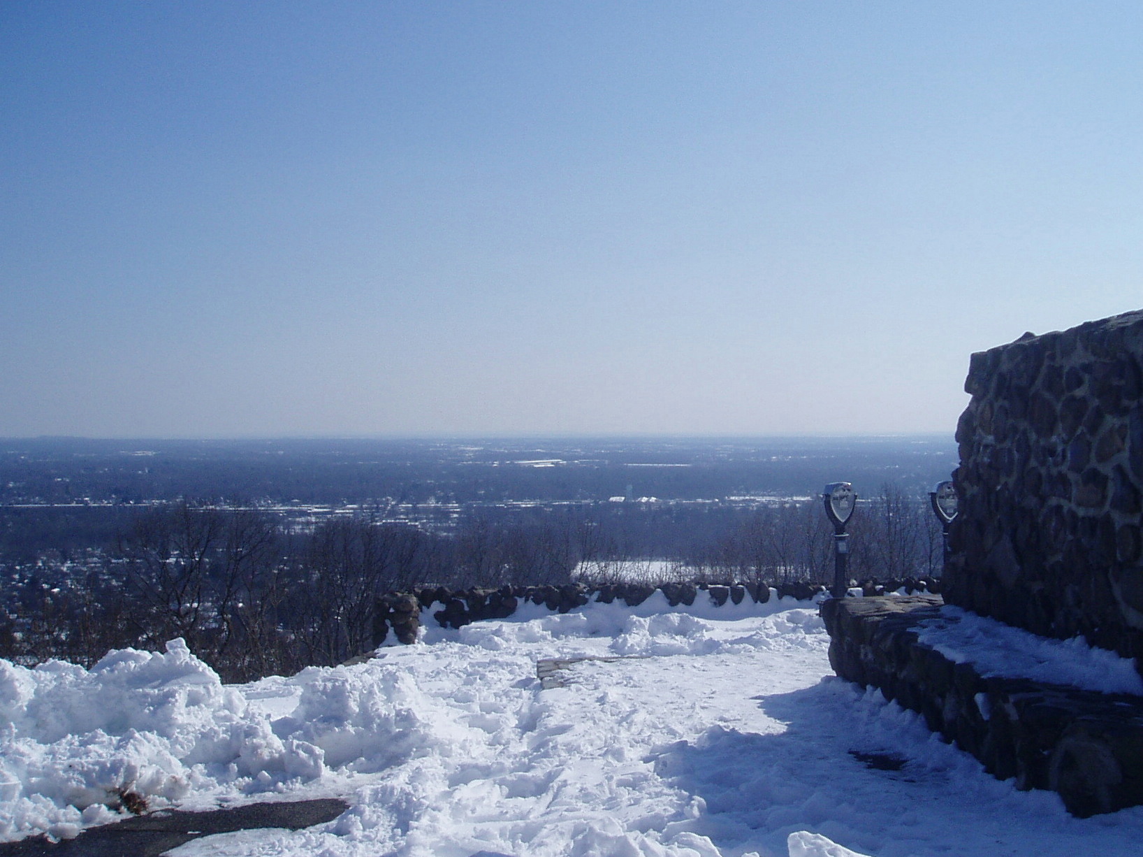
Stand at the overlook in Washington Rock State Park on a clear day and you can see thirty miles east across the New Jersey plains, all the way to the skyline of New York City. George Washington stood in roughly the same spot in 1777 and saw something else entirely: the campfires and column dust of a British army under General William Howe, moving across those same plains. The view has not changed much. What you make of it depends on what you are watching for.
The General's Lookout
Washington Rock sits atop the first Watchung ridge at an elevation of 538 feet, a natural vantage point that offered an unobstructed line of sight across the eastern lowlands toward Staten Island and Manhattan. During the Revolutionary War, the Continental Army built a network of 23 beacon signal stations to relay warnings about British troop movements. Washington Rock was Beacon Signal Station 9. Its purpose was simple and critical: watch the British forces quartered on Staten Island and in New York City, and light the beacon the moment they moved. The system was a low-tech early warning network, fire passed from hilltop to hilltop faster than any horseback rider could travel.
The Day the Beacons Burned
The lookout earned its place in history on June 23, 1780. From this ridge, observers spotted the British launching a westward attack toward Hobart Gap, a natural pathway through the Watchung Mountains that led to Washington's main encampment at Morristown. The attack was a pincer movement: Hessian troops advanced along Vaux Hall Road while British regulars pushed up Galloping Hill Road, both forces trying to break through to the Gap and reach the Continental Army's winter quarters. The Essex County and Newark militias were warned in time. The Hessians were stopped at the base of the mountain; the British were repelled at Springfield. Had the beacons failed, had the warning come too late, the route to Morristown would have been open. The stakes were not abstract.
Preservation on the Ridge
The land that is now Washington Rock State Park was purchased in 1913, more than 130 years after the Revolutionary War events it commemorates. The 52-acre park preserves most of its acreage as woodland, keeping the ridgeline much as it appeared when sentries scanned the horizon for redcoats. At the overlook itself, walking trails wind through the trees and a picnic area offers a place to sit with the same panorama Washington once studied through a spyglass. A commemorative plaque marks the historical significance of the site. The park is operated by the New Jersey Division of Parks and Forestry.
The View That Endures
What makes Washington Rock compelling is not its size -- 52 acres is modest for a state park -- but the persistence of its sightline. The 30-mile vista across the eastern plains of New Jersey remains essentially unobstructed, even as the landscape below has filled with highways, suburbs, and shopping centers. From the overlook, the New York City skyline rises on the horizon much as the smoke of British campfires once did. The Watchung Mountains themselves are ancient, a basalt ridge formed by volcanic activity roughly 200 million years ago during the breakup of Pangaea. Washington did not choose this lookout for its geology. He chose it because he could see everything that mattered, and that has not changed.
From the Air
Located at 40.613N, 74.473W on the first Watchung ridge in Green Brook Township, Somerset County, New Jersey. Elevation 538 feet. The wooded ridgeline is visible from the air as part of the Watchung Mountain chain running SW-NE across central New Jersey. Nearest airports: Somerset Airport (KSMQ, 5nm SW), Morristown Municipal (KMMU, 10nm NW), Linden (KLDJ, 8nm SE). Area is beneath New York Class B shelf airspace.