Washougal
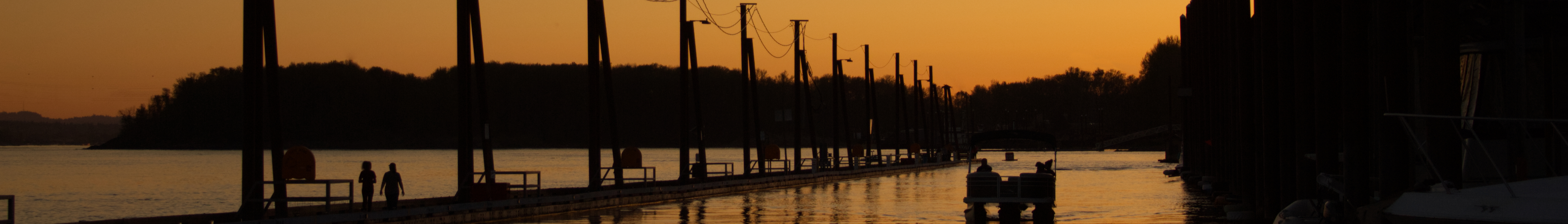
The Washougal River tumbles out of the Cascades and meets the Columbia here, creating a confluence that has drawn people for millennia. The town that took the river's name has grown to 17,000, a riverside community where summer means swimming holes and inner tubes, where the motocross nationals draw thousands to Washougal MX Park, and where the Lewis and Clark Highway begins its journey through the Columbia River Gorge. It's a place defined by water and by access - access to recreation, to scenic beauty, to the outdoor life that draws people to the Pacific Northwest.
River Town
The Washougal River provides summer recreation that draws visitors from throughout the Portland metro area. When temperatures climb, families head for the swimming holes and beaches along the river, their inner tubes and kayaks joining a flotilla that works its way downstream. The water runs cold and clear out of the Cascades, its rocky pools offering escape from the heat that settles in the Columbia Gorge in August.
Washougal River Road follows the water upstream, passing swimming access points and eventually the Christmas tree farms that draw a different crowd in winter. The tradition of cutting your own tree has survived here, families making the drive to select and fell their holiday centerpiece while drinking hot chocolate and experiencing a ritual that connects generations. It's a seasonal rhythm that defines the community - summer on the river, winter in the tree farms, spring and fall on the trails that lace the surrounding hills.
Motocross Capital
Each summer the Washougal MX Park hosts rounds of the AMA Pro Motocross Championship, transforming the town into a destination for motorsports fans from across the country. The natural terrain amphitheater provides sightlines that let spectators watch the entire course, the roar of engines echoing off the surrounding hills as riders attack one of the most challenging tracks on the circuit.
The motocross culture extends beyond the nationals. Local tracks and riding areas dot the hills east of town, the sport's community maintaining a year-round presence. The mix might seem unlikely - inner tubes and dirt bikes, swimming holes and engine noise - but Washougal accommodates both, its outdoor recreation culture embracing powered and unpowered sports alike. It's a blue-collar version of outdoor recreation, accessible and unpretentious, the kind of place where a day on the river might end at a track watching riders send it over jumps.
Gorge Gateway
The Lewis and Clark Highway - Highway 14 - runs through Washougal, following the Columbia's north bank into the Gorge. This is the Washington side of the canyon, less developed than the Oregon shore but offering its own viewpoints and attractions. Cape Horn provides the first dramatic overlook east of town, the river curving through basalt cliffs, the scale of the Gorge becoming apparent.
The drive through the Gorge on Highway 14 reveals different perspectives than the Oregon side. The road runs closer to river level in places, the cliffs rising directly above. Beacon Rock, an ancient volcanic plug that rises 848 feet from the water, is accessible from the Washington side, a steep trail climbing to its summit. The waterfall density is lower than Oregon's famous Multnomah Falls side, but the scenery rivals anything the region offers. Washougal marks the transition from suburb to wilderness, the last services before the canyon deepens and the development thins.
Four Seasons
Washougal celebrates each season distinctly. Summer brings the river crowds and the motocross fans. Autumn transforms the Gorge drive into a color tour, the Lewis and Clark Highway threading through auburn and gold as maple and oak line the route. Cape Horn overlook becomes a photographer's destination as the fall colors peak and the morning mists fill the canyon.
Winter quiets the town but brings the Christmas tree tradition that has made Washougal River Road a regional destination. Spring awakens the hiking trails that climb into the Cascade foothills, wildflowers blooming on slopes above the river. The seasonal rhythm gives structure to life here, each transition marked by different activities and different visitors. It's not a place that tries to be all things year-round but rather one that embraces what each season offers, the outdoor culture adapting to conditions rather than fighting them.
From the Air
Located at 45.58N, 122.35W at the confluence of the Washougal and Columbia Rivers in southwest Washington. The town is visible on the Columbia's north bank east of Camas. The Washougal River flows from the Cascade foothills northeast of town. Highway 14 (Lewis and Clark Highway) runs through town, continuing east into the Columbia River Gorge. Mount Hood is visible to the south across the Columbia. Portland International Airport (KPDX) is approximately 20 minutes west via I-205 and Highway 14. The Columbia Gorge opens to the east; Cape Horn overlook is a few miles downstream.